Maps of Argyll and Bute

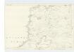
Islay - Bartholomew's 'Survey Atlas of Scotland'
1 : 126720 Topographic maps John Bartholomew & Son, Ltd John Bartholomew & Son, Ltd
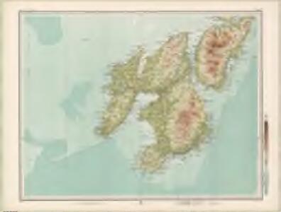
Islay - OS One-Inch Map
1 : 63360 Topographic maps Ordnance Survey Ordnance Survey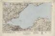
Islay (69) - OS One-Inch map
1 : 63360 Topographic maps Ordnance Survey Ordnance Survey
Islay (69) - OS One-Inch map
1 : 63360 Topographic maps Ordnance Survey Ordnance Survey
Bowmore - OS One-Inch map
1 : 63360 Topographic maps Ordnance Survey Ordnance Survey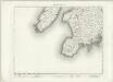
Bowmore - OS One-Inch map
1 : 63360 Topographic maps Ordnance Survey Ordnance Survey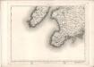
Bowmore - OS One-Inch map
1 : 63360 Topographic maps Ordnance Survey Ordnance Survey
Portascaig - OS One-Inch map
1 : 63360 Topographic maps Ordnance Survey Ordnance Survey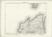
Portascaig - OS One-Inch map
1 : 63360 Topographic maps Ordnance Survey Ordnance Survey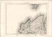
Portascaig - OS One-Inch map
1 : 63360 Topographic maps Ordnance Survey Ordnance Survey
Sound of Islay
Great Britain. Hydrographic Office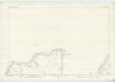
Argyllshire, Sheet CLXXV & CLXXVI - OS 6 Inch map
1 : 10560 Topographic maps Ordnance Survey Ordnance Survey
Argyllshire, Sheet CCXVII - OS 6 Inch map
1 : 10560 Topographic maps Ordnance Survey Ordnance Survey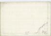
Argyllshire, Sheet CLXXXV - OS 6 Inch map
1 : 10560 Topographic maps Ordnance Survey Ordnance Survey
Argyllshire, Sheet CCXXIX - OS 6 Inch map
1 : 10560 Topographic maps Ordnance Survey Ordnance Survey
Argyll and Bute Sheet CCXVII - OS 6 Inch map
1 : 10560 Topographic maps Ordnance Survey Ordnance Survey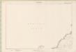
Argyll and Bute Sheet CLXXXV - OS 6 Inch map
1 : 10560 Topographic maps Ordnance Survey Ordnance Survey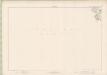
Argyll and Bute Sheet CCXXIX - OS 6 Inch map
1 : 10560 Topographic maps Ordnance Survey Ordnance Survey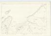
Argyllshire, Sheet CLXXXVI - OS 6 Inch map
1 : 10560 Topographic maps Ordnance Survey Ordnance Survey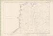
Argyll and Bute Sheet CXCVI - OS 6 Inch map
1 : 10560 Topographic maps Ordnance Survey Ordnance Survey
Argyll and Bute Sheet CCVII - OS 6 Inch map
1 : 10560 Topographic maps Ordnance Survey Ordnance Survey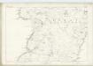
Argyllshire, Sheet CCVII - OS 6 Inch map
1 : 10560 Topographic maps Ordnance Survey Ordnance Survey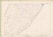
Argyll and Bute Sheet CCXVIII - OS 6 Inch map
1 : 10560 Topographic maps Ordnance Survey Ordnance Survey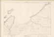
Argyll and Bute Sheet CLXXXVI - OS 6 Inch map
1 : 10560 Topographic maps Ordnance Survey Ordnance Survey
Argyllshire, Sheet CCXXX - OS 6 Inch map
1 : 10560 Topographic maps Ordnance Survey Ordnance Survey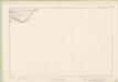
Argyll and Bute Sheet CCXXX - OS 6 Inch map
1 : 10560 Topographic maps Ordnance Survey Ordnance Survey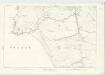
Argyllshire, Sheet CCXIX - OS 6 Inch map
1 : 10560 Topographic maps Ordnance Survey Ordnance Survey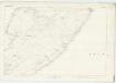
Argyllshire, Sheet CCXVIII - OS 6 Inch map
1 : 10560 Topographic maps Ordnance Survey Ordnance Survey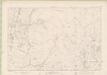
Argyll and Bute Sheet CXCVII - OS 6 Inch map
1 : 10560 Topographic maps Ordnance Survey Ordnance Survey