Maps of Scottish Borders
Dumfriesshire, Sheet IV - OS 6 Inch map
1 : 10560 Topographic maps Ordnance Survey Ordnance Survey
Dumfriesshire Sheet IV.SW - OS 6 Inch map
1 : 10560 Topographic maps Ordnance Survey Ordnance Survey
Dumfriesshire Sheet IV.SE - OS 6 Inch map
1 : 10560 Topographic maps Ordnance Survey Ordnance Survey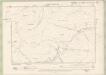
Selkirkshire Sheet XVIIA & XVII.NW - OS 6 Inch map
1 : 10560 Topographic maps Ordnance Survey Ordnance Survey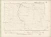
Peebles-shire Sheet XXIV.SW & SE - OS 6 Inch map
1 : 10560 Topographic maps Ordnance Survey Ordnance Survey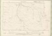
Peebles-shire Sheet XXIV.SW & SE - OS 6 Inch map
1 : 10560 Topographic maps Ordnance Survey Ordnance Survey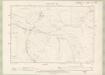
Selkirkshire Sheet XIIIa.SE - OS 6 Inch map
1 : 10560 Topographic maps Ordnance Survey Ordnance Survey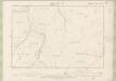
Selkirkshire Sheet XIII.SW - OS 6 Inch map
1 : 10560 Topographic maps Ordnance Survey Ordnance Survey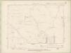
Peebles-shire Sheet XXVI.NW & SW - OS 6 Inch map
1 : 10560 Topographic maps Ordnance Survey Ordnance Survey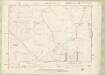
Peebles-shire Sheet XXVI.NW & SW - OS 6 Inch map
1 : 10560 Topographic maps Ordnance Survey Ordnance Survey
NT11 - OS 1:25,000 Provisional Series Map
1 : 25000 Topographic maps Ordnance Survey Ordnance Survey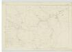
Peebles-shire, Sheet XXIV - OS 6 Inch map
1 : 10560 Topographic maps Ordnance Survey Ordnance Survey
Peebles-shire, Sheet XXVII - OS 6 Inch map
1 : 10560 Topographic maps Ordnance Survey Ordnance Survey
Selkirkshire, Sheet XVII - OS 6 Inch map
1 : 10560 Topographic maps Ordnance Survey Ordnance Survey
Selkirkshire, Sheet XIII - OS 6 Inch map
1 : 10560 Topographic maps Ordnance Survey Ordnance Survey
NT21 - OS 1:25,000 Provisional Series Map
1 : 25000 Topographic maps Ordnance Survey Ordnance Survey
NT12 - OS 1:25,000 Provisional Series Map
1 : 25000 Topographic maps Ordnance Survey Ordnance Survey
Selkirkshire Sheet XVII.SW - OS 6 Inch map
1 : 10560 Topographic maps Ordnance Survey Ordnance Survey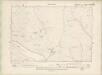
Peebles-shire Sheet XXIV.NW - OS 6 Inch map
1 : 10560 Topographic maps Ordnance Survey Ordnance Survey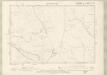
Peebles-shire Sheet XXIV.NW - OS 6 Inch map
1 : 10560 Topographic maps Ordnance Survey Ordnance Survey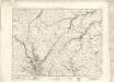
Moffat - OS One-Inch map
1 : 63360 Topographic maps Ordnance Survey Ordnance Survey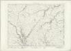
Moffat - OS One-Inch map
1 : 63360 Topographic maps Ordnance Survey Ordnance Survey
Moffat - OS One-Inch map
1 : 63360 Topographic maps Ordnance Survey Ordnance Survey
A new and correct map of the Shire of Peebles or Tweeddale / survey'd by Will. Edgar, 1741 ; R. Cooper sculp.
Edgar, William, fl. 1717-1746 Cooper, Richard, 1705-1764
The Shire of Peebles or Tweeddale.
Edgar, William, fl. 1717-1746
To the... Earl of March and Ruglen... this map of the County of Peebles or Tweedale is... inscribed by... Mostyn Jno. Armstrong
Armstrong, Mostyn, fl. 1769-1791
Peebles-Shire.
Thomson, John, 1777- ca. 1840 Johnson, William, fl. 1806-1840
Peebles-Shire.
1 : 78000 Thomson, John
Selkirk - OS One-Inch Map
1 : 63360 Topographic maps Ordnance Survey Ordnance Survey