Maps of Scottish Borders

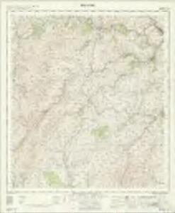
Selkirk - OS One-Inch Map
1 : 63360 Topographic maps Ordnance Survey Ordnance Survey
Selkirk Shire.
Thomson, John, 1777- ca. 1840 Johnson, William, fl. 1806-1840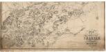
Map of the County of Selkirk and District of Melrose.
Mitchell, Thomas, fl. 1831-1851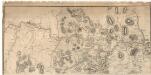
Map of the County of Selkirk and District of Melrose.
Mitchell, Thomas, fl. 1831-1851
Map of Selkirkshire or Ettrick Forest.
Ainslie, John, 1745-1828
The Sherifdome of Etrik Forest.
Adair, John, ca. 1650-1722
Peebles & Galashiels (80) - OS One-Inch map
1 : 63360 Topographic maps Ordnance Survey Ordnance Survey
Peebles & Galashiels (80) - OS One-Inch map
1 : 63360 Topographic maps Ordnance Survey Ordnance Survey
Hawick & Eskdale (85) - OS One-Inch map
1 : 63360 Topographic maps Ordnance Survey Ordnance Survey
Hawick & Eskdale (85) - OS One-Inch map
1 : 63360 Topographic maps Ordnance Survey Ordnance Survey
EVIA et ESCIA, | Scotis | EVSDAIL | et | ESKDAIL.
Auct. Tim. Pont. I. Blaeu Excud.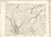
Moffat - OS One-Inch map
1 : 63360 Topographic maps Ordnance Survey Ordnance Survey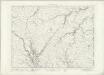
Moffat - OS One-Inch map
1 : 63360 Topographic maps Ordnance Survey Ordnance Survey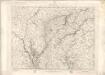
Moffat - OS One-Inch map
1 : 63360 Topographic maps Ordnance Survey Ordnance Survey
Peebles-Shire.
Thomson, John, 1777- ca. 1840 Johnson, William, fl. 1806-1840
A new and correct map of the Shire of Peebles or Tweeddale / survey'd by Will. Edgar, 1741 ; R. Cooper sculp.
Edgar, William, fl. 1717-1746 Cooper, Richard, 1705-1764
The Shire of Peebles or Tweeddale.
Edgar, William, fl. 1717-1746
To the... Earl of March and Ruglen... this map of the County of Peebles or Tweedale is... inscribed by... Mostyn Jno. Armstrong
Armstrong, Mostyn, fl. 1769-1791
Evia et Escia, scotis Evsdail et Eskdail
1 Karte : Kupferdruck ; 41 x 51 cm Blaeu; Pont Joan Blaeu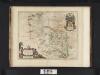
Evia et Escia Scotis, Evsdail et Eskdail / Auct. Timotheo Pont, I. Blaeu excud.
Pont, Timothy, 1560?-1614? Blaeu, Joan, 1596-1673
NT13 - OS 1:25,000 Provisional Series Map
1 : 25000 Topographic maps Ordnance Survey Ordnance Survey
NT12 - OS 1:25,000 Provisional Series Map
1 : 25000 Topographic maps Ordnance Survey Ordnance Survey
NT11 - OS 1:25,000 Provisional Series Map
1 : 25000 Topographic maps Ordnance Survey Ordnance Survey
NT23 - OS 1:25,000 Provisional Series Map
1 : 25000 Topographic maps Ordnance Survey Ordnance Survey
NT10 - OS 1:25,000 Provisional Series Map
1 : 25000 Topographic maps Ordnance Survey Ordnance Survey
NT22 - OS 1:25,000 Provisional Series Map
1 : 25000 Topographic maps Ordnance Survey Ordnance Survey
NY19 - OS 1:25,000 Provisional Series Map
1 : 25000 Topographic maps Ordnance Survey Ordnance Survey
NT21 - OS 1:25,000 Provisional Series Map
1 : 25000 Topographic maps Ordnance Survey Ordnance Survey
NT33 - OS 1:25,000 Provisional Series Map
1 : 25000 Topographic maps Ordnance Survey Ordnance Survey