Maps of Cheshire
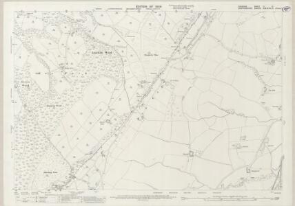
Cheshire LI.14 (includes: Biddulph; Moreton cum Alcumlow; Newbold Astbury; Newchapel; Odd Rode) - 25 Inch Map
1 : 2500 Topographic maps Ordnance Survey Ordnance Survey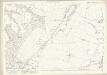
Cheshire LI.14 (includes: Biddulph; Moreton cum Alcumlow; Newbold Astbury; Newchapel; Odd Rode) - 25 Inch Map
1 : 2500 Topographic maps Ordnance Survey Ordnance Survey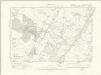
Cheshire LI.SW & SE - OS Six-Inch Map
1 : 10560 Topographic maps Ordnance Survey Ordnance Survey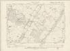
Cheshire LI.SW - OS Six-Inch Map
1 : 10560 Topographic maps Ordnance Survey Ordnance Survey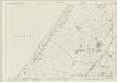
Staffordshire VII.1 (includes: Biddulph; Moreton Cum Alcumlow; Newbold Astbury) - 25 Inch Map
1 : 2500 Topographic maps Ordnance Survey Ordnance Survey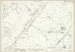
Staffordshire VII.1 (includes: Biddulph; Moreton Cum Alcumlow; Newbold Astbury) - 25 Inch Map
1 : 2500 Topographic maps Ordnance Survey Ordnance Survey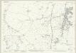
Staffordshire VII.5 (includes: Biddulph; Moreton Cum Alcumlow; Newchapel) - 25 Inch Map
1 : 2500 Topographic maps Ordnance Survey Ordnance Survey
Staffordshire VII.5 (includes: Biddulph; Moreton Cum Alcumlow; Newchapel) - 25 Inch Map
1 : 2500 Topographic maps Ordnance Survey Ordnance Survey
Staffordshire VII.NW - OS Six-Inch Map
1 : 10560 Topographic maps Ordnance Survey Ordnance Survey
Staffordshire VII.NW - OS Six-Inch Map
1 : 10560 Topographic maps Ordnance Survey Ordnance Survey
Staffordshire VII.NW - OS Six-Inch Map
1 : 10560 Topographic maps Ordnance Survey Ordnance Survey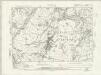
Staffordshire VII.NW - OS Six-Inch Map
1 : 10560 Topographic maps Ordnance Survey Ordnance Survey
Staffordshire VII.NW - OS Six-Inch Map
1 : 10560 Topographic maps Ordnance Survey Ordnance Survey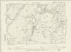
Staffordshire VII.NW - OS Six-Inch Map
1 : 10560 Topographic maps Ordnance Survey Ordnance Survey
Staffordshire VII.NW - OS Six-Inch Map
1 : 10560 Topographic maps Ordnance Survey Ordnance Survey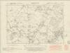
Staffordshire VI.NE - OS Six-Inch Map
1 : 10560 Topographic maps Ordnance Survey Ordnance Survey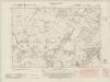
Staffordshire VI.NE - OS Six-Inch Map
1 : 10560 Topographic maps Ordnance Survey Ordnance Survey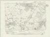
Staffordshire VI.NE - OS Six-Inch Map
1 : 10560 Topographic maps Ordnance Survey Ordnance Survey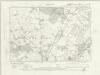
Staffordshire VI.NE - OS Six-Inch Map
1 : 10560 Topographic maps Ordnance Survey Ordnance Survey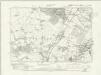
Staffordshire VI.NE - OS Six-Inch Map
1 : 10560 Topographic maps Ordnance Survey Ordnance Survey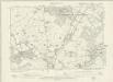
Staffordshire VI.NE - OS Six-Inch Map
1 : 10560 Topographic maps Ordnance Survey Ordnance Survey
Staffordshire VI.NE - OS Six-Inch Map
1 : 10560 Topographic maps Ordnance Survey Ordnance Survey
Staffordshire VI.8 (includes: Biddulph; Church Lawton; Moreton Cum Alcumlow; Newchapel; Odd Rode) - 25 Inch Map
1 : 2500 Topographic maps Ordnance Survey Ordnance Survey
Staffordshire VI.8 (includes: Biddulph; Church Lawton; Moreton Cum Alcumlow; Newchapel; Odd Rode) - 25 Inch Map
1 : 2500 Topographic maps Ordnance Survey Ordnance Survey
Cheshire LI (inset LII) - OS Six-Inch Map
1 : 10560 Topographic maps Ordnance Survey Ordnance Survey
SJ85 - OS 1:25,000 Provisional Series Map
1 : 25000 Topographic maps Ordnance Survey Ordnance Survey
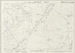
Ordnance Survey hill sketches
Ordnance Survey
Potteries
1 : 31680 .A triangulation diagram appears on the reverse of this drawing. This was an essential tool enabling the draughtsman to plot topographical features of the landscape. There is no hill sketching on this drawing, suggesting that it is an intermediate version rather than the finished plan. Yellow lines represent the borders of the printed sheet. Major lines of communication are coloured yellow, following standard military cartographic convention. Stevens, Henry
Macclesfield
1 : 31680 .This drawing covers the counties of Cheshire and Staffordshire, the boundary being indicated by a red pecked line. There is no hill sketching on this drawing, suggesting that it is an intermediate version rather than the finished plan. Yellow lines represent the borders of the printed sheet. Major lines of communication are coloured yellow, following standard military cartographic convention. The Macclesfield Canal stretches across the drawing from top to bottom, marked by a royal blue line and,broken by locks. Approved by an Act of Parliament in April 1826, the canal route was surveyed by Thomas Telford and constructed by William Crosley. It was built to serve the mills, mines and quarries of the Macclesfield and Congleton areas, forming a link from Manchester to the Potteries and Midlands. The canal was opened in November 1831. Stevens, Henry