Maps of Staffordshire Moorlands
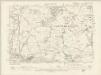
Staffordshire VII.NW - OS Six-Inch Map
1 : 10560 Topographic maps Ordnance Survey Ordnance Survey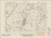
Staffordshire VII.NW - OS Six-Inch Map
1 : 10560 Topographic maps Ordnance Survey Ordnance Survey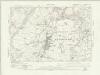
Staffordshire VII.NW - OS Six-Inch Map
1 : 10560 Topographic maps Ordnance Survey Ordnance Survey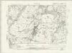
Staffordshire VII.NW - OS Six-Inch Map
1 : 10560 Topographic maps Ordnance Survey Ordnance Survey
Staffordshire VII.NW - OS Six-Inch Map
1 : 10560 Topographic maps Ordnance Survey Ordnance Survey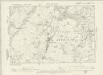
Staffordshire VII.NW - OS Six-Inch Map
1 : 10560 Topographic maps Ordnance Survey Ordnance Survey
Staffordshire VII.NW - OS Six-Inch Map
1 : 10560 Topographic maps Ordnance Survey Ordnance Survey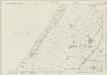
Staffordshire VII.1 (includes: Biddulph; Moreton Cum Alcumlow; Newbold Astbury) - 25 Inch Map
1 : 2500 Topographic maps Ordnance Survey Ordnance Survey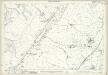
Staffordshire VII.1 (includes: Biddulph; Moreton Cum Alcumlow; Newbold Astbury) - 25 Inch Map
1 : 2500 Topographic maps Ordnance Survey Ordnance Survey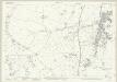
Staffordshire VII.5 (includes: Biddulph; Moreton Cum Alcumlow; Newchapel) - 25 Inch Map
1 : 2500 Topographic maps Ordnance Survey Ordnance Survey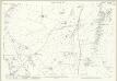
Staffordshire VII.5 (includes: Biddulph; Moreton Cum Alcumlow; Newchapel) - 25 Inch Map
1 : 2500 Topographic maps Ordnance Survey Ordnance Survey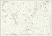
Staffordshire VII.6 (includes: Biddulph) - 25 Inch Map
1 : 2500 Topographic maps Ordnance Survey Ordnance Survey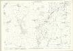
Staffordshire VII.6 (includes: Biddulph) - 25 Inch Map
1 : 2500 Topographic maps Ordnance Survey Ordnance Survey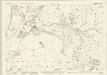
Staffordshire VII.2 (includes: Biddulph) - 25 Inch Map
1 : 2500 Topographic maps Ordnance Survey Ordnance Survey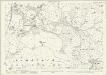
Staffordshire VII.2 (includes: Biddulph) - 25 Inch Map
1 : 2500 Topographic maps Ordnance Survey Ordnance Survey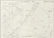
Cheshire LI.14 (includes: Biddulph; Moreton cum Alcumlow; Newbold Astbury; Newchapel; Odd Rode) - 25 Inch Map
1 : 2500 Topographic maps Ordnance Survey Ordnance Survey
Cheshire LI.14 (includes: Biddulph; Moreton cum Alcumlow; Newbold Astbury; Newchapel; Odd Rode) - 25 Inch Map
1 : 2500 Topographic maps Ordnance Survey Ordnance Survey
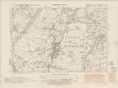
Cheshire LI.SE - OS Six-Inch Map
1 : 10560 Topographic maps Ordnance Survey Ordnance Survey
Cheshire LVIII.2 (includes: Biddulph; Newchapel; Odd Rode) - 25 Inch Map
1 : 2500 Topographic maps Ordnance Survey Ordnance Survey
Cheshire LI.7 &.11 (includes: Biddulph; Congleton) - 25 Inch Map
1 : 2500 Topographic maps Ordnance Survey Ordnance Survey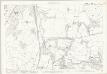
Cheshire LI.11 (includes: Biddulph; Congleton) - 25 Inch Map
1 : 2500 Topographic maps Ordnance Survey Ordnance Survey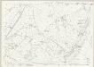
Cheshire LI.10 (includes: Biddulph; Congleton; Moreton cum Alcumlow; Newbold Astbury) - 25 Inch Map
1 : 2500 Topographic maps Ordnance Survey Ordnance Survey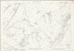
Cheshire LI.10 (includes: Biddulph; Congleton; Moreton cum Alcumlow; Newbold Astbury) - 25 Inch Map
1 : 2500 Topographic maps Ordnance Survey Ordnance Survey
Ordnance Survey hill sketches
Ordnance Survey
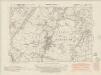
SJ85 - OS 1:25,000 Provisional Series Map
1 : 25000 Topographic maps Ordnance Survey Ordnance Survey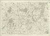
Cheshire LI (inset LII) - OS Six-Inch Map
1 : 10560 Topographic maps Ordnance Survey Ordnance Survey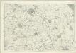
Cheshire LVIII - OS Six-Inch Map
1 : 10560 Topographic maps Ordnance Survey Ordnance Survey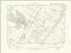
Cheshire LI.SW & SE - OS Six-Inch Map
1 : 10560 Topographic maps Ordnance Survey Ordnance Survey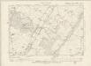
Cheshire LI.SW - OS Six-Inch Map
1 : 10560 Topographic maps Ordnance Survey Ordnance Survey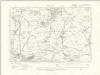
Cheshire LVIII.NW - OS Six-Inch Map
1 : 10560 Topographic maps Ordnance Survey Ordnance Survey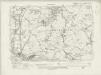
Cheshire LVIII.NW - OS Six-Inch Map
1 : 10560 Topographic maps Ordnance Survey Ordnance Survey