Maps of Essex
Essex XLII - OS Six-Inch Map
1 : 10560 Topographic maps Ordnance Survey Ordnance Survey
Essex nLIII.NW - OS Six-Inch Map
1 : 10560 Topographic maps Ordnance Survey Ordnance Survey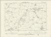
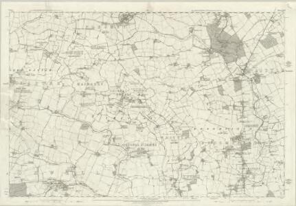
Essex XLII.NW - OS Six-Inch Map
1 : 10560 Topographic maps Ordnance Survey Ordnance Survey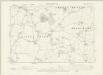
Essex XLII.SW - OS Six-Inch Map
1 : 10560 Topographic maps Ordnance Survey Ordnance Survey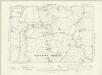
Essex XLII.NE - OS Six-Inch Map
1 : 10560 Topographic maps Ordnance Survey Ordnance Survey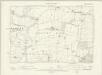
Essex XLII.SE - OS Six-Inch Map
1 : 10560 Topographic maps Ordnance Survey Ordnance Survey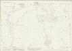
Essex (New Series 1913-) n XLIII.14 (includes: High Easter; Leaden Roding; Margaret Roding) - 25 Inch Map
1 : 2500 Topographic maps Ordnance Survey Ordnance Survey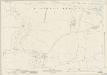
Essex (New Series 1913-) n LIII.2 (includes: Abbess Beauchamp and Berners Roding; Margaret Roding) - 25 Inch Map
1 : 2500 Topographic maps Ordnance Survey Ordnance Survey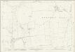
Essex (New Series 1913-) n LIII.6 (includes: Abbess Beauchamp and Berners Roding; Willingale) - 25 Inch Map
1 : 2500 Topographic maps Ordnance Survey Ordnance Survey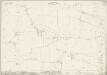
Essex (New Series 1913-) n XLIII.13 (includes: Abbess Beauchamp and Berners Roding; Leaden Roding; White Roding) - 25 Inch Map
1 : 2500 Topographic maps Ordnance Survey Ordnance Survey
Essex (New Series 1913-) n LIII.1 (includes: Abbess Beauchamp and Berners Roding) - 25 Inch Map
1 : 2500 Topographic maps Ordnance Survey Ordnance Survey
Essex (New Series 1913-) n LIII.5 (includes: Abbess Beauchamp and Berners Roding; Fyfield; Willingale) - 25 Inch Map
1 : 2500 Topographic maps Ordnance Survey Ordnance Survey
Essex (1st Ed/Rev 1862-96) XLII.1 (includes: Hatfield Broad Oak; Matching; White Roding) - 25 Inch Map
1 : 2500 Topographic maps Ordnance Survey Ordnance Survey
Essex (1st Ed/Rev 1862-96) XLII.5 (includes: Abbess Beauchamp and Berners Roding; Hatfield Broad Oak; Matching; White Roding) - 25 Inch Map
1 : 2500 Topographic maps Ordnance Survey Ordnance Survey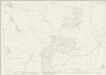
Essex (New Series 1913-) n XLII.16 (includes: Hatfield Broad Oak; Matching; White Roding) - 25 Inch Map
1 : 2500 Topographic maps Ordnance Survey Ordnance Survey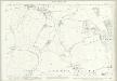
Essex (1st Ed/Rev 1862-96) XLII.9 (includes: Abbess Beauchamp and Berners Roding; High Laver; Little Laver; Matching) - 25 Inch Map
1 : 2500 Topographic maps Ordnance Survey Ordnance Survey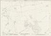
Essex (New Series 1913-) n LII.4 (includes: Abbess Beauchamp and Berners Roding; Little Laver; Matching; White Roding) - 25 Inch Map
1 : 2500 Topographic maps Ordnance Survey Ordnance Survey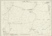
Essex (1st Ed/Rev 1862-96) XLII.13 (includes: High Laver; Little Laver; Moreton) - 25 Inch Map
1 : 2500 Topographic maps Ordnance Survey Ordnance Survey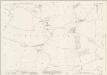
Essex (New Series 1913-) n LII.8 (includes: Abbess Beauchamp and Berners Roding; Fyfield; Little Laver; Moreton) - 25 Inch Map
1 : 2500 Topographic maps Ordnance Survey Ordnance Survey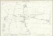
Essex (1st Ed/Rev 1862-96) XLII.2 (includes: White Roding) - 25 Inch Map
1 : 2500 Topographic maps Ordnance Survey Ordnance Survey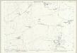
Essex (1st Ed/Rev 1862-96) XLII.6 (includes: Abbess Beauchamp and Berners Roding; White Roding) - 25 Inch Map
1 : 2500 Topographic maps Ordnance Survey Ordnance Survey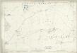
Essex (1st Ed/Rev 1862-96) XLII.10 (includes: Abbess Beauchamp and Berners Roding) - 25 Inch Map
1 : 2500 Topographic maps Ordnance Survey Ordnance Survey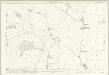
Essex (1st Ed/Rev 1862-96) XLII.14 (includes: Abbess Beauchamp and Berners Roding; Fyfield) - 25 Inch Map
1 : 2500 Topographic maps Ordnance Survey Ordnance Survey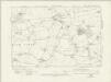
Essex nLII.NE - OS Six-Inch Map
1 : 10560 Topographic maps Ordnance Survey Ordnance Survey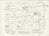
Essex nLII.NE - OS Six-Inch Map
1 : 10560 Topographic maps Ordnance Survey Ordnance Survey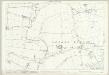
Essex (1st Ed/Rev 1862-96) XLII.3 (includes: Aythorpe Roding; Leaden Roding; White Roding) - 25 Inch Map
1 : 2500 Topographic maps Ordnance Survey Ordnance Survey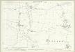
Essex (1st Ed/Rev 1862-96) XLII.7 (includes: Abbess Beauchamp and Berners Roding; Leaden Roding; Margaret Roding) - 25 Inch Map
1 : 2500 Topographic maps Ordnance Survey Ordnance Survey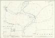
Essex (1st Ed/Rev 1862-96) XLII.11 (includes: Abbess Beauchamp and Berners Roding; Margaret Roding) - 25 Inch Map
1 : 2500 Topographic maps Ordnance Survey Ordnance Survey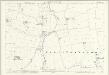
Essex (1st Ed/Rev 1862-96) XLII.15 (includes: Abbess Beauchamp and Berners Roding; Willingale) - 25 Inch Map
1 : 2500 Topographic maps Ordnance Survey Ordnance Survey