Maps of Essex
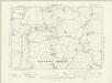
Essex XLII.NE - OS Six-Inch Map
1 : 10560 Topographic maps Ordnance Survey Ordnance Survey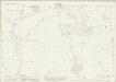
Essex (New Series 1913-) n XLIII.14 (includes: High Easter; Leaden Roding; Margaret Roding) - 25 Inch Map
1 : 2500 Topographic maps Ordnance Survey Ordnance Survey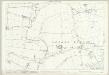
Essex (1st Ed/Rev 1862-96) XLII.3 (includes: Aythorpe Roding; Leaden Roding; White Roding) - 25 Inch Map
1 : 2500 Topographic maps Ordnance Survey Ordnance Survey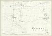
Essex (1st Ed/Rev 1862-96) XLII.7 (includes: Abbess Beauchamp and Berners Roding; Leaden Roding; Margaret Roding) - 25 Inch Map
1 : 2500 Topographic maps Ordnance Survey Ordnance Survey
Essex (1st Ed/Rev 1862-96) XLII.4 (includes: Good Easter; High Easter) - 25 Inch Map
1 : 2500 Topographic maps Ordnance Survey Ordnance Survey
Essex (1st Ed/Rev 1862-96) XLII.8 (includes: Good Easter; High Easter; Margaret Roding) - 25 Inch Map
1 : 2500 Topographic maps Ordnance Survey Ordnance Survey
Essex (New Series 1913-) n XLIII.15 (includes: Good Easter; High Easter) - 25 Inch Map
1 : 2500 Topographic maps Ordnance Survey Ordnance Survey
Essex (New Series 1913-) n XLIII.10 (includes: Aythorpe Roding; Leaden Roding) - 25 Inch Map
1 : 2500 Topographic maps Ordnance Survey Ordnance Survey
Essex (New Series 1913-) n XLIII.11 (includes: High Easter) - 25 Inch Map
1 : 2500 Topographic maps Ordnance Survey Ordnance Survey
Essex (New Series 1913-) n LIII.2 (includes: Abbess Beauchamp and Berners Roding; Margaret Roding) - 25 Inch Map
1 : 2500 Topographic maps Ordnance Survey Ordnance Survey
Essex (New Series 1913-) n LIII.3 (includes: Good Easter; Margaret Roding; Roxwell) - 25 Inch Map
1 : 2500 Topographic maps Ordnance Survey Ordnance Survey
Essex (New Series 1913-) n XLIII.13 (includes: Abbess Beauchamp and Berners Roding; Leaden Roding; White Roding) - 25 Inch Map
1 : 2500 Topographic maps Ordnance Survey Ordnance Survey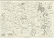
Essex XLII - OS Six-Inch Map
1 : 10560 Topographic maps Ordnance Survey Ordnance Survey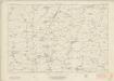
Essex nXLIII - OS Six-Inch Map
1 : 10560 Topographic maps Ordnance Survey Ordnance Survey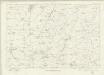
Essex nXLIII - OS Six-Inch Map
1 : 10560 Topographic maps Ordnance Survey Ordnance Survey
TL61 - OS 1:25,000 Provisional Series Map
1 : 25000 Topographic maps Ordnance Survey Ordnance Survey
TL51 - OS 1:25,000 Provisional Series Map
1 : 25000 Topographic maps Ordnance Survey Ordnance Survey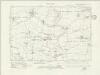
Essex nLIII.NW - OS Six-Inch Map
1 : 10560 Topographic maps Ordnance Survey Ordnance Survey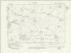
Essex nLIII.NE - OS Six-Inch Map
1 : 10560 Topographic maps Ordnance Survey Ordnance Survey
Essex (New Series 1913-) n XLIII.9 (includes: Aythorpe Roding; Leaden Roding; White Roding) - 25 Inch Map
1 : 2500 Topographic maps Ordnance Survey Ordnance Survey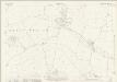
Essex (New Series 1913-) n LIII.1 (includes: Abbess Beauchamp and Berners Roding) - 25 Inch Map
1 : 2500 Topographic maps Ordnance Survey Ordnance Survey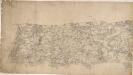
Braintree
Although it was not obligatory to record archaeological sites until 1816, many draughtsmen displayed their interest in history by indicating them prior to this date. At Pleshey, to the centre-bottom of the plan, a dark circular form represents the prehistoric earthworks used by the Romans, Saxons and Normans as a defensive position. At Barrington Hall to the left of centre, near the top, the details of ornamental gardens and avenues of trees are shown, an indication of the meticulous nature of the Survey.
Epping (Hills) - OS One-Inch Revised New Series
1 : 63360 Topographic maps Ordnance Survey Ordnance Survey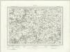
Epping (Outline) - OS One-Inch Revised New Series
1 : 63360 Topographic maps Ordnance Survey Ordnance Survey
London passenger transport map
Ordnance Survey
Ordnance Survey of England and Wales (Sheet 7), South Wales
Ordnance Survey, Great Britain
London N.E. - OS One-Inch Map
1 : 63360 Topographic maps Ordnance Survey Ordnance Survey
Saffron Walden - OS One-Inch Map
1 : 63360 Topographic maps Ordnance Survey Ordnance Survey
A New and Correct Mapp of Middlesex, Essex and Hertfordshire
Bland, Joseph, Parker, Samuel, Smyth, Payler and Warburton, John


