Maps of Norwich
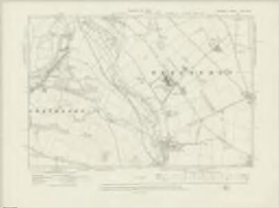
Norfolk LXIII.NW - OS Six-Inch Map
1 : 10560 Topographic maps Ordnance Survey Ordnance Survey
Norfolk LXIII.NW - OS Six-Inch Map
1 : 10560 Topographic maps Ordnance Survey Ordnance Survey
Norfolk LXIII.NW - OS Six-Inch Map
1 : 10560 Topographic maps Ordnance Survey Ordnance Survey
Norfolk LXIII.NW - OS Six-Inch Map
1 : 10560 Topographic maps Ordnance Survey Ordnance Survey
Norfolk LXIII.NW - OS Six-Inch Map
1 : 10560 Topographic maps Ordnance Survey Ordnance Survey
Norfolk LXIII.NW - OS Six-Inch Map
1 : 10560 Topographic maps Ordnance Survey Ordnance Survey
Norfolk LXIII.6 (includes: Costessey; Hellesdon; Norwich) - 25 Inch Map
1 : 2500 Topographic maps Ordnance Survey Ordnance Survey
Norfolk LXIII.6 (includes: Costessey; Hellesdon; Norwich) - 25 Inch Map
1 : 2500 Topographic maps Ordnance Survey Ordnance Survey
Norfolk LXIII.6 (includes: Costessey; Hellesdon; Norwich) - 25 Inch Map
1 : 2500 Topographic maps Ordnance Survey Ordnance Survey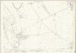
Norfolk LXIII.6 (includes: Costessey; Hellesdon; Norwich) - 25 Inch Map
1 : 2500 Topographic maps Ordnance Survey Ordnance Survey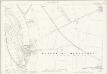
Norfolk LXIII.6 (includes: Costessey; Hellesdon; Norwich) - 25 Inch Map
1 : 2500 Topographic maps Ordnance Survey Ordnance Survey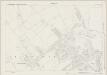
Norfolk LXIII.2 (includes: Drayton; Hellesdon; Horsford; Horsham St Faith With Newton St Faith) - 25 Inch Map
1 : 2500 Topographic maps Ordnance Survey Ordnance Survey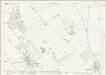
Norfolk LXIII.2 (includes: Drayton; Hellesdon; Horsford; Horsham St Faith With Newton St Faith) - 25 Inch Map
1 : 2500 Topographic maps Ordnance Survey Ordnance Survey
Norfolk LXIII.2 (includes: Drayton; Hellesdon; Horsford; Horsham St Faith With Newton St Faith) - 25 Inch Map
1 : 2500 Topographic maps Ordnance Survey Ordnance Survey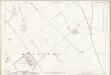
Norfolk LXIII.2 (includes: Drayton; Hellesdon; Horsford; Horsham St Faith With Newton St Faith) - 25 Inch Map
1 : 2500 Topographic maps Ordnance Survey Ordnance Survey
Norfolk LXIII.5 (includes: Costessey; Hellesdon; Norwich) - 25 Inch Map
1 : 2500 Topographic maps Ordnance Survey Ordnance Survey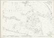
Norfolk LXIII.5 (includes: Costessey; Hellesdon; Norwich) - 25 Inch Map
1 : 2500 Topographic maps Ordnance Survey Ordnance Survey
Norfolk LXIII.5 (includes: Costessey; Hellesdon; Norwich) - 25 Inch Map
1 : 2500 Topographic maps Ordnance Survey Ordnance Survey
Norfolk LXIII.5 (includes: Costessey; Hellesdon; Norwich) - 25 Inch Map
1 : 2500 Topographic maps Ordnance Survey Ordnance Survey
Norfolk LXIII.5 (includes: Costessey; Hellesdon; Norwich) - 25 Inch Map
1 : 2500 Topographic maps Ordnance Survey Ordnance Survey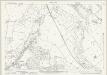
Norfolk LXIII.1 (includes: Costessey; Drayton; Hellesdon; Taverham) - 25 Inch Map
1 : 2500 Topographic maps Ordnance Survey Ordnance Survey
Norfolk LXIII.1 (includes: Costessey; Drayton; Hellesdon; Taverham) - 25 Inch Map
1 : 2500 Topographic maps Ordnance Survey Ordnance Survey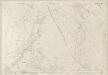
Norfolk LXIII.1 (includes: Costessey; Drayton; Hellesdon; Taverham) - 25 Inch Map
1 : 2500 Topographic maps Ordnance Survey Ordnance Survey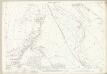
Norfolk LXIII.1 (includes: Costessey; Drayton; Hellesdon; Taverham) - 25 Inch Map
1 : 2500 Topographic maps Ordnance Survey Ordnance Survey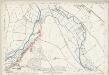
Norfolk LXIII.1 (includes: Costessey; Drayton; Hellesdon; Taverham) - 25 Inch Map
1 : 2500 Topographic maps Ordnance Survey Ordnance Survey
TG11 - OS 1:25,000 Provisional Series Map
1 : 25000 Topographic maps Ordnance Survey Ordnance Survey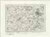
Norwich (Outline) - OS One-Inch Revised New Series
1 : 63360 Topographic maps Ordnance Survey Ordnance Survey
Norwich (Hills) - OS One-Inch Revised New Series
1 : 63360 Topographic maps Ordnance Survey Ordnance Survey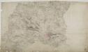
Norwich 23
1 : 31680 This plan covers part of Norfolk with the county town of Norwich,depicted at lower right., Built,on a hill, Norwich was of strategic importance to the invading Saxons, Romans and Normans.,,Light pencil interlining ('hachuring') is employed to represent the slight undulation,and the low hills of this part of East Anglia., The landscape is characterised by fertile farmland with a few woodland areas and wild heaths. Budgen, Charles