Maps of Barford St. Martin
Wiltshire LXV.SE - OS Six-Inch Map
1 : 10560 Topographic maps Ordnance Survey Ordnance Survey
Wiltshire LXV.SE - OS Six-Inch Map
1 : 10560 Topographic maps Ordnance Survey Ordnance Survey
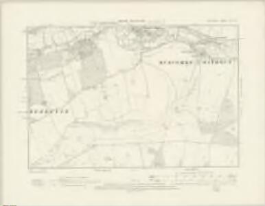
Wiltshire LXV.11 (includes: Barford St Martin; Compton Chamberlayne) - 25 Inch Map
1 : 2500 Topographic maps Ordnance Survey Ordnance Survey
Wiltshire LXV.11 (includes: Barford St Martin; Compton Chamberlayne) - 25 Inch Map
1 : 2500 Topographic maps Ordnance Survey Ordnance Survey
Wiltshire LXV.11 (includes: Barford St Martin; Compton Chamberlayne) - 25 Inch Map
1 : 2500 Topographic maps Ordnance Survey Ordnance Survey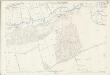
Wiltshire LXV.11 (includes: Barford St Martin; Compton Chamberlayne) - 25 Inch Map
1 : 2500 Topographic maps Ordnance Survey Ordnance Survey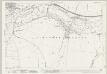
Wiltshire LXV.12 (includes: Barford St Martin; Burcombe Without; Wilton) - 25 Inch Map
1 : 2500 Topographic maps Ordnance Survey Ordnance Survey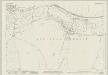
Wiltshire LXV.12 (includes: Barford St Martin; Burcombe Without; Wilton) - 25 Inch Map
1 : 2500 Topographic maps Ordnance Survey Ordnance Survey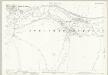
Wiltshire LXV.12 (includes: Barford St Martin; Burcombe Without; Wilton) - 25 Inch Map
1 : 2500 Topographic maps Ordnance Survey Ordnance Survey
Wiltshire LXV.12 (includes: Barford St Martin; Burcombe Without; Wilton) - 25 Inch Map
1 : 2500 Topographic maps Ordnance Survey Ordnance Survey
Wiltshire LXV.12 (includes: Barford St Martin; Burcombe Without; Wilton) - 25 Inch Map
1 : 2500 Topographic maps Ordnance Survey Ordnance Survey
Wiltshire LXV.15 (includes: Barford St Martin; Broad Chalke; Burcombe Without; Compton Chamberlayne) - 25 Inch Map
1 : 2500 Topographic maps Ordnance Survey Ordnance Survey
Wiltshire LXV.15 (includes: Barford St Martin; Broad Chalke; Burcombe Without; Compton Chamberlayne) - 25 Inch Map
1 : 2500 Topographic maps Ordnance Survey Ordnance Survey
Wiltshire LXV.15 (includes: Barford St Martin; Broad Chalke; Burcombe Without; Compton Chamberlayne) - 25 Inch Map
1 : 2500 Topographic maps Ordnance Survey Ordnance Survey
Wiltshire LXV.15 (includes: Barford St Martin; Broad Chalke; Burcombe Without; Compton Chamberlayne) - 25 Inch Map
1 : 2500 Topographic maps Ordnance Survey Ordnance Survey
Wiltshire LXV.16 (includes: Barford St Martin; Bishopstone; Broad Chalke; Burcombe Without; Wilton) - 25 Inch Map
1 : 2500 Topographic maps Ordnance Survey Ordnance Survey
Wiltshire LXV.16 (includes: Barford St Martin; Bishopstone; Broad Chalke; Burcombe Without; Wilton) - 25 Inch Map
1 : 2500 Topographic maps Ordnance Survey Ordnance Survey
Wiltshire LXV.16 (includes: Barford St Martin; Bishopstone; Broad Chalke; Burcombe Without; Wilton) - 25 Inch Map
1 : 2500 Topographic maps Ordnance Survey Ordnance Survey
Wiltshire LXV.16 (includes: Barford St Martin; Bishopstone; Broad Chalke; Burcombe Without; Wilton) - 25 Inch Map
1 : 2500 Topographic maps Ordnance Survey Ordnance Survey
Wiltshire LXV.16 (includes: Barford St Martin; Bishopstone; Broad Chalke; Burcombe Without; Wilton) - 25 Inch Map
1 : 2500 Topographic maps Ordnance Survey Ordnance Survey
Wiltshire LXV - OS Six-Inch Map
1 : 10560 Topographic maps Ordnance Survey Ordnance Survey
SU02 - OS 1:25,000 Provisional Series Map
1 : 25000 Topographic maps Ordnance Survey Ordnance Survey
SU03 - OS 1:25,000 Provisional Series Map
1 : 25000 Topographic maps Ordnance Survey Ordnance Survey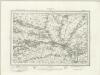
Salisbury (Outline) - OS One-Inch Revised New Series
1 : 63360 Topographic maps Ordnance Survey Ordnance Survey
Salisbury (Hills) - OS One-Inch Revised New Series
1 : 63360 Topographic maps Ordnance Survey Ordnance Survey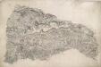
Berwick St. John
Small red crosses at Baverstoke, at the top centre, and Et Knoyle, at the top left,mark observation points used by the surveyor to plot topographical details and measure distances. The draughtsman has faithfully recorded the relative relief of the hills and indicated areas of woodland, using various shades of green to distinguish woods from grassland. The ancient circular earthworks of Chiselbury are marked by concentric rings on White Sheet Hill, in the centre of the drawing.
Dorset Shire, 3
2 Blätter : 109 x 45 cm s.n.
Salisbury - OS One-Inch Map
1 : 63360 Topographic maps Ordnance Survey Ordnance Survey
Cary's Improved Map of England and Wales
Cary, George, & Cary, John London : G. & J. Cary