Maps of Lambeth
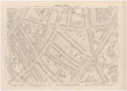
London XI.33 - OS London Town Plan
1 : 1056 Topographic maps Ordnance Survey Ordnance Survey
London (1915- Numbered sheets) IX.5 (includes: Battersea; Lambeth St Mary; Wandsworth Borough) - 25 Inch Map
1 : 2500 Topographic maps Ordnance Survey Ordnance Survey
London (Edition of 1894-96) CI (includes: Battersea; Lambeth St Mary; Wandsworth Borough) - 25 Inch Map
1 : 2500 Topographic maps Ordnance Survey Ordnance Survey
London (First Editions c1850s) LXV (includes: Battersea; Lambeth St Mary; Wandsworth Borough) - 25 Inch Map
1 : 2500 Topographic maps Ordnance Survey Ordnance Survey
London (1915- Numbered sheets) IX.6 (includes: Camberwell; Lambeth St Mary) - 25 Inch Map
1 : 2500 Topographic maps Ordnance Survey Ordnance Survey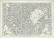
London (First Editions c1850s) LXVI (includes: Camberwell; Lambeth St Mary) - 25 Inch Map
1 : 2500 Topographic maps Ordnance Survey Ordnance Survey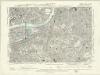
London XI.NW - OS Six-Inch Map
1 : 10560 Topographic maps Ordnance Survey Ordnance Survey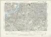
Surrey III.SW - OS Six-Inch Map
1 : 10560 Topographic maps Ordnance Survey Ordnance Survey
Charles Booth's descriptive map of London poverty 1889
Charles Booth
Insurance Plan of London South West District Vol. K: Key Plan
1 : 10560 This "key plan" indicates coverage of the Goad 1897 series of fire insurance maps of London that were originally produced to aid insurance companies in assessing fire risks. The building footprints, their use (commercial, residential, educational, etc.), the number of floors and the height of the building, as well as construction materials (and thus risk of burning) and special fire hazards (chemicals, kilns, ovens) were documented in order to estimate premiums. Names of individual businesses, property lines, and addresses were also often recorded. Together these maps provide a rich historical shapshot of the commercial activity and urban landscape of towns and cities at the time. The British Library holds a comprehensive collection of fire insurance plans produced by the London-based firm Charles E. Goad Ltd. dating back to 1885. These plans were made for most important towns and cities of the British Isles at the scales of 1:480 (1 inch to 40 feet), as well as many foreign towns at 1:600 (1 inch to 50 feet). Chas E Goad Limited Chas E Goad Limited
London SW.
1 : 15840 Stanford, Edward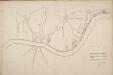
Thames and Metropolis Improvement plan
Martin, John
London SE.
1 : 15840 Stanford, Edward
An exact survey of the city's of London Westminster , VII
1 Blatt : 53 x 71 cm John Rocque
London Sheet O - OS Six-Inch Map
1 : 10560 Topographic maps Ordnance Survey Ordnance Survey
London Sheet O - OS Six-Inch Map
1 : 10560 Topographic maps Ordnance Survey Ordnance Survey
Middlesex XXII - OS Six-Inch Map
1 : 10560 Topographic maps Ordnance Survey Ordnance Survey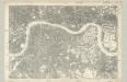
Surrey III - OS Six-Inch Map
1 : 10560 Topographic maps Ordnance Survey Ordnance Survey
Insurance Plan of London Western District Vol. A: Key Plan
1 : 21120 This "key plan" indicates coverage of the Goad 1901 series of fire insurance maps of London that were originally produced to aid insurance companies in assessing fire risks. The building footprints, their use (commercial, residential, educational, etc.), the number of floors and the height of the building, as well as construction materials (and thus risk of burning) and special fire hazards (chemicals, kilns, ovens) were documented in order to estimate premiums. Names of individual businesses, property lines, and addresses were also often recorded. Together these maps provide a rich historical shapshot of the commercial activity and urban landscape of towns and cities at the time. The British Library holds a comprehensive collection of fire insurance plans produced by the London-based firm Charles E. Goad Ltd. dating back to 1885. These plans were made for most important towns and cities of the British Isles at the scales of 1:480 (1 inch to 40 feet), as well as many foreign towns at 1:600 (1 inch to 50 feet). Chas E Goad Limited Chas E Goad Limited
Londini Angliae regni metropolis delineatio accuratissima / autore F. de Witt
1 : 13000 Wit, Frederik de Amsterdam : F. de Witt
A colored plan, on vellum, of Southwark, and the country on the Surrey side of the Thames from Vauxhall to Deptford, with proposed roads from Westminster Bridge

Map shewing the situation of all premises licensed for the sale of intoxicating liquors in the County of London
London County Council
BOWLES'S NEW PLAN OF LONDON, WESTMINSTER AND SOUTHWARK, WITH THEIR ENVIRONS TO THE EXTENT OF THREE MILES ROUND ST. PAUL'S
The Bowles family were prolific publishers and their output spans more than a century. This map is relatively unusual as it is presented in a circle. The map is divided by lines into square miles. In the margins of the sheet are reference tables and adverts for coming publications. Baker Street, laid out from 1755 on, is shown by a pecked line, as is Gloucester Street. Carington Bowles
Nouvelle carte du gouvernement civil d'Angleterre et de celuy de la ville de Londres
2 Karten : Kupferdruck ; Bildgrösse 35 x 45 cm Châtelain s.n.
London.
1 : 19495 Letts, Son & Co.
General Plan for Trusts of the Turnpike Gates
Cary, John
PLAN of LONDON
Only the main roads appear on this map, giving the appearance of a rather spacious capital city. The new London Bridge is shown without its approaches. Pecked lines show the intended location of the Thames Tunnel. Marc Brunel, father of the great engineer Isobard, solved the problem of how to bore through soft ground or under water, inventing the tunnelling shield. Both father and son worked on the tunnel which was completed as a foot tunnel in 1843, before becoming a railway tunnel for the East London Railway in the 1860s. The East and West India Docks are also shown. Phillips, Horatio
Map of London, shewing the BOUNDARIES of the GENERAL and Two Penny Post
This outline map of London was commissioned by the House of Commons for the21st Report of the Commissioners of Revenue Inquiry in 1830. The map's title features at top right, with the boundaries of the nine postal districts and those of the General-, Two- and Three-Penny Post deliveries outlined in colour. Boundaries are explained at top left with a key to colour usage in panel below the plan. Basire, James
Cary's new plan of London and its vicinity
Cary, John; Cary, George Cary