Maps of Carlisle
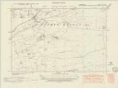
Cumberland XVIII.NE - OS Six-Inch Map
1 : 10560 Topographic maps Ordnance Survey Ordnance Survey
Cumberland XVIII.NE - OS Six-Inch Map
1 : 10560 Topographic maps Ordnance Survey Ordnance Survey
Cumberland XVIII.NE - OS Six-Inch Map
1 : 10560 Topographic maps Ordnance Survey Ordnance Survey
Cumberland XVIII.4 (includes: Nether Denton) - 25 Inch Map
1 : 2500 Topographic maps Ordnance Survey Ordnance Survey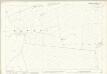
Cumberland XVIII.4 (includes: Nether Denton) - 25 Inch Map
1 : 2500 Topographic maps Ordnance Survey Ordnance Survey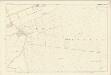
Cumberland XVIII.4 (includes: Nether Denton) - 25 Inch Map
1 : 2500 Topographic maps Ordnance Survey Ordnance Survey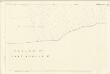
Cumberland XVIII.8 (includes: Farlam) - 25 Inch Map
1 : 2500 Topographic maps Ordnance Survey Ordnance Survey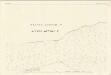
Cumberland XVIII.8 (includes: Farlam) - 25 Inch Map
1 : 2500 Topographic maps Ordnance Survey Ordnance Survey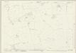
Cumberland XVIII.7 (includes: Brampton) - 25 Inch Map
1 : 2500 Topographic maps Ordnance Survey Ordnance Survey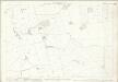
Cumberland XVIII.7 (includes: Brampton) - 25 Inch Map
1 : 2500 Topographic maps Ordnance Survey Ordnance Survey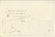
Cumberland XVIII.7 (includes: Brampton) - 25 Inch Map
1 : 2500 Topographic maps Ordnance Survey Ordnance Survey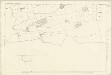
Cumberland XVIII.7 (includes: Brampton) - 25 Inch Map
1 : 2500 Topographic maps Ordnance Survey Ordnance Survey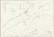
Cumberland XVIII.3 (includes: Nether Denton) - 25 Inch Map
1 : 2500 Topographic maps Ordnance Survey Ordnance Survey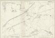
Cumberland XVIII.3 (includes: Nether Denton) - 25 Inch Map
1 : 2500 Topographic maps Ordnance Survey Ordnance Survey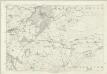
Cumberland XVIII - OS Six-Inch Map
1 : 10560 Topographic maps Ordnance Survey Ordnance Survey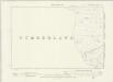
Northumberland XCI.SW - OS Six-Inch Map
1 : 10560 Topographic maps Ordnance Survey Ordnance Survey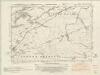
Northumberland nLXXXVIII.NW & nLXXXVIII.SW - OS Six-Inch Map
1 : 10560 Topographic maps Ordnance Survey Ordnance Survey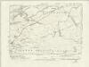
Northumberland nLXXXVIII.NW & nLXXXVIII.SW - OS Six-Inch Map
1 : 10560 Topographic maps Ordnance Survey Ordnance Survey
Northumberland nLXXXVIII.NW & nLXXXVIII.SW - OS Six-Inch Map
1 : 10560 Topographic maps Ordnance Survey Ordnance Survey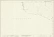
Northumberland (New Series) LXXXVIII.14 (includes: Nether Denton; Thirlwall; Upper Denton) - 25 Inch Map
1 : 2500 Topographic maps Ordnance Survey Ordnance Survey
NY56 - OS 1:25,000 Provisional Series Map
1 : 25000 Topographic maps Ordnance Survey Ordnance Survey
NY66 - OS 1:25,000 Provisional Series Map
1 : 25000 Topographic maps Ordnance Survey Ordnance Survey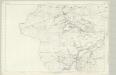
Northumberland XCI - OS Six-Inch Map
1 : 10560 Topographic maps Ordnance Survey Ordnance Survey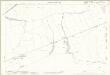
Northumberland (Old Series) XCI.5 (includes: Nether Denton; Thirlwall; Upper Denton) - 25 Inch Map
1 : 2500 Topographic maps Ordnance Survey Ordnance Survey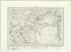
Brampton (Outline) - OS One-Inch Revised New Series
1 : 63360 Topographic maps Ordnance Survey Ordnance Survey
Brampton (Hills) - OS One-Inch Revised New Series
1 : 63360 Topographic maps Ordnance Survey Ordnance Survey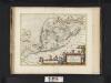
Lidalia vel Lidisdalia regio, Lidisdail / Auct. Timotheo Pont.
Pont, Timothy, 1560?-1614? Blaeu, Joan, 1596-1673
LIDALIA | vel | LIDISDALIA REGIO, | LIDISDAIL.
Auct. Timotheo Pont. [Amsterdam : Joan Blaeu]
Carlisle - OS One-Inch Map
1 : 63360 Topographic maps Ordnance Survey Ordnance Survey