Maps of Carlisle
Northumberland nLXXXVIII.NW & nLXXXVIII.SW - OS Six-Inch Map
1 : 10560 Topographic maps Ordnance Survey Ordnance Survey
Northumberland nLXXXVIII.NW & nLXXXVIII.SW - OS Six-Inch Map
1 : 10560 Topographic maps Ordnance Survey Ordnance Survey
Northumberland nLXXXVIII.NW & nLXXXVIII.SW - OS Six-Inch Map
1 : 10560 Topographic maps Ordnance Survey Ordnance Survey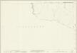
Northumberland (New Series) LXXXVIII.14 (includes: Nether Denton; Thirlwall; Upper Denton) - 25 Inch Map
1 : 2500 Topographic maps Ordnance Survey Ordnance Survey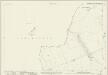
Northumberland (New Series) LXXXVIII.6 (inset LXXXVIII.10) (includes: Nether Denton; Thirlwall; Upper Denton; Waterhead) - 25 Inch Map
1 : 2500 Topographic maps Ordnance Survey Ordnance Survey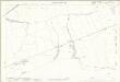
Northumberland (Old Series) XCI.5 (includes: Nether Denton; Thirlwall; Upper Denton) - 25 Inch Map
1 : 2500 Topographic maps Ordnance Survey Ordnance Survey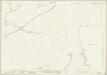
Cumberland XII.16 (includes: Nether Denton) - 25 Inch Map
1 : 2500 Topographic maps Ordnance Survey Ordnance Survey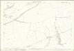
Cumberland XII.16 (includes: Nether Denton) - 25 Inch Map
1 : 2500 Topographic maps Ordnance Survey Ordnance Survey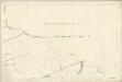
Cumberland XII.16 (includes: Nether Denton) - 25 Inch Map
1 : 2500 Topographic maps Ordnance Survey Ordnance Survey
Cumberland XII.16 (includes: Nether Denton) - 25 Inch Map
1 : 2500 Topographic maps Ordnance Survey Ordnance Survey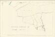
Cumberland XII.16 (includes: Nether Denton) - 25 Inch Map
1 : 2500 Topographic maps Ordnance Survey Ordnance Survey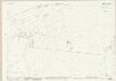
Cumberland XVIII.4 (includes: Nether Denton) - 25 Inch Map
1 : 2500 Topographic maps Ordnance Survey Ordnance Survey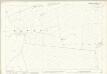
Cumberland XVIII.4 (includes: Nether Denton) - 25 Inch Map
1 : 2500 Topographic maps Ordnance Survey Ordnance Survey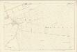
Cumberland XVIII.4 (includes: Nether Denton) - 25 Inch Map
1 : 2500 Topographic maps Ordnance Survey Ordnance Survey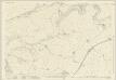
Cumberland XII.15 (includes: Burtholme) - 25 Inch Map
1 : 2500 Topographic maps Ordnance Survey Ordnance Survey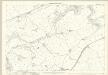
Cumberland XII.15 (includes: Burtholme) - 25 Inch Map
1 : 2500 Topographic maps Ordnance Survey Ordnance Survey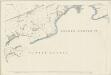
Cumberland XII.15 (includes: Burtholme) - 25 Inch Map
1 : 2500 Topographic maps Ordnance Survey Ordnance Survey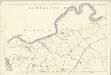
Cumberland XII.15 (includes: Burtholme) - 25 Inch Map
1 : 2500 Topographic maps Ordnance Survey Ordnance Survey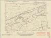
Cumberland XII.SE - OS Six-Inch Map
1 : 10560 Topographic maps Ordnance Survey Ordnance Survey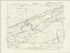
Cumberland XII.SE - OS Six-Inch Map
1 : 10560 Topographic maps Ordnance Survey Ordnance Survey
Cumberland XII.SE - OS Six-Inch Map
1 : 10560 Topographic maps Ordnance Survey Ordnance Survey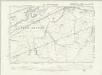
Northumberland XCI.NW - OS Six-Inch Map
1 : 10560 Topographic maps Ordnance Survey Ordnance Survey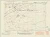
Cumberland XVIII.NE - OS Six-Inch Map
1 : 10560 Topographic maps Ordnance Survey Ordnance Survey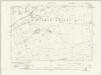
Cumberland XVIII.NE - OS Six-Inch Map
1 : 10560 Topographic maps Ordnance Survey Ordnance Survey
Cumberland XVIII.NE - OS Six-Inch Map
1 : 10560 Topographic maps Ordnance Survey Ordnance Survey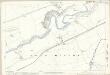
Northumberland (Old Series) XCI.2 (includes: Thirlwall; Upper Denton; Waterhead) - 25 Inch Map
1 : 2500 Topographic maps Ordnance Survey Ordnance Survey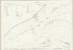
Cumberland XVIII.3 (includes: Nether Denton) - 25 Inch Map
1 : 2500 Topographic maps Ordnance Survey Ordnance Survey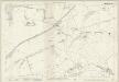
Cumberland XVIII.3 (includes: Nether Denton) - 25 Inch Map
1 : 2500 Topographic maps Ordnance Survey Ordnance Survey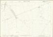
Cumberland XIII.13 (includes: Blenkinsopp) - 25 Inch Map
1 : 2500 Topographic maps Ordnance Survey Ordnance Survey