Maps of Landkreis Landsberg am Lech

Bairische Landtafeln XXIIII. Darinnē das hochlöblich Furstenthumb Obern unnd Nidern Bayrn sambt der Obern Pflaz Erz unnd Stifft Salzburg Eichstet unnd andern mehrern anstossenden Herschafftē]
1 : 145000 Mollova mapová sbírka Apian, Philipp Amman, Jost Apian, Petrus
Landsperger Gegend
Mollova mapová sbírka Bodenehr, Gabriel Bodenehr, Gabriel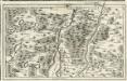
München, HeiligBerg Andex, Schöfflarn a okolí]
Mollova mapová sbírka Bodenehr, Gabriel Bodenehr, Gabriel
Karte vom Starnberger See
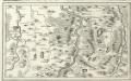
Kavfbeiren, Löder, Schonga, Weilheim a okolí]
Mollova mapová sbírka Bodenehr, Gabriel Bodenehr, Gabriel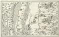
Bobingen, Liechtenberg, Babern, Möhringen a okolí]
Mollova mapová sbírka Bodenehr, Gabriel Bodenehr, Gabriel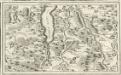
Beurberg, Wurmsee, Tölltz a okolí]
Mollova mapová sbírka Bodenehr, Gabriel Bodenehr, Gabriel
München mit der Gegend
Mollova mapová sbírka Bodenehr, Gabriel Bodenehr, Gabriel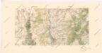
Speciální mapy okolí různých měst

Describit Partem Regim: Monach: intra Lycum et Isaram versus Merid: sitam Secund: ej; Præf: Partic. Episc: Augustani, Comit: Werdenfels et Tirol
1 : 150000 Mollova mapová sbírka Buna, Wilhelm C. Broenner, Heinrich Ludwig
Pars VII. describit partem regim: monach: intra Lycum et Isaram versus merid: sitam secund: ej[us] præf: partic. episc: Augustani, comit: Werdenfels et Tirol
1 Karte : 54 x 52 cm Heinrich Ludwig Broenner
München 143, uit: Special-Karte von Mittel-Europa / nach amtlichen Quellen bearbeitet von W. Liebenow
1 : 300000 titelvariant: W. Liebenow's Mittel-Europa; Annotatie: Titel boven de bladen: W. Liebenow's Mittel-Europa Johannes Wilhelm Liebenow 1822-1897 Frankfurt a. M. : Ludwig Ravenstein
Gebirgs-Karte
Alpy rakouské (pohoří) in Commission der literarisch-artistischen Anstalt
Mappa Electoratus et Ducatus Bavariae Superioris et Inferioris, Ducatus Neoburgesis cum Episcopatibus Frisingensi Ratisbonensi Passaviensi et Praepositura Bergtolsgadensi].
1 : 260000 Mollova mapová sbírka Apian, Philipp
Sacri Romani imperii circuli et electoratus Bavariae tabula, 5
6 Blätter : s.n.
Accurata Delineatio Episcopat. Frisingensis
1 : 266600 Mollova mapová sbírka Seutter, Matthäus Seutter, Matthäus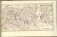

Sacri imperii Romani circuli et electoratus Bavariæ, 3
1 Karte : mehrfarbig ; R. et J. Ottens
[Fol. III]
1 Karte : 43 x 55 cm Königliche Akademie der Wissenschaften
Das Herzogthum Ober und Nieder Baiern, 3
1 Karte : 43 x 55 cm Lotter
Accurata delineatio episcopat[us] Frisingensis
1 Karte : Kupferdruck ; 55 x 47 cm Lotter Tobias Conrad Lotter
Accurata delineatio episcopat[us] Frisingensis
1 Karte : Kupferdruck ; 54 x 48 cm Seutter Matthäus Seutter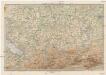
Karte der Bayrischen und Algäuer Alpen
1 : 250000 Allgäuské Alpy (Německo a Rakousko) Ravenstein, Ludwig L. Ravenstein

Bavaria. Suevia
Mollova mapová sbírka Hoffmann, Johannes Hoffmann, Johann
Episcopatus Avgvstanvs compendio
1 : 630000 Mollova mapová sbírka Glasser, Johann Friedrich Mayr, Johann L. Glasser, Johann Friedrich
Brunn's Tourenkarte von Oberbayern mit angrenzenden Ländern Nordtirol und Salzburg
1 : 250000 Brunn
Augsburg
1 : 200000 Herder, Benjamin
Militair Karte von Süd-Deutschland in 20 Sectionen
1 : 400000 14. Section Coulon, Alois von A. von Coulon
![Bairische Landtafeln XXIIII. Darinnē das hochlöblich Furstenthumb Obern unnd Nidern Bayrn sambt der Obern Pflaz Erz unnd Stifft Salzburg Eichstet unnd andern mehrern anstossenden Herschafftē]](https://images-0.georeferencer.com/images/iiif/890508709762/full/,300/0/native.jpg)

