Maps of Germany

Accuratissima Germaniae tabula / denuo in lucem edita à Frederico de Wit
1 : 2400000 Annotatie: Origineel is Blad 62 in atlas factice Wit, Frederik de Amstelodami : [Fredericus de Wit]
Neueste Eisenbahn- und Kriegs-Karte
Evropa střední A.H. Payne
Ubersicht der Meteorologischen Stationen in Deutschland.
1 : 3700000 Berghaus, Heinrich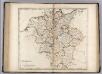
Germany.
1 : 2920000 Carey, Mathew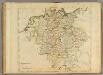
Germany.
1 : 2950000 Carey, Mathew

Besondere Post und Reise Carte der Wege Durch Teutschland
1 : 3600000 Mollova mapová sbírka
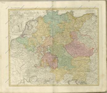
Tabula Geographica totius S[acri] Imperii Romani
1 : 1800000 Mollova mapová sbírka Müller, Johann Ulrich Bodenehr, Georg Conrad
Germania in Circulos Divisa
1 : 4300000 Mollova mapová sbírka Weigel, Christoph Weigel, Christoph I.
Imperii Romano-Germanici
1 : 2400000 Mollova mapová sbírka Schatz, Johann Jakob Homann, Johann Baptista - dědici
Imperii Romano-Germanici
1 : 2400000 Mollova mapová sbírka Schatz, Johann Jakob Homann, Johann Baptista - dědici
Imperium Romano-Germanicum
1 : 2400000 Mollova mapová sbírka Homann, Johann Baptist Homann, Johann Baptista - dědici
Imperium Romano-Germanicum
1 : 2400000 Mollova mapová sbírka Homann, Johann Baptist Homann, Johann Baptista - dědici
Tabula Geographica Totius Germaniae
1 : 2400000 Homann, Johann Baptist

S[anctum] Imperium Romano-Germanicum oder Teutschland Mit Seinen Angräntzenden Königreichen Und Provincien
Reichelt, Julius; Visscher, Nicolaes; Hogeboom, Andries

S. Imperium Romano-Germanicum oder Teutschland mit seinen angräntzenden Königreichen und Provincien
1 : 2420000 Evropa střední Reichelt, Julius Hogeboom, A. durch Nicolaum Visscher
S. Imperium Romano-Germanicum oder Teutschland mit seinen angräntzenden Königreichen und Provincien
1 : 2450000 Evropa střední Reichelt, Julius Hogeboom, Andries durch Nicolaum Visscher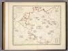
Botanische Karte von Deutschland.
1 : 3700000 Berghaus, Heinrich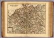
Carte exacte des postes et routes de l'Empire d'Allemagne divisee en ses cercles.
1 : 2500000 Covens et Mortier
Tabula geographica totius Germaniae
1 : 2426000 Německo Homann, Johann Baptist J. B. Homann
Germania Secundum

Neu-vermehrte Post-Charte durch gantz Teutschland nach Italien, Franckreich, Niederland, Preußen, Polen und Ungarn &c.
1 : 2500000 Mollova mapová sbírka Nell, Johann Peter Homann, Johann Baptista

Homannův atlas světa
1 : 12500000
Karte von Deutschland
1 : 1880000 Evropa střední Reilly, Franz Johann Josef von Benedicti, Hieronymus Franz Joh. Jos. von Reilly
Karte von Deutschland
1 : 1880000 Evropa střední Reilly, Franz Johann Josef von Benedicti, Hieronymus Franz Joh. Jos. von Reilly