Maps of Czech Republic

Království České

Cesty ptáků zemních v Čechách
Čechy (Česko) Šír, Vladislav
Cesty ptáků bahních a vodních v Čechách
Čechy (Česko) Schier, Vladislav
Království české podle nejnovějšího rozdělení na 7 krajů a s poznamenáním sídel okresních hejtmanství a soudů
1 : 800000 Čechy (Česko) Krečmar, Bedřich
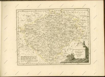
Charte vom Königreiche Böheim
1 : 550000 Česko Kreibich, František Jakub Jindřich David, Martin Alois in der A.G. Schneider u. Weigelschen Kunst- u. Landkartenhandlung
Charte vom Königreiche Böheim
1 : 569000 Česko Kreibich, František Jakub Jindřich David, Martin Alois in der A.G. Schneider u. Weigelschen Kunst- u. Landkartenhandlung
Charte vom Königreiche Böheim
1 : 569000 Česko Kreibich, František Jakub Jindřich David, Martin Alois A.G. Schneider u. Weigelschen Kunst u. Landkartenhandlung
Mapa Království českého pro automobilisty
1 : 560000 Česko Bayer, J. L. Jos. L. Švíkal
[Čechy]
Česko
[Čechy]
Česko
Automobil-Karte von Böhmen
1 : 560000 Čechy (Česko) Bayer, J. L Klement's Nachfolger
Konigreich Boheim
1 : 905000 Česko Sanson, Nicolas le Sr. Sanson d'Abbeuille
Přehledná železniční mapa království Českého

Bohemia in XVI circulos divisa, notitiis plurimis illustrata
1 : 350000 Česko Bock-Polach, Josef Ferdinand Müller, Johann Christoph Artaria
Postcours-Karte von Böhmen
Praha (Česko) R. v. Waldheim
Karte des Koenigreichs Boehmen

Místopisná mapa království českého

Karten zur Statistik des Königreiches Böhmen

Karte über die Schafwollwaren...

Mapa Českého království
1 : 418000
Das Königreich Böhmen
Čechy (Česko) Benecke Bormann, E. Ignaz Fuchs
G. Freytag's Landtags-Wahlkarte von Böhmen 1901
1 : 1000000 Česko Freytag, Gustav G. Freytag & Berndt
Volební mapa do říšského sněmu
1 : 1000000 Česko G. Freytag & Berndt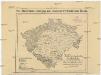
Rozdělení Království českého
Česko Ludvík Bratršovský
Přehledná mapa železniční království Českého

Národnostní mapa Království Českého na základě sčítání lidu z roku 1880

Geologische Karte von Böhmen
Mapa rozšíření rašelin v Čechách
1 : 2660000 Čechy (Česko) Sitenský, František Ladislav Kořistka, Karel František Edvard A. Haase