Maps of Czech Republic

Bohemia in XVI circulos divisa, notitiis plurimis illustrata
1 : 350000 Česko Bock-Polach, Josef Ferdinand Müller, Johann Christoph Artaria
Charte vom Königreiche Böheim
1 : 550000 Česko Kreibich, František Jakub Jindřich David, Martin Alois in der A.G. Schneider u. Weigelschen Kunst- u. Landkartenhandlung
Charte vom Königreiche Böheim
1 : 569000 Česko Kreibich, František Jakub Jindřich David, Martin Alois in der A.G. Schneider u. Weigelschen Kunst- u. Landkartenhandlung
Charte vom Königreiche Böheim
1 : 569000 Česko Kreibich, František Jakub Jindřich David, Martin Alois A.G. Schneider u. Weigelschen Kunst u. Landkartenhandlung
Místopisná mapa království českého

Automobil-Karte von Böhmen
1 : 560000 Čechy (Česko) Bayer, J. L Klement's Nachfolger
Mapa Českého království
1 : 418000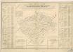
Orientirungs - Karte in der neuen gerichtlichen und politischen Eintheilung des Königreichs Böhmen

Konigreich Boheim
1 : 905000 Česko Sanson, Nicolas le Sr. Sanson d'Abbeuille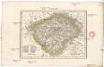
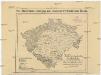
Čechy
1 : 2775000 Čechy (Česko)
Karten zur Statistik des Königreiches Böhmen

Místopisná mapa království Českého

Charte von Boehmen
Česko Kipferling, Karl Joseph David, Martin Alois im Verlage des Kunst u. Industrie Comptoirs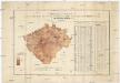
Uebersichts-Karte und statistische Darstellung der Area und der Grundsteuer-Vorschreibung des landtäflichen Grossgrundbesitzes dann des Grundbesitzes überhaupt im Königreiche Böhmen
České království Procházka, Johann F. Joh. F. Procházka
Charte vom Königreiche Böheim
1 : 563000 Česko Kreibich, František Jakub Jindřich David, Martin Alois in der Kunst- und Landkarten-Handlung des Marco Berra
Charte vom Königreiche Böheim
Česko Kreibich, František Jakub Jindřich David, Martin Alois in der Kunst- und Landkarten-Handlung des Marco Berra
Mappa totius regni Bohemiae
1 : 700000 Čechy (Česko) Bock-Polach, Josef Ferdinand Müller, Johann Christoph
Mappa totius regni Bohemiae
1 : 700000 Čechy (Česko) Bock-Polach, Josef Ferdinand Ponheimer, Kilian
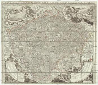
Das Königreich Böhmen : nach der neuesten politischen Eintheilungen berichtigt / entw. und gez. von C.F. Weiland
1 : 600000 Weiland, C. F. Weimar : Geograph. Institut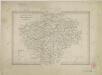
II. vojenské mapování Klad mapových listů

Králowstwí České
Jireček, Josef
Hydrografická přehledná mapa Čech

Království České
1 : 600000 Česko Gräf, K. Müller, A. Výmarský ústav zeměpisný
Království České
1 : 600000 Čechy (Česko) Gräf, K. Biedermann, E. Ústav zeměpisný
Království České
1 : 600000 Čechy (Česko) Gräf, K. Biedermann, E. Ústav zeměpisný
Království České
1 : 600000 Česko Gräf, K. Müller, A. Výmarský ústav zeměpisný
[Čechy]
1 : 580000 Česko
G. Freytag's Landtags-Wahlkarte von Böhmen 1901
1 : 1000000 Česko Freytag, Gustav G. Freytag & Berndt
Volební mapa do říšského sněmu
1 : 1000000 Česko G. Freytag & Berndt