Maps of Praha

Orientační plán hlavního města Prahy s okolím
1 : 5000
Orientační plán Prahy a obcí sousedních List 26.
1 : 5000
Sliwenetz (Sliwenec) - c7041-1-003 - Kaiserpflichtexemplar der Landkarten des stabilen Katasters
1 : 2880
Sliwenetz (Sliwenec) - c7041-1-004 - Kaiserpflichtexemplar der Landkarten des stabilen Katasters
1 : 2880
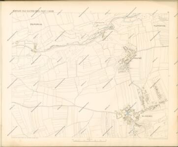
Sliwenetz (Sliwenec) - c7041-1-001 - Kaiserpflichtexemplar der Landkarten des stabilen Katasters
1 : 2880
Sliwenetz (Sliwenec) - c7041-1-002 - Kaiserpflichtexemplar der Landkarten des stabilen Katasters
1 : 2880
Sliwenetz (Sliwenec) - c7041-1-005 - Kaiserpflichtexemplar der Landkarten des stabilen Katasters
1 : 2880
Environs de Hlubočep
1 : 6150 Hlubočepy (Praha, Česko) Barrande, Joachim
Orientační plán hlavního města Prahy
Orientierungsplan der Hauptstadt Prag
Jiřík, Rudolf
Umgebung von Prag

Výškopisný plán hlavního města Prahy s okolím

Prag und seine Umgebungen
Praha (Česko) Bittner, Joseph Kettner, C. J. G. Calvesche Buchhandlung
Nejnovější plán Prahy : připojen abecední seznam ulic k rychlému vyhledávání, seznam škol...
1 : 17500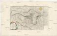
Belagerung und Bloquade der Stadt Prag durch die königl. preussische Armée, im Jahre 1757
Praha (Česko)
Prag und seine Umgebungen, nach den besten Hülfsmitteln dargestellt
1 : 42000 C. Kettner sculp. Prag : J. G. Calve'sche Buchhandlung
Die öffentlichen Verkehrsmittel der Hauptstadt Prag
1 : 17500 Praha (Česko) Městské podniky pražské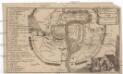
Plan der Merckwürdrgen [sic] Belagerung der Stadt Prag in Böhmen Anno 1743
Praha (Česko)
Okolí Prahy
1 : 25000 Praha (Česko : oblast) Hurtig, Alfred Stát. komise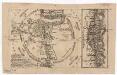
Grundriss der könig. böhmische[n] Haupt Stadt Prag
Praha (Česko)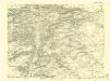
III. vojenské mapování 3953/3
1 : 25000
Grundriss der König. Bohmischen Haupt Stadt Prag
Praha (Česko) Christoph Riegel Buchhändlen
Bez titulu: Jihovýchodní okolí Prahy

Okolí města Prahy na hodinu cesty
Praha-oblast (Česko) K. Hübner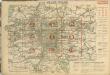
Auto-Praha : automobilní plán Velké Prahy a příručka pro automobilisty
1 : 50000
Specielle Telegrafen und Eisenbahn Karte von Böhmen

Plan der Hauptstadt Prag und der umliegenden Gegend sammt dem Lustlager der kais. königl. Armée
1 : 47500 Praha (Česko)
Plan der Hauptstadt Prag und der umliegenden Gegend sammt dem Lustlager der kais. königl. Armée
1 : 47500 Praha (Česko)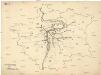
[Praha - projekt podzemní a nadzemní dráhy].
Praha (Česko) Poláček, K. Wallenfels, F.