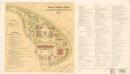
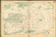
Maps of Holešovice

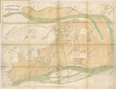
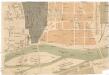
Polohopisný plán VII. části Prahy
1 : 4000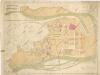
Polohopisný plán VII. části Prahy
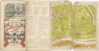
Auto-Praha : automobilní plán Velké Prahy a příručka pro automobilisty
1 : 50000
Polohopisný plán VII. části Prahy

Polohopisný plán VII. části Prahy
1 : 4000
Holeschowitz - c1960-1-001 - Kaiserpflichtexemplar der Landkarten des stabilen Katasters
1 : 2880
Holeschowitz - c1960-1-005 - Kaiserpflichtexemplar der Landkarten des stabilen Katasters
1 : 2880
Holeschowitz - c1960-1-003 - Kaiserpflichtexemplar der Landkarten des stabilen Katasters
1 : 2880
Holeschowitz - c1960-1-004 - Kaiserpflichtexemplar der Landkarten des stabilen Katasters
1 : 2880
Holeschowitz - c1960-1-006 - Kaiserpflichtexemplar der Landkarten des stabilen Katasters
1 : 2880
Holeschowitz - c1960-1-002 - Kaiserpflichtexemplar der Landkarten des stabilen Katasters
1 : 2880
Orientační plán hlavního města Prahy s okolím
1 : 5000
Orientační plán hlavního města Prahy s okolím

Orientační plán hlavního města Prahy s okolím
[Holešovice]
Holešovice (Praha, Česko) Srp, Jan Trávníček, František
Polohopisný plán Holešovic Buben a Bubenče

Polohopisný plán Bubenče, Holešovic - Buben, pak částí Dejvic a Libně
Wltžkův nejnovější orientační plán Prahy a nejbližšího okolí

Vorder Owenetz (Przednj Owenetz) - c0621-1-005 - Kaiserpflichtexemplar der Landkarten des stabilen Katasters
1 : 2880
Vorder Owenetz (Przednj Owenetz) - c0621-1-004 - Kaiserpflichtexemplar der Landkarten des stabilen Katasters
1 : 2880
Vorder Owenetz (Przednj Owenetz) - c0621-1-007 - Kaiserpflichtexemplar der Landkarten des stabilen Katasters
1 : 2880
Vorder Owenetz (Przednj Owenetz) - c0621-1-006 - Kaiserpflichtexemplar der Landkarten des stabilen Katasters
1 : 2880
Vorder Owenetz (Przednj Owenetz) - c0621-1-002 - Kaiserpflichtexemplar der Landkarten des stabilen Katasters
1 : 2880
Vorder Owenetz (Przednj Owenetz) - c0621-1-001 - Kaiserpflichtexemplar der Landkarten des stabilen Katasters
1 : 2880
Vorder Owenetz (Przednj Owenetz) - c0621-1-003 - Kaiserpflichtexemplar der Landkarten des stabilen Katasters
1 : 2880
Vorder Owenetz (Przednj Owenetz) - c0621-1-008 - Kaiserpflichtexemplar der Landkarten des stabilen Katasters
1 : 2880
Orientační plán Prahy a obcí sousedních List 11.

Orientační plán Prahy a obcí sousedních List 11.
1 : 5000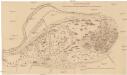
Entwurf eines Landes-Ausstellungsgebäudes im Baumgarten
1 : 2880 Královská obora (Praha, Česko)