Maps of Tebingtinggi

Opmeting voor de grens Serdang, Dolk, Bedagei / de Gouvernements Landmeter A. den Berger
Medan : [Gouvernementskantoor]
Dolok van Panei
[S.l. : s.n.]
[Saranggiting Kendjahe] : opgenomen in 1913-1914
Topographische Inrichting Batavia Batavia : Topographische Inrichting
[Tandjoengdjahe] : opgenomen in 1913-1914
Topographische Inrichting Batavia Batavia : Topographische Inrichting
[Serbadolok] : opgenomen in 1914-1917
Topographische Inrichting Batavia Batavia : Topographische Inrichting
[Berastagi] : opgenomen in het jaar 1914
Topographische Inrichting Batavia Batavia : Topographische Inrichting
[Bingkat] : opgenomen 1912-1913
Topographische Inrichting Batavia Batavia : Topographische Inrichting
[Tandjoengmorawa Kiri] : opgenomen 1912-1913
Topographische Inrichting Batavia Batavia : Topographische Inrichting
[D[elen]g Tenaroh] : opgenomen in 1913-1915
Topographische Inrichting Batavia Batavia : Topographische Inrichting
Plantplannen [van de] N.V. Senembah M[aatschapp]ij / N.V. Senembah Maatschappij
N.V. Senembah Maatschappij [Medan : N.V. Boekhandel en Drukkerij v[oor]h[een] Varekamp & Co.]
[Oedjoengandar] : opgenomen 1911-1914
Topographische Inrichting Batavia Batavia : Topographische Inrichting
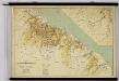
[Tebingtinggi] : opgenomen in 1914-1915
Topographische Inrichting Batavia Batavia : Topographische Inrichting
[Dolokkataran] : opgenomen in 1914-1915
Topographische Inrichting Batavia Batavia : Topographische Inrichting
Plantplannen [van de] N.V. Senembah M[aatschapp]ij / N.V. Senembah Maatschappij
N.V. Senembah Maatschappij [Medan : N.V. Boekhandel en Drukkerij v[oor]h[een] Varekamp & Co.]
Overzichtskaart van Simeloengoen / geteekend door Ferdinand Simandjoentak, 22-7-[19]37
[S.l. : s.n.]
Nederlandsch-Indië / J.H. de Bussy
Amsterdam : J.H. De Bussy
Overzichtskaart van Simeloengoen
[S.l. : s.n.]
Afdeeling Serdang / bewerkt door W.A. Janssen ; uitgegeven door de firma Henri Dentz in samenwerking met W.A. Janssen
HenriDentz Amsterdam Amsterdam : Dentz
Wegen rond Medan / D[eli] A[utomobiel] C[lub]
Deli Automobiel Club Medan [Medan] : D[eli] A[utomobiel] C[lub]
Medan en omgeving / DAC
Deli Automobiel Club (DAC) Medan [Medan] : D[eli] A[utomobiel] C[lub]
Kaart der Onderafdeeling Boven-Deli

Kaart der Onderafdeeling Boven-Deli

[Tebingtinggi] : opgenomen 1912-1913
Topographische Inrichting Batavia Batavia : Topographische Inrichting
Kaart der ondernemingen der Serdang Cultuur Maatschappij
Serdang Cultuur Maatschappij
Plantplannen [van de] N.V. Senembah M[aatschapp]ij / N.V. Senembah Maatschappij
N.V. Senembah Maatschappij [Medan : N.V. Boekhandel en Drukkerij v[oor]h[een] Varekamp & Co.]
Kaart van de te volgen route van het bezoek van Gouverneur Generaal B.C. de Jonge aan de afdeling Simeloengoen- en Karolanden, 1936
[S.l. : s.n.]
Overzichtskaart van Simeloengoen
[S.l. : s.n.]
Kaart der Bataklanden : bijlage voor het Sumatra's O[ost] K[ust] Album
[S.l. : s.n.]
Kaart der tabaksondernemingen ter Oostkust van Sumatra : tevens aangevende de koffieondernemingen / naar de nieuwste gegevens bewerkt door P. de Vries & Zoon, makelaars in tabak te Amsterdam ; gedrukt en uitgegeven bij J.H. de Bussy ; J. Wackie, Geogr[afisch] Lith[ograaf]
P. de Vries en Zoon Amsterdam Amsterdam : J.H. de Bussy