Maps of Selbu

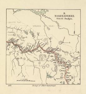
Spesielle kart 22-2: Tyvold - Rognæs
1 : 400000 Albert Cammermeyer Forlag
Kartblad 93: Carte over det Selboische Compagnie District
Carl Henning Krog
Spesielle kart 103-1: Flötningskart over Glommens Vassdrag
1 : 1000 Einar Sigurd Ween
Portefølje nr 71
1 : 100000 Munthe
Portefølje nr 71
1 : 100000 Munthe
Geologisk kart 36: NorgesGeologiske Undersøgelse, Rektangel 47A Selbu
1 : 100000 K. M. Hauan | C. Homan | H. Reusch | Johannessen | M. Bugge Norges geologiske undersøkelse
47A Selbu
1 : 100000 Harald Ingvald Johannessen | C. Pedersen
47A Selbu
1 : 100000 C. Pedersen | Harald Ingvald Johannessen
47A Selbu
1 : 100000 Harald Ingvald Johannessen | C. Pedersen
47A Selbu
1 : 100000 Johan Nordhagen | Harald Ingvald Johannessen
47A Selbu
1 : 100000 Harald Ingvald Johannessen | C. Pedersen
47A Selbu
1 : 100000 C. Pedersen | Harald Ingvald Johannessen
47A Selbu
1 : 100000 Harald Ingvald Johannessen | C. Pedersen
43C Haltdalen
1 : 100000 Johan Gulbrandsen Natrud | Ole Engh
43C Haltdalen
1 : 100000
43C Holtaalen
1 : 100000 Johan Gulbrandsen Natrud | H. Hagen
43C Haltdalen
1 : 100000 Johan Gulbrandsen Natrud | Ole Engh
43C Haltdalen
1 : 100000
43C Holtaalen
1 : 100000 Ole Engh | Johan Gulbrandsen Natrud
43C Holtaalen
1 : 100000 Johan Gulbrandsen Natrud | H. Hagen
1621-2 Selbu
1 : 50000 Statens kartverk
1620-1 Haltdalen
1 : 50000 Statens kartverk
1621-2 Selbu
1 : 50000 Norges Geografiske Oppmåling
1620-1 Haltdalen
1 : 50000 Statens kartverk
1621-2 Selbu
1 : 50000 Norges Geografiske Oppmåling
1720-4 Ålen
1 : 50000 Norges Geografiske Oppmåling
1621-3 Stören
1 : 50000 Norges Geografiske Oppmåling
1620-4 Budal
1 : 50000 Statens kartverk
43C 5; 43C 6; 43C 9; 43C 10
1 : 50000 Johan Lauritz Bull