Maps of Holtålen

Maps of Holtålen

$title$

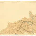
Spesielle kart 103-1: Flötningskart over Glommens Vassdrag

1 : 1000 Einar Sigurd Ween
$title$

Spesielle kart 22-2: Tyvold - Rognæs

1 : 400000 Albert Cammermeyer Forlag
$title$

Portefølje nr 71

1 : 100000 Munthe
$title$

Portefølje nr 71

1 : 100000 Munthe
$title$

Kartblad 166b-1b: Wej-Cart over det Aamodske Compagnie; 166b-1b

$title$

Sammensetning av deler av følgende kart utgitt av Norges geografiske oppmåling

1 : 100000
$title$

43A 3; 43A 4; 43A 7

1 : 100000 Kristian Gleditsch
$title$

43C Haltdalen

1 : 100000 Johan Gulbrandsen Natrud | Ole Engh
$title$

43C Haltdalen

1 : 100000
$title$

43C Holtaalen

1 : 100000 Johan Gulbrandsen Natrud | H. Hagen
$title$

43C Haltdalen

1 : 100000 Johan Gulbrandsen Natrud | Ole Engh
$title$

43C Haltdalen

1 : 100000
$title$

43C Holtaalen

1 : 100000 Ole Engh | Johan Gulbrandsen Natrud
$title$

43A Røros

1 : 100000
$title$

43A Røros

1 : 100000 Harald Ingvar Johannessen | Ole Engh
$title$

43A Røros

1 : 100000 Harald Ingvar Johannessen | Ole Engh
$title$

43A Røros

1 : 100000
$title$

43A Røros

1 : 100000 Johan Nordhagen | Harald Ingvar Johannessen
$title$

43C Holtaalen

1 : 100000 Johan Gulbrandsen Natrud | H. Hagen
$title$

1620-1 Haltdalen

1 : 50000 Statens kartverk
$title$

1620-2 Dalsbygda

1 : 50000 Statens kartverk
$title$

1720-4 Ålen

1 : 50000 Norges Geografiske Oppmåling
$title$

1620-1 Haltdalen

1 : 50000 Statens kartverk
$title$

1620-2 Forollhogna

1 : 50000 Statens kartverk
$title$

1620-2 Vangröftdalen

1 : 50000 Norges Geografiske Oppmåling
$title$

1620-2 Dalsbygda

1 : 50000 Norges Geografiske Oppmåling
$title$

43D 1; 43D 2; 43D 3; 43D 5; 43D 6; 43D 7

1 : 100000 Karl Sigwald Johannes Bull
$title$

43C 5; 43C 6; 43C 9; 43C 10

1 : 50000 Johan Lauritz Bull
$title$

1620-1 Haltdalen

1 : 50000 Norges Geografiske Oppmåling
$title$

1720-3 Røros

1 : 50000 Statens kartverk
© MapTiler © OpenStreetMap contributors
How does it work?
These instructions will show you how to find historical maps online.
Getting started
Type the place name in the search box to find the exact location. You can further adjust the search by zooming in and out.
Zoom
Zoom in and out with the buttons or use your mouse or touchpad natively.
Exact Area tool
Click here and draw a rectangle over the map to precisely define the search area.
Set filters
Narrow your search with advanced settings, such as Years (from/to), Fulltext, Publisher, etc.
Results
See the results of your search on the right side. You can scroll down to find more maps of this location.
?

Download OldMapsOnline Mobile