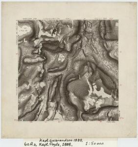
Maps of Grane

60A 3
1 : 50000 Gulbrandson | Thorvald Prydz
60A 3 (halv); 60A 4; 60A 7; 60A 8
1 : 50000 Thorvald Prydz
57C 11; 60A 3 (1/3)
1 : 50000 Thorvald Kristian Oscar Holtan | Gulbrandson
57C 10
1 : 50000 Thorvald Kristian Oscar Holtan
1826-2 Eiterådalen
1 : 50000 Statens kartverk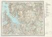
I18 Velfjord
1 : 100000
I18 Velfjord
1 : 100000 Arnt Magnus Andreassen Øgaard | H. C. Wanggård
I18 Velfjorden
1 : 100000 H. C. Wanggård | Arnt Magnus Andreassen Øgaard
60A 2; 60A 6
1 : 50000 Carl Aksel Sigurd Sissener
I18 Velfjord
1 : 100000
I18 Velfjord
1 : 100000 Arnt Magnus Andreassen Øgaard | H. C. Wanggård
I18 Velfjorden
1 : 100000 Arnt Magnus Andreassen Øgaard
1825-1 Tosbotn
1 : 50000 Statens kartverk
1825-1 Tosbotn
1 : 50000 Norges Geografiske Oppmåling
1825-1 Tosbotn
1 : 50000 Statens kartverk
1825-1 Tosbotn
1 : 50000 Norges Geografiske Oppmåling
1826-2 Eiterådalen
1 : 50000 Norges Geografiske Oppmåling
1826-2 Eiterådalen
1 : 50000 Statens kartverk
1826-2 Eiterådalen
1 : 50000 Statens kartverk
1826-2 Eiterå
1 : 50000 Norges Geografiske Oppmåling
1825-1 Tosbotn
1 : 50000 Statens kartverk
1926-3 Trofors
1 : 50000 Statens kartverk
1926-3 Trofors
1 : 50000 Norges Geografiske Oppmåling
Geologisk kart 124: Vistenvassdraget - Kvartærgeologi og geomorfologi
1 : 50000 J. L. Sollid | L. M. Sollid Geografisk institutt, Universitetet i Oslo
1926-3 Trofors
1 : 50000 Statens kartverk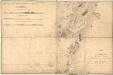
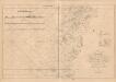
Museumskart 135: Kart over Den Norske Kyst fra Lekøe til Dønnæsøe
1 : 200000 H. Paludan | Vibe | Hagerup
Vega
1 : 250000
Geologisk kart 53: Geologisk Generalkart; Vega
1 : 250000 J. Rekstad Norges geologiske undersøkelse
Geologisk kart 56: Geologisk Generalkart; Hatfjelldal
1 : 250000 J. Rekstad Norges geologiske undersøkelse