Maps of Bindal

Maps of Bindal

$title$

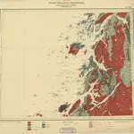
Geologisk kart 53: Geologisk Generalkart; Vega

1 : 250000 J. Rekstad Norges geologiske undersøkelse
$title$

Vega

1 : 250000
$title$

Museumskart 135: Kart over Den Norske Kyst fra Lekøe til Dønnæsøe

1 : 200000 H. Paludan | Vibe | Hagerup
$title$

Museumskart 217-1 Kart over den Norske Kyst fra Lekøe til Dønnæsøe

1 : 50000 Hagerup | G. L. Fehr | Vibe | H. Paludan Opmaalings Directionen
$title$

Statistikk 43-19- Bosettingskart over Mosjøen. Blad 19

1 : 250000 Statistisk Sentralbyrå
$title$

Vega

1 : 250000
$title$

Statistikk 43-19-2: Bosettingskart over Mosjøen. Blad 19

1 : 250000 Statistisk Sentralbyrå
$title$

Trigonometrisk grunnlag, Squelet-Cart 38: Trigonometrisk Kart for 1829

1 : 400000 Vibe
$title$

Norge 55-12: Accurat landcaart over Norges Rige anden Part

1 : 3000000 G. Bordin
$title$

H17 Flovær

1 : 100000 Torgrim Lundtvedt | Ole Engh
$title$

I17 Mosjøen

1 : 100000 Torgrim Lundtvedt | C. Pedersen
$title$

H19 Helgelandsflesa

1 : 100000 Einar Sigurd Ween | Arnt Magnus Andreassen Øgaard
$title$

I18 Velfjorden

1 : 100000 H. C. Wanggård | Arnt Magnus Andreassen Øgaard
$title$

I19 Bindalen

1 : 100000 Oluf Lier | Finn Abrahamson
$title$

H17 Flovær

1 : 100000 Ole Engh | Torgrim Lundtvedt
$title$

H18 Vega

1 : 100000 Carl Christian P. Olberg | Arnt Magnus Andreassen Øgaard
$title$

H17 Flovær

1 : 100000 Torgrim Lundtvedt | Ole Engh
$title$

I18 Velfjord

1 : 100000 Arnt Magnus Andreassen Øgaard | H. C. Wanggård
$title$

H19 Helgelandsflesa

1 : 100000 Einar Sigurd Ween | Arnt Magnus Andreassen Øgaard
$title$

H17 Flovær

1 : 100000 Torgrim Lundtvedt | Ole Engh
$title$

I17 Mosjøen

1 : 100000
$title$

H18 Vega

1 : 100000 H. C. Wanggård | Arnt Magnus Andreassen Øgaard
$title$

H17 Flovær

1 : 100000
$title$

H18 Vega

1 : 100000
$title$

H19 Helgelandsflesa

1 : 100000
$title$

I17 Mosjøen

1 : 100000
$title$

I18 Velfjord

1 : 100000
$title$

G19 Sklinden

1 : 100000 Georg Peter Leganger Mamen | Einar Sigurd Ween
$title$

H18 Vega

1 : 100000 Arnt Magnus Andreassen Øgaard | Carl Christian P. Olberg
$title$

H18 Vega

1 : 100000 Arnt Magnus Andreassen Øgaard | Carl Christian P. Olberg
© MapTiler © OpenStreetMap contributors
How does it work?
These instructions will show you how to find historical maps online.
Getting started
Type the place name in the search box to find the exact location. You can further adjust the search by zooming in and out.
Zoom
Zoom in and out with the buttons or use your mouse or touchpad natively.
Exact Area tool
Click here and draw a rectangle over the map to precisely define the search area.
Set filters
Narrow your search with advanced settings, such as Years (from/to), Fulltext, Publisher, etc.
Results
See the results of your search on the right side. You can scroll down to find more maps of this location.
?

Download OldMapsOnline Mobile