Maps of Eidsvoll

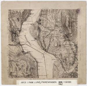
20C 2
1 : 50000 Lund | Finckenhagen
Kartblad 1: Kart over Veien fra Eidsvold til Gausdal og til Skydsstationen Holmen i Øyer
J. H. Reichborn
20C 2
1 : 20000
Fra Eidsvoll til Eidseter
J. H. Reichborn
Fra Jonsrud til Dorr
1 : 20000 J. H. Reichborn
Fra Ladderud til Karlstua
1 : 20000 J. H. Reichborn
20C 3 nv
1 : 25000 Bjerkebok
20C 3 sv
1 : 25000 Bjarkebæk
Fra Seterbekken til Skjelstad
J. H. Reichborn
20C 3 vestre del
1 : 10000 Bjærkebæk
20C 3 nv/4
1 : 10000 Bjærkebæk
20C 3 sv
1 : 10000 Bjærkebæk
20C 6 sv
1 : 10000
20C 3 sv
1 : 10000 Bjærkebæk
Trigonometrisk grunnlag, vedlegg 30: Fundament Tabel Quadrat-Miilen No 116 og 117
1 : 10000
Kartblad 65: Wey-Cart over det Eidswoldske lette Infanterie Compagnie District

Kartblad 4 Cituations-Cart over det Edsvoldske Compagnies Distrigt
Neumann
Trigonometrisk grunnlag, vedlegg 58
1 : 50000
20C Eidsvoll
1 : 100000 Torgrim Lundtvedt | Gjestvang | H. C. Wanggård
20C Eidsvoll
1 : 100000 Gjestvang | Torgrim Lundtvedt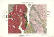
Geologisk kart 33: Den Geologiske Undersøgelse, Rektangel 20C Eidsvold
1 : 100000 Torgrim Lundtvedt | Gjestvang Norges geologiske undersøkelse
Portefølje nr 32
1 : 100000 F. Akrell
20C Eidsvoll
1 : 100000 Torgrim Lundtvedt | Gjestvang
20C Eidsvoll
1 : 100000 Gjestvang | Torgrim Lundtvedt
Trigonometrisk grunnlag, vedlegg 53: Kart over endeel Triangler
1 : 50000 N. S. Darre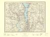
20C Eidsvoll
1 : 100000
20C Eidsvoll
1 : 100000 H. C. Wanggård | Torgrim Lundtvedt | Gjestvang
20C Eidsvoll
1 : 100000 Gjestvang | Torgrim Lundtvedt
20C Eidsvoll
1 : 100000 Gjestvang | Torgrim Lundtvedt