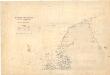
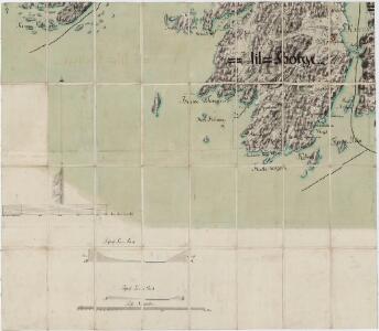
Maps of Fredrikstad

Jegerkorps nr 4-4: Situationskart over en Deel af Berg, Scheberg og Borge Sogner med tilhørende Annexer, sv
1 : 13000 von Staffeldt | Nøkleby | von Krebs
10C 2
1 : 20000 Ramm
10C 2 vest
1 : 25000 Gerorg Peter Leganger
10C 1
1 : 25000 Daniel Tønnesen
Mil nr 6
1 : 10000 Johan Jacob Rieck (Rick)
Mil nr 12
1 : 10000 Johan Jacob Rieck (Rick)
Mil nr 12
1 : 10000 Johan Jacob Rieck (Rick)
Mil nr 6
1 : 10000 Johan Jacob Rieck (Rick)
10A-9-og-10C-1
1 : 10000 Theodor Johann von Wegener
10C-1-øst
1 : 10000 Theodor Johann von Wegener
10C-1-vest
1 : 10000 Theodor Johann von Wegener
10A-10-og-10C-2
1 : 10000 Theodor Johann von Wegener
1913-3 Fredrikstad
1 : 50000 Norges Geografiske Oppmåling
1913-3 Fredrikstad
1 : 50000 Statens kartverk
1913-3 Fredrikstad
1 : 50000 Statens kartverk
1913-3 Fredrikstad
1 : 50000 Statens kartverk
1913-3 Fredrikstad
1 : 50000 Norges Geografiske Oppmåling
1913-3 Fredrikstad
1 : 50000 Statens kartverk
Jegerkorps nr 3-2: Situationskart over en Deel af Scheberg og Borge Sogner med tilhørende Annexer, versjon A, vestre del
1 : 10000 von Staffeldt | von Krebs
10C 2 sø
1 : 25000 Harald Ingvar Johannessen
10C 1
1 : 20000 Ramm
10C 2 nø
1 : 25000 Harald Ingvar Johannessen
10A 10
1 : 25000 Haakon Schive
10A-9-øst
1 : 10000
Mil nr 11
1 : 10000 von Wegener
10C 2 sø
1 : 25000 Harald Ingvar Johannessen | Daniel Tønnesen
Mil nr 12
1 : 10000 Johan Jacob Rieck (Rick)
Museumskart 217-46: Specialkart over Kristianiafjorden, fra Hankø til Torbjørnskjær og Idefjorden
1 : 50000 C. F. Wille | A. Dellinger Den Geografiske Opmaaling
Museumskart 3 Situations Carte over eendeel af Friderichshalds District
1 : 50000