Maps of Strömstads kommun

Mil nr 6
1 : 10000 Johan Jacob Rieck (Rick)
10A-10-og-10C-2
1 : 10000 Theodor Johann von Wegener
10A 10
1 : 25000 Haakon Schive
10A 10
1 : 20000 Ramm
10C 2 sø
1 : 25000 Harald Ingvar Johannessen | Daniel Tønnesen
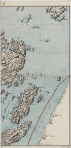
1913-2 Halden
1 : 50000 Norges Geografiske Oppmåling
1913-2 Halden
1 : 50000 Statens kartverk
1913-2 Halden
1 : 50000 Norges Geografiske Oppmåling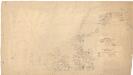
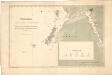
Museumskart 3: Kart over kysten utenfor Strømstad nordover mot Sponvika
1 : 50000 S. Müller
10C 3 nord; 10C 7
1 : 25000 Finn Abrahamson
1913-3 Fredrikstad
1 : 50000 Norges Geografiske Oppmåling
1913-3 Fredrikstad
1 : 50000 Statens kartverk
10C 2 sø
1 : 25000 Harald Ingvar Johannessen
Jegerkorps nr 4-4: Situationskart over en Deel af Berg, Scheberg og Borge Sogner med tilhørende Annexer, sv
1 : 13000 von Staffeldt | Nøkleby | von Krebs
1913-2 Halden
1 : 50000 Statens kartverk
1913-2 Halden
1 : 50000 Statens kartverk
1913-2 Halden
1 : 50000 Norges Geografiske Oppmåling
1913-2 Halden
1 : 50000 Statens kartverk
Kartblad 2- Vei-Carte over det Bergske Compagnie District; versjon 1
Hocherup
10C 2
1 : 20000 Ramm
10C 3 sv
1 : 25000 Einar Halle
10C 2 vest
1 : 25000 Gerorg Peter Leganger
Mil nr 6
1 : 10000 Johan Jacob Rieck (Rick)
10A-9-og-10C-1
1 : 10000 Theodor Johann von Wegener
10C 2 nø
1 : 25000 Harald Ingvar Johannessen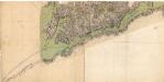
10C-3
1 : 10000 Theodor Johann von Wegener
Mil nr 7
1 : 10000 Carl Alexander Stricker
Mil nr 12
1 : 10000 Johan Jacob Rieck (Rick)
Museumskart 8: Sjøgrændsen fra bunden af Iddefjorden til Nord Hällsö og Gylte varde
1 : 50000