Maps of Nes

Kartblad 43: Wej-Cart over det Næsiske lette Infanterie Compagnies District

20A Nannestad
1 : 100000 Carl Christian Olberg | Johan Ferdinand Normann
1915-2 Ullensaker
1 : 50000 Statens kartverk
1915-2 Ullensaker
1 : 50000 Norges Geografiske Oppmåling
Kartblad 42: Vej-Cort over det Ullensagerske Compagnies District (Under Norske Jægerkorps)
C. Hals
1915-2 Ullensaker
1 : 50000 Norges Geografiske Oppmåling
20A Nannestad
1 : 100000 Johan Ferdinand Normann | Carl Christian Olberg
20A Nannestad
1 : 100000 Johan Ferdinand Normann | Carl Christian Olberg
20A Nannestad
1 : 100000 Johan Ferdinand Nordmann | Ole Engh
Trigonometrisk grunnlag, vedlegg 22: Kvadratmilien No 97, kvadratmilen No 58
1 : 10000
Ekserserplasskart; Gardermoen sydlig blad
1 : 50000
1915-2 Ullensaker
1 : 50000 Statens kartverk
1915-2 Jessheim
1 : 50000 Statens kartverk
1915-2 Ullensaker
1 : 50000 Norges Geografiske Oppmåling
Spesielle kart 50: Kart over Glommen eller Stor Elven fra Næss Kirke til Bingens Lentser; fløtningskart
Peter Hiort
Kartblad II: Vei-kaart over den trondhjemske Kongevei fra Christiania til Røraas gjennom Eidsvold, Rommedal, Levthen og Østerdalen
1 : 20000 J. H. Reichborn
Mil nr 86
1 : 10000 O. von Gedde
15C 11
1 : 20000 Collin
Fra Kværner til Leir
1 : 20000 J. H. Reichborn
20A 4
1 : 20000 O. Lund
Fra Fløgstad til Smedstua
1 : 20000 J. H. Reichborn
Fra Kløfta til Vårum
1 : 20000 J. H. Reichborn
Kartblad I: Kart over Postveien fra Gaarden Kløften i Ullensager Sogn om Magnor til Rigsgrændsen
1 : 20000 J. H. Reichborn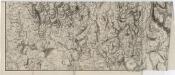
Mil nr 76
1 : 10000 Stochfleth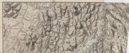
Mil nr 76
1 : 10000 Stochfleth
15C 12 øst
1 : 10000 Stockfleth
Fra Oppåker til Ullern kirke
1 : 20000 J. H. Reichborn
Ekserserplasskart; Kart over Gardermoen
1 : 25000 A. Thirud
Spesielle kart nr 49: Kart over den nordligste deel af Vormen Elv
1 : 5000


