Maps of Ullensaker

Kartblad I: Kart over Postveien fra Gaarden Kløften i Ullensager Sogn om Magnor til Rigsgrændsen
1 : 20000 J. H. Reichborn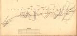
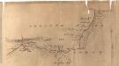
Fra Kløfta til Vårum
1 : 20000 J. H. Reichborn
20A 3 n
1 : 10000 Peter Myhre?
20A 3 nv
1 : 10000
Akershus amt nr 116-5b: Terrenget omkring Ullensaker
1 : 20000 Christophersen
20A 6 sø
1 : 10000 Andreas Samuel Krebs
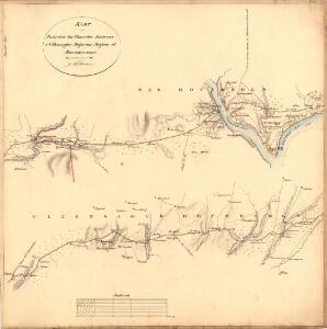
Kartblad II: Vei-kaart over den trondhjemske Kongevei fra Christiania til Røraas gjennom Eidsvold, Rommedal, Levthen og Østerdalen
1 : 20000 J. H. Reichborn
Fra Fløgstad til Smedstua
1 : 20000 J. H. Reichborn
20A 7 vest
1 : 20000 Jørgen Scielderup Grimseth
1915-2 Ullensaker
1 : 50000 Norges Geografiske Oppmåling
1915-2 Jessheim
1 : 50000 Statens kartverk
1915-2 Ullensaker
1 : 50000 Statens kartverk
1915-2 Ullensaker
1 : 50000 Norges Geografiske Oppmåling
Ekserserplasskart; Gardermoen sydlig blad
1 : 50000
1915-2 Ullensaker
1 : 50000 Norges Geografiske Oppmåling
1915-2 Ullensaker
1 : 50000 Statens kartverk
20A Nannestad
1 : 100000 Johan Ferdinand Nordmann | Ole Engh
20A Nannestad
1 : 100000 Johan Ferdinand Normann | Carl Christian Olberg
20A Nannestad
1 : 100000 Johan Ferdinand Normann | Carl Christian Olberg
Kartblad 43: Wej-Cart over det Næsiske lette Infanterie Compagnies District

Kartblad 42: Vej-Cort over det Ullensagerske Compagnies District (Under Norske Jægerkorps)
C. Hals
Kartblad 24: Wei-Kaart over det Schijedsmoiske Compagnie District
Lihme senior
Spesielle kart 50: Kart over Glommen eller Stor Elven fra Næss Kirke til Bingens Lentser; fløtningskart
Peter Hiort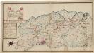
Kartblad 173: Situations Chart over det Nannestadske Captain Hans Abelsteds andfortroede Dragoner Compagni District
C. A. Hiorth
20A 2
1 : 20000
20A 3 nø
1 : 10000 Qvist
20A 3 nø
1 : 10000 Qvist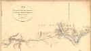
Fra Kværner til Leir
1 : 20000 J. H. Reichborn
20A 7 sø
1 : 10000 Jacob Rørdam