Maps of Snåsa

1823-2 Gjevsjøen
1 : 50000 Statens kartverk
51C 7; 51C 11
1 : 50000 August Geelmuyden Spørck
Geologisk kart 83: Geologisk kart, Jævsjø
1 : 100000 Steinar Foslie Norges geologiske undersøkelse
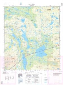
51C Jævsjø
1 : 100000
51C Jævsjø
1 : 100000 H. Hagen | Arnt Magnus Andreassen Øgaard
51C Jævsjø
1 : 100000 Arnt Magnus Andreassen Øgaard | H. C. Wanggård
51C Jævsjø
1 : 100000
51C 9; 51C 10
1 : 50000 Hans Gjestvang | Ole Hagbart Bertrand Norgrenn
51C 5; 51C 6
1 : 50000 Hans Gjestvang
51C Jævsjø
1 : 100000 H. Hagen | Arnt Magnus Andreassen Øgaard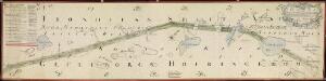
NRA GA 11
Holm | Thodal | Friedenreich | Krogh | Marelius | Ratkind
54A 2; 54A 3; 54A 4; 54A 8
1 : 100000 Thorvald Prydz
1823-1 Andorsjöen
1 : 50000 Norges Geografiske Oppmåling
51C 8; 51C 12; 51D 5; 51D 9
1 : 50000 Reinald Fritjof Valdemar Gulbrandsen
1823-1 Andorsjøen
1 : 50000 Statens kartverk
NRA GA 12
Marelius | Thodal | Friedenreich | Ratkind | Holm | Krogh
54A 1
1 : 50000 Thomas Georg Backer
51A 5; 51A 9; 51C 1; 51C 2
1 : 50000 Thorlak Aas
1923-3 Blåfjellhatten
1 : 50000 Statens kartverk
1923-3 Blåfjellhatten
1 : 50000 Norges Geografiske Oppmåling
Liene
1 : 250000
Statistikk 43-18- Bosettingskart over Grogn. Blad 18
1 : 250000 Statistisk Sentralbyrå
Statistikk 43-18-2: Bosettingskart over Grong. Blad 18
1 : 250000 Statistisk Sentralbyrå
Norge 55-7: Accurat landcaart over Norges Rige anden Part
1 : 300000 G. Bordin
Kartblad 71a vest: Carte over det 1. Trondhiemsche Regiment tillige med de 3 Nordenfi: Skieløber Compagniers Situation; kopi vestre del
Isach Jørgen Coldevin
Geologisk kart 112: Kvartærgeologisk kart over Nord-Trøndelag og Fosen
1 : 250000 Geografisk institutt, Universitetet i Oslo
XVIII
1 : 400000 N. Franck
XV
1 : 400000 R. Haavin
Statistikk 38-7: Bosettingskart over Norge. Blad 7
Statistisk Sentralbyrå