Maps of Sirdal

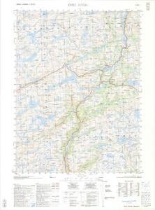
1312-1 Övre Sirdal
1 : 50000 Norges Geografiske Oppmåling
1312-1 Övre Sirdal
1 : 50000 Norges Geografiske Oppmåling
C38-9
1 : 50000 Andreas Theodor Walle
1312-1 Övre Sirdal
1 : 50000 Statens kartverk
1312-1 Övre Sirdal
1 : 50000 Statens kartverk
1312-1 Övre Sirdal
1 : 50000 Statens kartverk
C38-10; C38-11
1 : 50000
C38-10; C38-11-v/2
1 : 50000 Lars Rosland
1312-1 Övre Sirdal
1 : 50000 Norges Geografiske Oppmåling
C38-4; C38-5-v/2
1 : 50000 Lars Rosland
C38-4; C38-5-v/2
1 : 50000 Lars Rosland
C38-4; C38-5-v/2
1 : 50000 Lars Rosland
7A 12 7B 9
1 : 50000 Fredrik Christian Sejersted
7A 4 7A 8 7B 5
1 : 50000 O. Krefting
C38-3
1 : 50000 Andreas Theodor Walle
C38 vest Hunnedalaen
1 : 100000
C38 vest Hunndalen
1 : 100000
Kartblad 150: Situations Carte über den nordlichen Theil des 4ten Listerschen Compagnie District
Løwenthal
7C 3 7C 4
1 : 50000 O. Krefting
7A 6 7A 7
1 : 50000 O. Krefting
7B 5 nà ̧
1 : 50000 Hedvard Carl Scharffenberg
7A 10 7A 11
1 : 50000 Fredrik Christian Sejersted
7B 1
1 : 50000 Andreas Dahl
Portefølje nr 5
1 : 100000
Trigonometrisk grunnlag, Squelet-Cart 48: Kart for 1852
Johannes Falkenberg
Trigonometrisk grunnlag, Squelet-Cart 46: Kart for 1850
C. Bassøe
Spesielle kart 80: Oversiktskart vedkommende Rensdyrsaken i Valle
F. Flate
Kartblad 15 Situations Cart over det 1ste Stavangerske Compagnie District
C. Tobiesen
Kartblad 153: Kart over det 1ste Ryfylkiske Compagnie District