Maps of Hamarøy

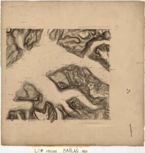
L11 sørvestre del
1 : 50000 Kristian Kristiansen Laake | Thorleif Barlag
L11 sørvestre del
1 : 50000 Kristian Kristiansen Laake
2130-4 Nordfold
1 : 50000 Statens kartverk
2130-4 Nordfold
1 : 50000 Norges Geografiske Oppmåling
2130-3 Helldalisen
1 : 50000 Statens kartverk
L11 Nordfold
1 : 100000 Ole Engh | Torgrim Lundtvedt
L11 Nordfold
1 : 100000 Torgrim Lundtvedt | Ole Engh
L11 Nordfold
1 : 100000 Torgrim Lundtvedt | Ole Engh
L11 Nordfold
1 : 100000
L11 Nordfold
1 : 100000
L11 Nordfold
1 : 100000 Torgrim Lundtvedt | Ole Engh
L11 Nordfold
1 : 100000
L11 Nordfold
1 : 100000 Ole Engh | Torgrim Lundtvedt
2130-3 Helldalisen
1 : 50000 Statens kartverk
2130-3 Helldalisen
1 : 50000 Statens kartverk
2130-3 Helldalisen
1 : 50000 Norges Geografiske Oppmåling
2130-3 Helldalisen
1 : 50000 Norges Geografiske Oppmåling
L11 nordvestre del
1 : 50000 Bjarne Gjølme | Arve Staxrud
2130-4 Nordfold
1 : 50000 Norges Geografiske Oppmåling
2130-4 Nordfold
1 : 50000 Statens kartverk
2130-4 Nordfold
1 : 50000 Statens kartverk
L11 sørøstre del
1 : 50000 Kristian Kristiansen Laake | Carl Ludvig Soelberg
L12 nordøstre del
1 : 50000 Otto Hjersing Munthe-Kaas
L12 nordøstre del
1 : 50000 Sigurd Sandvik | Otto Hjersing Munthe-Kaas | William Steffens | Bent Eskildssøn Bentzen
L12 norvestre del
1 : 50000 Sigurd Sandvik | William Steffens | Jacob Hvinden Haug
Museumskart 217-50: Fiskekart over den indre del af Vestfjorden i Lofoten
1 : 100000 M. Lyng Den Geografiske Opmaaling
Salta
1 : 250000 Bernh. Tolstad | O. Engh
Statistikk 43-22- Bosettingskart over Sulitjelma. Blad 22
1 : 250000 Statistisk Sentralbyrå
K11 Steigen
1 : 100000