Maps of Maryland

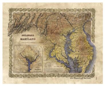
Delaware Maryland and Washington D.C
1 : 2000
Delaware, Maryland.
1 : 975000 Johnson, A.J.
Delaware and Maryland.
1 : 1000000 Colton, G.W.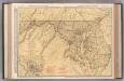
Maryland and Delaware.
1 : 602000 Rand McNally and Company
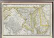
Delaware and Maryland.
1 : 2000000 Colton, G.W.
Maryland and Delaware.
1 : 1130000 Mitchell, Samuel Augustus
Maryland and Delaware.
1 : 1130000 Mitchell, Samuel Augustus
Maryland and Delaware.
Rand McNally and Company
Maryland and Delaware.
1 : 1190000 Tanner, Henry S.
Delaware and Maryland.
1 : 1000000 Colton, G.W.
Delaware and Maryland.
1 : 960000 Colton, G.W.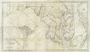
Map of the state of Maryland : laid down from an actual survey of all the principal waters, public roads, and divisions of the counties therein : describing the situation of the cities, towns, villages, houses of worship and other public buildings, furna
from Maryland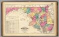
New railroad map of the states of Maryland, Delaware, & District of Columbia.
1 : 633600 Gray, Frank Arnold
Delaware And Maryland. (with) District of Columbia.
1 : 970000 Colton, G.W.
Maryland, Delaware.
1 : 1300000 Cram, George Franklin; Davis, Ellis Arthur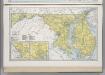
Maryland. Delaware.
1 : 874643 Hammond, C.S.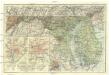
Maryland, Delaware and District of Columbia
1 : 900000 Baltimore (Maryland : oblast) National Geographic Society
Delaware and Maryland. Baltimore.
1 : 958000 Gray, Ormando Willis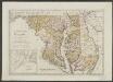
Maryland und Delaware
1 : 500000 Sotzmann, D. F Bey Carl Ernst Bohn
Maryland, Washington D.C., and Delaware.
1 : 697000 Rand McNally and Company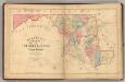
Martenet's Map of Maryland, Atlas Edition.
1 : 950400 Martenet, Simon J.
Maryland.
1 : 1380000 Tanner, Henry S.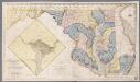
Map of the state of Maryland : laid down from an actual survey of all the principal waters ... as also a sketch of the state of Delaware; shewing the probable connection of the Chesapeake and Delaware bays / by Dennis Griffith ; engraved by J. Thackara & J. Vallance
1 : 440000 Griffith, Dennis; Thackara, J.; Vallance, J Philad[elphi]a : J. Milish
Maryland.
from Carey's general atlas, improved and enlarged : being a collection of maps of the world and quarters, their principal empires, kingdoms, &c.
Maryland.
1 : 1100000 Lucas, Fielding Jr.
The new war map of Virginia, Maryland & Pennsylvania
1 : 510000 Russel, B.B. (Benjamin B.)
Delaware and Maryland.
1 : 1000000 Colton, G.W.
Maryland.
1 : 1385000 Finley, Anthony
Map to illustrate the 1862 (Virginia) Campaign
Map to illustrate the 1862 (Virginia) Campaign. Map to illustrate the American Civil War of sixty years previously. This small map details the areas of Virginia around the capitals of Washington, D.C. and Richmond where a great amount of fighting took place in 1862 and indeed across the war period. Several places on the map, such as Fredericksburg, Petersburg and Manassas Junction/Bull Run witnessed heavy clashes during the conflict. The map also details railway routes in the region. War Office