Maps of Czech Republic

Vollständige General Posten- und Straßen-Karte des Königreichs Ungarn ; Ungarns Tittelkupfer sammt Abbildung der Städtn Preßburg, Pesth und Ofen. Gränze zu Preussen, Schlesien, Böhmen, Mähren und Baiern
Ungarn Verkehrsweg
Übersichtskarte der Protektoratsbahnen Böhmen und Mähren
1 : 400000 Protektorát Čechy a Morava Ministerstvo dopravy
Bohemia
1 : 990000 Mollova mapová sbírka Merian, Matthäus Merian, Matthäus
Le Royaume de Boheme divisée en ses douze cercles. Carte Reduite Sur celle de 25 feuilles
1 : 700000 Mollova mapová sbírka Müller, Johann Christoph Schenk, Peter II
BOHEMIA et Provinciae huic Regno unitae
1 : 3900000 Česko
Bohemia et provinciae huic regno unitae
1 : 3900000 Česko
Bohemia et provinciae huic regno unitae
1 : 3900000 Česko
Bohemia et provinciae huic regno unitae
1 : 3900000 Česko
Chogragraphia Insignis Regni Bohemiae

Bohemia [Karte], in: Le théâtre du monde, ou, Nouvel atlas contenant les chartes et descriptions de tous les païs de la terre, Bd. 1, S. 204.
1 Karte aus Atlas Blaeu, Willem Janszoon und Blaeu, Joan Blaeu, Willem Janszoon
Charte von Boehmen
1 : 100000 Čechy (Česko)
Kreis-, Gerichts-, Völker-, Telegrafen-, Eisenbahn- und Post-Karte des Königreiches Boehmen
1 : 890000 Česko Raffelsperger, Franz Franz Raffelsperger
Kreis-, Gerichts-, Völker-, Telegrafen-, Eisenbahn- und Post-Karte des Königreiches Boehmen
1 : 890000 Čechy (Česko) Raffelsperger, Franz Franz Raffelsperger
Bohemia [Karte], in: Novus Atlas, das ist, Weltbeschreibung, Bd. 1, S. 171.
1 Karte aus Atlas Blaeu, Joan Blaeu, Willem Janszoon
Blatt II, uit: Geologische Übersichts-Karte der Österreichisch-Ungarischen Monarchie / nach den Aufnahmen der K.K. Geologischen Reichsanstalt bearb. von Franz Ritter von Hauer ; gezeichn. von Eduard Jahn
1 : 576000 Annotatie geografische gegevens: Gebaseerd op veldwerk in de jaren 1850 tot 1865 Hauer, Franz Ritter von; Jahn, Eduard; Kaiserlich-Königliche Geologische Reichsanstalt, Wenen Wien : Beck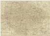
Charte von Boehmen
1 : 1030000 Česko
Geognostische Karte des Königsreichs Böhmen
1 : 1020000 Čechy (Česko) Preininger, Andreas Biller, Dominicus
Special-Karte des Königreiches Böhmen

Karte des Königreiches Boehmen
1 : 880000 Čechy (Česko) Raffelsperger, Franz Rumpold, F. im Typographischen Landkarten-Verlage
Le Royaume de Boheme divisée en ses douze cercles
1 : 580000 Čechy (Česko) Jaeger, Johann Christian Ioha. Chris. Iaeger
Le Royaume de Boheme divisée en ses douze cercles
1 : 760000 Čechy (Česko) Müller, Johann Christoph Schenk, Pieter chez Pierre Schenk
Le Royaume Boheme divisée en ses douze cercles
1 : 760000 Čechy (Česko) Müller, Johann Christoph Schenk, Pieter chez Pierre Schenk
Le Royaume de Boheme divisée en ses douze cercles
1 : 760000 Čechy (Česko) Müller, Johann Christoph Schenk, Pieter chez Pierre Schenk
Bohemia [Karte], in: Theatrum orbis terrarum, sive, Atlas novus, Bd. 1, S. 133.
1 Karte aus Atlas Blaeu, Joan Blaeu, Willem Janszoon
Bohemia in suas partes geographicé distincta

Bohemiae regnum in XII. circulos divisum cum com. Glac. et distr. Egrano ceterisq[ue] circumjacentibus terris
1 : 680000 Čechy (Česko) Müller, Johann Christoph per Homannianos Heredes
Bohemiae regnum in XVI. circulos divisum cum com. Glac. et distr Egrano ceterisq[ue] circumjacentibus terris
1 : 680000 Čechy (Česko) Müller, Johann Christoph per Homannianos Heredes
Bohemiae regnum in XII. circulos divisum cum com. Glac. et distr. Egrano ceterisq[ue] circumjacentibus terris ex Müllerianis aliisq[ue] chorographicis subsidiis delineatum
1 : 680000 Čechy (Česko) Müller, Johann Christoph Homannianos Heredes
Bohemiae regnum in XVI. circulos divisum cum com. Glac. et distr Egrano ceterisq[ue] circumjacentibus terris
1 : 680000 Čechy (Česko) Müller, Johann Christoph per Homannianos Heredes
Bohemia regnum in XVI circulos divisum
1 : 680000 Česko Müller, Johann Christoph Hommanianos Heredes
Bohemia regnum in XVI circulos divisum
1 : 680000 Česko Müller, Johann Christoph Hommanianos Heredes
Bohemiae regnum in XII. circulos divisum cum com. Glac. et distr. Egrano ceterisq[ue] circumjacentibus terris
1 : 680000 Čechy (Česko) Müller, Johann Christoph per Homannianos Heredes
Bohemiae regnum in XII. circulos divisum cum com. Glac. et distr. Egrano ceterisq[ue] circumjacentibus terris
1 : 680000 Čechy (Česko) Müller, Johann Christoph per Homannianos Heredes
Bohemiae regnum in XII. circulos divisum cum com. Glac. et distr. Egrano ceterisq[ue] circumjacentibus terris
1 : 680000 Čechy (Česko) Müller, Johann Christoph per Homannianos Heredes
Bohemiae regnum in XII. circulos divisum cum com. Glac. et distr. Egrano ceterisq[ue] circumjacentibus terris
1 : 680000 Čechy (Česko) Müller, Johann Christoph per Homannianos Heredes


