Maps of Czech Republic

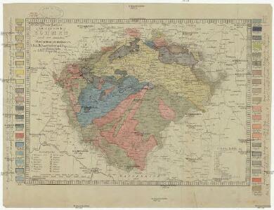
Geognostische Karte des Königsreichs Böhmen
1 : 1020000 Čechy (Česko) Preininger, Andreas Biller, Dominicus
Mapa krajského rozdělení Čech r. 1654 na podkladě územní organisace soudních okresů r. 1946
Hölzelova generální mapa Království českého
Čechy (Česko) Wagner, Jan Eduard Lepař, Zdeněk v geografickém závodě Ed. Hölzela
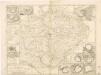
Special-Karte des Königreiches Böhmen

Bez titulu: Soubor statistických map Čech
Eisenbahn-Uebersichtskarte des Königreiches Böhmen

Bohemia [Karte], in: Le théâtre du monde, ou, Nouvel atlas contenant les chartes et descriptions de tous les païs de la terre, Bd. 1, S. 204.
1 Karte aus Atlas Blaeu, Willem Janszoon und Blaeu, Joan Blaeu, Willem Janszoon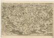
Chogragraphia Insignis Regni Bohemiae
Theatre de la guerre en Boheme...

Bohemia [Karte], in: Novus Atlas, das ist, Weltbeschreibung, Bd. 1, S. 171.
1 Karte aus Atlas Blaeu, Joan Blaeu, Willem Janszoon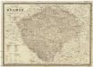
Karte von Böhmen
1 : 660000 Česko Schmitfeldt, Georg Mollo, Tranquillo Tranquillo Mollo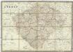
Karte von Böhmen
1 : 660000 Česko Schmitfeldt, Georg Mollo, Tranquillo Tranquillo Mollo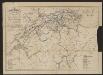
Bohemia In Suas Partes Geographicé Distincta. [Karte], in: Gerardi Mercatoris et I. Hondii Newer Atlas, oder, Grosses Weltbuch, Bd. 1, S. 328.
1 Karte aus Atlas Mercator, Gerhard und Hondius, Jodocus Jansson, Jan
Charte der älteren und neueren Bergbaue in Böhmen
1 : 960000 Česko Hamernik, J.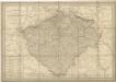
General Post & Strassen Karte des Königreichs Boehmen
General-Post & Strassen-Karte des Königreichs Boehmen
1 : 650000 Čechy (Česko) Fried, Franz Artaria & Comp.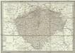
Neueste General-Post & Strassen-Karte des Königreichs Boehmen
1 : 650000 Česko Fried, Franz Artaria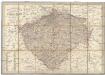
Neueste General-Post & Strassen-Karte des Königreichs Boehmen
Čechy (Česko) Fried, Franz Sartorius, Johann Christoph Artaria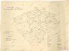
Přehledná mapa vodohospodářské služby v Čechách

Charte von Boehmen
1 : 1000000 Česko Kipferling, Karl Joseph in J. Riedl's Kunsthandlung
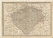
Karte fon Königreiche Böhmen...

Karte des Königreiches Boehmen
1 : 880000 Čechy (Česko) Raffelsperger, Franz Rumpold, F. im Typographischen Landkarten-Verlage
Charte des Königreiches Böhmen...

Hydrographische Karte des Königreiches Böhmen

BOHEMIA et Provinciae huic Regno unitae
1 : 3900000 Česko
Bohemia et provinciae huic regno unitae
1 : 3900000 Česko
Bohemia et provinciae huic regno unitae
1 : 3900000 Česko
Bohemia et provinciae huic regno unitae
1 : 3900000 Česko
Kreis-, Gerichts-, Völker-, Telegrafen-, Eisenbahn- und Post- Karte des Königreiches Böhmen
1 : 950000 Česko Raffelsperger, Franz Graben