Maps of Općina Preko
[Umgebung von Dugi Otok und Zeichenerklärung]
Kroatien Dalmatien Dugi Otok Umland
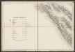
Zara.
from Spezialkarte der osterreichisch-ungarischen Monarchie.
Sale.
from Spezialkarte der osterreichisch-ungarischen Monarchie.
Zone 29, Kol. XII, Zara, uit: Geologische Karte der im Reichsrathe vertretenen Königreiche und Länder der Österreich-Ungarischen Monarchie : auf Grundlage der Specialkarte i.M. 1:75.000 des k.u.k. Militär-geographischen Institutes / neu bearb. und als Kartenwerk von 341 Blattnummern in zwanglosen Lfg. hrsg. durch die k.k. Geologische Reichsanstalt in Wien
1 : 75000 titelvariant: Geologische Spezialkarte der im Reichsrate vertretenen Königreiche und Länder der Österreichisch-Ungarischen Monarchie; Geologische Specialkarte der im Reichsrathe vertretenen Königreiche und Länder der Österreichisch-Ungarischen Monarchie; Annotatie: Titel bovenaan kaartblad: Geologische Spezialkarte der im Reichsrate vertretenen Königreiche und Länder der Österreichisch-Ungarischen Monarchie en Geologische Specialkarte der im Reichsrathe vertretenen Königreiche und Länder der Österreichisch-Ungarischen Monarchie; Annotatie geografische gegevens: Coördinaten gebaseerd op nulmeridiaan van Ferro (Hierro) Kaiserlich-Königliche Geologische Reichsanstalt, Wenen Wien : K.K. Geologische Reichsanstalt
Dioecesis Iadrensis
1 : 1850000 Diözese Zadar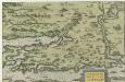
Zarae, Et Sebenici Descriptio
Mollova mapová sbírka Lazius, Wolfgang
Dalmatien
1 : 80000 Dalmácie (Chorvatsko) Oesterreicher, T. Hydrographisches Amt d. K. u. k. Kriegs-Marine, Seekarten-Depot
Zapuntello.; Spezialkarte der osterreichisch-ungarischen Monarchie.
from Spezialkarte der osterreichisch-ungarischen Monarchie. Austro-Hungarian Monarchy. Militärgeographisches Institut.,
Zone 29, Kol. XI, Zapuntello, uit: Geologische Karte der im Reichsrathe vertretenen Königreiche und Länder der Österreich-Ungarischen Monarchie : auf Grundlage der Specialkarte i.M. 1:75.000 des k.u.k. Militär-geographischen Institutes / neu bearb. und als Kartenwerk von 341 Blattnummern in zwanglosen Lfg. hrsg. durch die k.k. Geologische Reichsanstalt in Wien
1 : 75000 titelvariant: Geologische Spezialkarte der im Reichsrate vertretenen Königreiche und Länder der Österreichisch-Ungarischen Monarchie; Geologische Specialkarte der im Reichsrathe vertretenen Königreiche und Länder der Österreichisch-Ungarischen Monarchie; Annotatie: Titel bovenaan kaartblad: Geologische Spezialkarte der im Reichsrate vertretenen Königreiche und Länder der Österreichisch-Ungarischen Monarchie en Geologische Specialkarte der im Reichsrathe vertretenen Königreiche und Länder der Österreichisch-Ungarischen Monarchie; Annotatie geografische gegevens: Coördinaten gebaseerd op nulmeridiaan van Ferro (Hierro) Kaiserlich-Königliche Geologische Reichsanstalt, Wenen Wien : K.K. Geologische Reichsanstalt
Adriatisches Meer, Küstenkarte
1 : 180000 Dugi Otok (Chorvatsko : ostrov) Oesterreicher, Tobias von Hydrographisches Amt der k. u. k. Kriegsmarine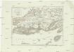
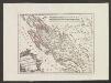
Westlicher Theil von Dalmatien
1 : 450000 Chorvatsko Santini, P. Engelman, J. W. F. A. Schraembl
Westlicher Theil von Dalmatien
1 : 445000 Chorvatsko Santini, P. Engelman, J. W. F. A. Schraembl
Iadera, Sicum et Aenona Vulgo Zara, Sibenico et Nona cum Insulis adiacentibus. in Parte Dalmatiae Boreali. [Karte], in: Het vijfde Deel Des Grooten Atlas : Vervatende De Water-Weereld, S. 234.
1 Karte aus Atlas Jansson, Jan Jansson, Jan
Iadera, Sicum et Aenona Vulgo Zara, Sibenico et Nona cum Insulis adjacentibus. in Parte Dalmatiae Boreali. [Karte], in: Novus atlas absolutissimus, Bd. 9, S. 314.
1 Karte aus Atlas Janssonius Offizin
Charte des nordwestlichen Theiles von Dalmatien
Dalmácie (Chorvatsko) im Verlage des Kunst und Industrie Comptoirs
Charte des nordwestlichen Theil von Dalmatien
Dalmácie (Chorvatsko) Verlage der Kunst und Industrie
Partie de la Dalmatie du nord ouest
Dalmácie (Chorvatsko) im Verlage des Kunst und Industrie Comptoirs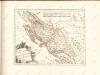
Der Noerdliche Theil Des Königreichs Dalmatien
1 : 1000000 Dalmatien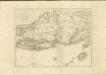

Jonction de la mer Adriatique á la Culpa
1 : 150000 Jaderské moře-oblast
Sheet XVII: Karte Des Oesterreichischen Kaiserstaates.
1 : 576000 Scheda, Josef
Übersichtskarte von Mittel - Europa

Dalmatien und Montenegro
Kroatien, Montenegro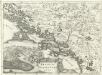
Regnum Dalmatiae
1 : 1200000 Mollova mapová sbírka Bruggen, Johann van der Brugge, Johannes van der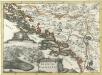
Regnum Dalmatiae
1 : 1200000 Mollova mapová sbírka Bruggen, Johann van der Brugge, Johannes van der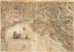
Golfo di Venetia Overo Mare Adriatico
Mollova mapová sbírka Scolari, Stefano Lovisa, Domenico
Strassen Karte der croatischen Militair Grenze
1 : 432000 Chorvatsko
XVII, uit: General-Karte des oesterreichischen Kaiserstaates mit einem grossen Theile der angrenzenden Länder / durch Josef Scheda ... bearb. und hrsg
1 : 576000 Annotatie geografische gegevens: Maatstokken: oesterreichische Meilen, geografische oder deutsche Meilen, preussische Meilen, türkische Berri, französische Lieues, russische Werste; Maatstok per blad: wiener Klafter, öster. Meilen; Blad XIX: statistische en taalkundige informatie; Blad XIX: legenda [Wien : K.K. Militärisch-Geografisches Institut]
![[Umgebung von Dugi Otok und Zeichenerklärung]](https://images-2.georeferencer.com/images/iiif/326044068324/full/,300/0/native.jpg)

