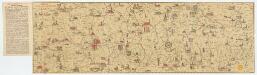
Maps of Mediterranean Sea
[Kaart], uit: Der Thüringerwald
1 : 150000 Annotatie: Verso: informatie [S.l. : Shell Reisedienst]
Turquie in Europe.
from A new systeme of the mathematicks: containing I. Arithmetick, as well natural and decimal, as in species, or the principles of algebra. II. Practical geometry, together with the first six books of Euclid's Elements, as also the eleventh and twelfth, symbo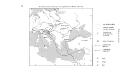
Geschäftsverbindungen und Kupferhandel der Medici 1393-1395
Europa Medici, Bankiers, Fuersten, Italien
Carte generale de toute l'Europe, 5
1 Blatt : 56 x 46 cm J.M. Will
Itinera expeditionum sacrarum
Europa, Mittelmeerraum, Reiseweg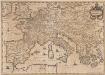
Imperium Caroli Magni [Karte], in: Novus atlas absolutissimus, Bd. 4, S. 28.
1 Karte aus Atlas Janssonius Offizin
Das Europaeische Turkei, Griechenland und die Ionischen Inslen
1 : 3000000 Graf, Carl
M. Herberers ongelukkige voyagie gedaan in verscheyde gedeeltens van Asia en Africa
1 : 24000000 1 Karte : Kupferdruck ; 22 x 29 cm Aa, Pieter van der [Michel Herberer]
[Historisch-geographischer Atlas zu den allgemeinen Geschichtswerken von C. v. Rotteck, Pölitz u. Becker] : Italien eine Uebersicht seiner Völker und Staaten in der ältesten Zeit
von Julius Loewenberg Lithographie von B. Herder in Freiburg im Breisgau [Freiburg im Breisgau] : [Herder]
Central Europe.
1 : 7303000 Fisher, Richard Swainson
Vorfrieden von San Stefano und Frieden von Berlin (1878)
Südosteuropa Russisch-Türkischer Krieg <1877-1878>, Frieden von San Stefano Zwick, J. ; Clewing, K.
L'Empire Grec à la mort de Basile le Bulgarochtone et sous ses Héritiers
Byzantinisches Reich Basileios II.
Südosteuropa um 1475
Südosteuropa, Osmanisches Reich, Georgius Castriota Zwick, J. ; Schmitt, O. J.
L'Empire Grec au Commencement du IX.e siècle
Byzantinisches Reich Kümmerly & Frey
Südosteuropa 1945/47
Südosteuropa Staatsgrenze Zwick, J. ; Portmann, M.
Südosteuropa 1918-1923
Südosteuropa Staatsgrenze Zwick, J. ; Clewing, K.
Südosteuropa – Bildung und Kultur (um 1900)
Südosteuropa Bildungswesen, Kulturelle Einrichtung Zwick, J. ; Sundhaussen, H.
16 bis. Europa etnografica.
1 : 6000000 Touring club italiano
Südosteuropa 1699 – 1718 – 1739
Südosteuropa Türkenkriege, Kroatische Militärgrenze Zwick, J. ; Koller, M. ; Kreuter, P. M.
Städtenetz und Bevölkerungsdichte (um 1870)
Südosteuropa Städtenetz, Bevölkerungsdichte Zwick, J. ; Clewing, K. ; Kreuter, P. M.
Südosteuropa um 1400
Südosteuropa, Osmanisches Reich, Expansion Zwick, J.
Völkerkarte von Mittel-und Südosteuropa
1 : 15000000 Mitteleuropa, Südosteuropa, ethnische Gruppe
IMPERII TVRCICI EVROPAEI TERRA, in primis GRAECIA
1 : 4700000 Turecko Harenberg, Johann Christoph curantibus Homannianis Heredibus
Imperii Tvrcici Evropaei terra, in primis Graecia cum confiniis, ad intelligendos scriptores N.T. ceterosque graecos et latinos accom[m]odata
1 : 4530000 Turecko Harenberg, Johann Christoph curantibus Homannianis Heredibus
Südosteuropa unter Kaiser Trajan (98-117)
Südosteuropa Trajan, Römisches Reich, Kaiser Zwick, J.
Physische Übersichtskarte (Südosteuropa heute)
Südosteuropa Staatsgrenze, Physische Geografie Zwick, J. ; Clewing, K. ; Kreuter, P. M.
Südosteuropa nach 1815
Südosteuropa, Osmanisches Reich, Griechischer Unabhängigkeitskrieg Zwick, J. ; Clewing, K.
Střední a jihovýchodní Europa v druhé polovici XIV. stol.

Mittel-Europa
1 : 3000000 Evropa střední G. Freytag & Berndt
![[Kaart], uit: Der Thüringerwald](https://images-2.georeferencer.com/images/iiif/429810092209/full/,300/0/native.jpg)

