Maps of Hoppegarten

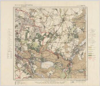
Blatt VII Cöpenick, uit: Karte von Berlin und Umgebung in 12 Blättern
1 : 50000 Annotatie: Toelichtingen opgeborgen bij kaart; Annotatie geografische gegevens: Met schaalstokken: Meter, Schritt, geographische Meile Paul Schneider Berlin : Reichsamt für Landesaufnahme
Meßtischblatt 3548 : Rüdersdorf, 1945
1 : 250000 Rüdersdorf. - Aufn. 1901 und 1927/34, hrsg. 1903, bericht. 1936, mehrfarb. hrsg. 1938, gedr. [19]45. - 1:25000. - [Berlin]: Reichsamt für Landesaufnahme, 1945. - 1 Kt.
Meßtischblatt 1910 : Rüdersdorf, 1922
1 : 250000 Rüdersdorf. - Aufn. 1901, bericht. 1920, kleine Nachtr. 1922. - 1:25000. - [Berlin]: Reichsamt für Landesaufnahme, 1922. - 1 Kt.
Meßtischblatt 1910 : Rüdersdorf, 1916
1 : 250000 Rüdersdorf. - Aufn. 1901, hrsg. 1903, Aufldr. 1916. - 1:25000. - [Berlin]: Reichsamt für Landesaufnahme, 1916. - 1 Kt.
Meßtischblatt 3547 : Köpenick, 1945
1 : 250000 Berlin (Süd). - Aufn. 1901 und 1929/35, hrsg. 1903, bericht. 1936, mehrfarb. hrsg. 1939, letzte Nachtr. 1942, Nachdr. m. farb. Eintr. der Gebäudeschäden 1945. - 1:25000. - [Berlin]: Reichsamt für Landesaufnahme, 1945. - 1 Kt.
Meßtischblatt 3547 : Köpenick, 1942
1 : 250000 Köpenick. - Aufn. 1901 und 1929/35, hrsg. 1903, bericht. 1936, mehrfarb. hrsg. 1939, letzte Nachtr. 1942. - 1:25000. - [Berlin]: Reichsamt für Landesaufnahme, 1942. - 1 Kt.
Meßtischblatt 1909 : Cöpenick, 1920
1 : 250000 Cöpenick. - Aufn. 1901, bericht. 1920. - 1:25000. - [Berlin]: Reichsamt für Landesaufnahme, 1920. - 1 Kt.
Meßtischblatt 1909 : Cöpenick, 1912
1 : 250000 Cöpenick. - Aufn. 1901, hrsg. 1903, bericht. 1906, einz. Nachtr. 1912. - 1:25000. - [Berlin]: Reichsamt für Landesaufnahme, 1912. - 1 Kt.
Meßtischblatt 3448 : Altlandsberg, 1940
1 : 250000 Altlandsberg. - Aufn. 1901, hrsg. 1903, bericht. 1920, letzte Nachtr. 1936, mehrfarb. hrsg. 1940. - 1:25000. - [Berlin]: Reichsamt für Landesaufnahme, 1940. - 1 Kt.
Meßtischblatt 3447 : Friedrichsfelde, 1942
1 : 250000 Friedrichsfelde. - Hrsg. 1903, bericht. 1936, mehrfarb. hrsg. 1940, letzte Nachtr. 1942. - 1:25000. - [Berlin]: Reichsamt für Landesaufnahme, 1942. - 1 Kt.
Meßtischblatt 1838 : Friedrichsfelde, 1930
1 : 250000 Friedrichsfelde. - Hrsg. 1903, bericht. 1920, einz. Nachtr. 1930. - 1:25000. - [Berlin]: Reichsamt für Landesaufnahme, 1930. - 1 Kt.
Meßtischblatt 1838 : Friedrichsfelde, 1918
1 : 250000 Friedrichsfelde. - Aufn. 1901, hrsg. 1903, Aufldr. 1918. - 1:25000. - [Berlin]: Reichsamt für Landesaufnahme, 1918. - 1 Kt.
Berlin (1944)
Germany. Berlin. Scale, 1: 59,000 (approx.). Copied from a German map dated 1931. G.S.G.S. (Misc.) No.168. [London] : War Office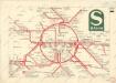
S Bahn

269. Berlin.
1 : 100000 Reichsamt fur Landesaufnahme
Composite: 269. Berlin.
1 : 100000 Reichsamt fur Landesaufnahme
294. Copenick.
1 : 100000 Reichsamt fur Landesaufnahme
Composite: 294. Copenick.
1 : 100000 Reichsamt fur Landesaufnahme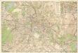
Strassenübersichtsplan von Berlin

Grundriss von Berlin
Berlín (Německo) Herzberg Veit Veit et Comp.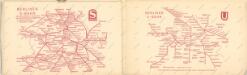
Taschenplan von Berlin

Topographische Carte : Hundert Quadrat-Meilen um Berlin
1 : 184000
Geologische Übersichtskarte der Umgegend von Berlin
1 : 100000 Berendt, G. ; Laufer, E. Lithogr. Institut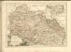

86. Berlin, Districts of Leipzig, Dresden, Karl-Marx-Stadt. The World Atlas.
1 : 1250000 USSR (Union of Soviet Socialist Republics).
Der Nieder-Barnimsche Creis
1 : 302000 Braniborsko (Německo) Oesfeld, Karl Ludwig von Glassbach, Carl Christian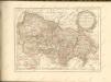

Berlin unter alliierter Verwaltung 1.9.1945
Berlin Kunz, Andreas ; Moeschl, Joachim Robert
Der Ober Barnimsche Creis
1 : 292000 Braniborsko (Německo) Oesfeld, Karl Ludwig von Jättnig, Karl