Maps of Region Nordschwarzwald

Strasburg 127, uit: [W. Liebenow's Special-Karte von Mittel-Europa]
1 : 300000 titelvariant: W. Liebenow's Mittel-Europa; Annotatie: Titel boven de bladen: W. Liebenow's Mittel-Europa Johannes Wilhelm Liebenow 1822-1897 Hannover : Hermann Oppermann
Strassburg 127, uit: Special-Karte von Mittel-Europa / nach amtlichen Quellen bearbeitet von W. Liebenow
1 : 300000 titelvariant: W. Liebenow's Mittel-Europa; Annotatie: Titel boven de bladen: W. Liebenow's Mittel-Europa Johannes Wilhelm Liebenow 1822-1897 Frankfurt a. M. : Ludwig Ravenstein
Kriegs-Theatrum.
Mollova mapová sbírka Lidl, Johann Jakob Lidl, Johann Jacob
Die untere Markgrafschaft Baaden oder die Grafschaft Eberstein mit den Durlachischen Landen
1 Karte : Kupferdruck ; 18 x 24 cm Reilly F. J. J. von Reilly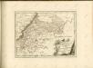
Geographica Provinciarum Sveviae Descriptio =
Mollova mapová sbírka Hurter, Johann Christoph Bodenehr, Gabriel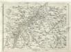
Geographica Provinciarum Sveviae Descriptio =
Mollova mapová sbírka Hurter, Johann Christoph Bodenehr, Johann Georg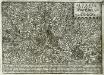
Alsatia inferior
1 Karte : Kupferdruck ; 17 x 27 cm Specklin; Quad Johannes Bussemacher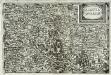
Alsatia inferior
1 Karte : Kupferdruck ; 14 x 22 cm Lambert Andreae
[Carte eines Theils des Schwartzwaldes]

170. Stuttgart, uit: Topographische Uebersichtskarte des Deutschen Reiches / herausgegeben v. d. Kartogr. Abt. d. Königl. Preuß. Landesaufnahme
1 : 200000 titelvariant: Topogr. Übersichtskarte des Deutschen Reiches; Annotatie: Titel boven bladen ook: Topogr. Übersichtskarte des Deutschen Reiches; Annotatie geografische gegevens: Op elk blad twee maatstokken: 10 Kilometer = 5,5 cm; 1 geogr. Meile = 3,6 cm; Legenda onder op elk blad Königlich Preußische Landesaufnahme. Kartographische Abtheilung [S.l : Königlich Preußische Landesaufnahme, Kartographische Abtheilung]
Alasatia superior et inferior III. tabulis delineata, 3
1 Blatt : 62 x 59 cm s.n.
Suevia Universa :
1 : 170000 Mollova mapová sbírka Michal, Jacques de Seutter, Matthäus Seutter, Matthäus
169. Strassburg i. Elsass, uit: Topographische Uebersichtskarte des Deutschen Reiches / herausgegeben v. d. Kartogr. Abt. d. Königl. Preuß. Landesaufnahme
1 : 200000 titelvariant: Topogr. Übersichtskarte des Deutschen Reiches; Annotatie: Titel boven bladen ook: Topogr. Übersichtskarte des Deutschen Reiches; Annotatie geografische gegevens: Op elk blad twee maatstokken: 10 Kilometer = 5,5 cm; 1 geogr. Meile = 3,6 cm; Legenda onder op elk blad Königlich Preußische Landesaufnahme. Kartographische Abtheilung [S.l : Königlich Preußische Landesaufnahme, Kartographische Abtheilung]
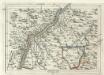
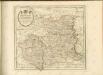
Der Pfinz und Enz Kreis im Grossherzogthum Baden
1 : 200000 Bádensko (Německo) Krauth Wolff, F. C.F. Müllerschen Buchhandlung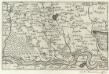
Landau mitt umbliegenden dörfferen und Stätten
1 : 170000 Mollova mapová sbírka Person, Nikolaus Person, Nicolas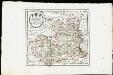
Des Herzogthums Würtemberg nordwestliche Aemter mit der freyen Reichsstadt Weil : Nro. 187
Reilly, Franz Johann Joseph von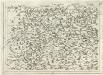
Geographica Provinciarum Sveviae Descriptio =
Mollova mapová sbírka Hurter, Johann Christoph Bodenehr, Johann Georg
Territorium Argentoratense
1 Karte : Kupferdruck ; 36 x 48 cm Janssonius van Waesbergen; Pitt; Swart apud Janssonio-Waesbergios Mosem Pitt et Stephanum Swart
Territorium Argentoratense
1 Karte : Kupferdruck ; 36 x 48 cm Janssonius; Keere Ioannes Ianssonius excudit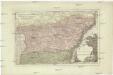
Der District Hagenau
1 : 182000 Haguenau (Francie)
Carte Particuliere de Pays qui sont situéz entre le Rhein, la Saare, la Moselle, et la Basse Alsace
1 : 150000 Mollova mapová sbírka Jaillot, Alexis-Hubert Jaillot, Alexis Hubert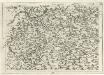
Geographica Provinciarum Sveviae Descriptio =
Mollova mapová sbírka Hurter, Johann Christoph Bodenehr, Gabriel
Chorographia Argentorati Alsatiæ metropolis
1 Karte : Kupferdruck ; 47 x 56 cm Seutter Matthäus Seutter
Argentorati territorium, vulgo Strasburger Gebiet
1 Karte : Kupferdruck ; 46 x 57 cm Allard by I. Cóvens et C. Mortier
Le Flambeau de la Guerre Allumee au Rhin
Mollova mapová sbírka Delisle, Guillaume Schenk, Peter II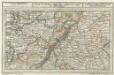
Fortlovis mitt der Gegend auff 6 Stunden.
1 : 250000 Mollova mapová sbírka Bodenehr, Gabriel Bodenehr, Gabriel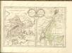

![Strasburg 127, uit: [W. Liebenow's Special-Karte von Mittel-Europa]](https://images-2.georeferencer.com/images/iiif/653575428816/full/,300/0/native.jpg)

