Maps of powiat sanocki

Sanok 108, uit: Special-Karte von Mittel-Europa / nach amtlichen Quellen bearbeitet von W. Liebenow
1 : 300000 titelvariant: W. Liebenow's Mittel-Europa; Annotatie: Titel boven de bladen: W. Liebenow's Mittel-Europa Johannes Wilhelm Liebenow 1822-1897 Frankfurt a. M. : Ludwig Ravenstein
Übersichtskarte von Mitteleuropa 1:300 000
1 : 300000 Levoča-oblast (Slovensko) Reichsamt für Landesaufnahme

Vom Dunajec bis zum Wislok
1 : 160000 Polen Dunajec-Gebiet Weltkrieg <1914-1918> Verl. Gerhard Stalling, Oldenburg
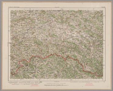
Reliefkarte Gorlice-Tarnów
Polen Tarnów Weltkrieg <1914-1918> Verl. Gerhard Stalling, Oldenburg
Jaslo und Dukla.
from Spezialkarte der osterreichisch-ungarischen Monarchie.
Dukla-Pasz (Galizien).
from Spezialkarte der osterreichisch-ungarischen Monarchie.
Bardiov a okolí
1 : 75000 Bardejov (Slovensko : oblast) Vojenský zeměpisný ústav
Lisko und Mezölaborcz
1 : 75000 Medzilaborce-oblast (Slovensko) Baumgarten K. u. k. Militärgeographisches Institut
Medzilaborce a Lisko
1 : 75000 Medzilaborce (Slovensko : oblast) Vojenský zeměpisný ústav
Medzilaborce a Lisko
1 : 75000 Medzilaborce-oblast (Slovensko) Vojenský zeměpisný ústav
III. vojenské mapování 4268
1 : 75000
Dukelský průsmyk
1 : 75000 Polsko Vojenský zeměpisný ústav
Průsmyk Dukelský
1 : 75000 Polsko Vojenský zeměpisný ústav
III. vojenské mapování 4267
1 : 75000
Lisko und Mezőlaborcz
1 : 75000 Bieszczady, Medzilaborce Geripp: Offiz. Schill u. Baumgarten. Terrain: Oberlt. Jonak Edl. v. Freyenwald und Zivilarb. Vogel
Jasło und Dukla
1 : 75000 Jasło-oblast (Polsko) Höller, K. K. u. K. militär- geographisches Institut
Lisko und Mezolaborcz.; Spezialkarte der osterreichisch-ungarischen Monarchie.
from Spezialkarte der osterreichisch-ungarischen Monarchie. Austro-Hungarian Monarchy. Militärgeographisches Institut.,
Brzozow und Sanok.; Spezialkarte der osterreichisch-ungarischen Monarchie.
from Spezialkarte der osterreichisch-ungarischen Monarchie. Austro-Hungarian Monarchy. Militärgeographisches Institut.,
Brzozów und Sanok
1 : 75000 Polsko Irlanda K. u. k. Militärgeographisches Institut
Bardejov
1 : 75000 Bardejov (Slovensko : oblast) Vojenský zeměpisný ústav
Bardejov
1 : 75000 Bardejov (Slovensko : oblast) Vojenský zeměpisný ústav
Crybow und Corlice.
from Spezialkarte der osterreichisch-ungarischen Monarchie.
Bartfa und Muszyna.
from Spezialkarte der osterreichisch-ungarischen Monarchie.
Brzostek und Strzyzow.
from Spezialkarte der osterreichisch-ungarischen Monarchie.
Bardiov a Muszyna
1 : 75000 Bardejov-oblast (Slovensko) Vojenský zeměpisný ústav
Bártfa und Muszyna
1 : 75000 Bardejov, Muszyna Geripp: Assist. Scherling u. Offiz. Kostrba. Terrain: Oberoffiz. Terlikowski u. Oberlt. Boltek
III. vojenské mapování 4266
1 : 75000
Grybów und Gorlice
1 : 75000 Gorlice (Polsko) Leitner K. u. k. Militärgeographisches Institut