Maps of India

Magni Mogol infeniutus / J.F.V.E.
1 : 5000000 Essen, J. F. van [Antwerpen : J.F.V.E.]
Indes I.
1 : 10000000 Bonne, Rigobert, 1727-1794
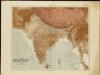
India and Adjacent Countries. Coal Resources of the World.
1 : 8553600 McInnes, William; Leach, W.W.; Dowling, D.B.
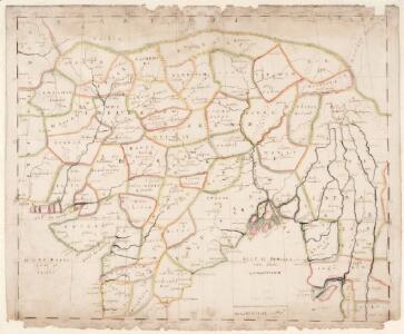
Imperii magni Mogolis sive Indici Padschach, juxta recentißimas navigationes accurata delineatio geographica
Indie Seutter, Matthäus Seutter, Albrecht Carl sumtibus Matth. Seutteri
1 Partie de la nouvelle grande carte des Indes Orientales, contenant les terres du Mogol, Surate, Malabar, Cormandel, Bengale, Aracan, Pegu, Siam, Camboje, Tonquin & une partie de la Chine
1 : 8000000 dressée avec soin, sur plusieurs cartes munuscrites, par un habile connoisseur, & publiée A Amsterdam : par R. & J. Ottens
Schul-Atlas für die alte Erdbeschreibung : zur allgemeinen Schul-encyclopädie gehörig
J. H. Campe Zusammensetzung und Zeichnung von [...] Dufour, unter Leitung von Heusinger ; gestochen von Frentzel. Braunschweig : Schulbuchhandlung
Map of High Asia
The Indian Empire and Ceylon
1 : 7500000
Tabula Asiae X. [Karte], in: Geographia universalis vetus et nova complectens Claudii Ptolemaei Alexandrini enarrationis libros VIII, S. 293.
1 Karte aus Atlas Münster, Sebastian [und Ptolemaeus, Claudius]
Decima Asiae Tabula [Karte], in: Claudii Ptolemei viri Alexandrini mathematice discipline philosophi doctissimi geographie opus [...], S. 220.
1 Karte aus Atlas Waldseemüller, Martin [und Ptolemaeus, Claudius] Übelin, Georg
India
1 : 8000000 Afghánistán James, J. O. N. Surveyor general's office
Language Map of India and ist Border Lands

[Vorder-Indien oder Ango-Indische Reich]
Hand-Atlas über alle Theile der Erde und über das Weltgebäude Stieler, Adolf Justus Perthes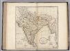
Hindostan or India.
1 : 9000000 Carey, Mathew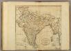
Map of Hindostan or India.
1 : 9500000 Carey, Mathew
Hindostan or India.
1 : 14572800 Carey, Mathew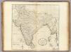
Map of Hindostan or India.
1 : 10264320 Carey, Mathew
Map of Hindostan or India.
1 : 10264320 Carey, Mathew
India
1 : 15000000 J.W. Clement Co.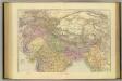
India North.
1 : 5448960 Stanford, Edward
Composite: India.
1 : 4457000 Johnston, Alexander Keith, 1804-1871
Tabula Asiae X. [Karte], in: Claud. Ptolemaeus. Geographia lat. cum mappis [...], S. 323.
1 Karte aus Atlas Münster, Sebastian [und Ptolemaeus, Claudius]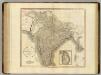
Hindoostan, Ceylon.
1 : 6900000 Cary, John, ca. 1754-1835
Composite: India.
1 : 4457000 Johnston, Alexander Keith
India
1 : 8000000 Asie jižní James, J. O. N. Surveyor general's office
Carte de la Inde
1 : 9300000 Herbin de Halle, Etienne de.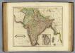
Hindostan.
1 : 8500000 Lizars, Daniel
134-135. India, Pakistan, Ceylon, Nepal, Political. The World Atlas.
1 : 7500000 USSR (Union of Soviet Socialist Republics).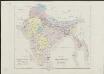
Karte vom Kriegsschauplatz in Ostindien
1 : 9500000 gezeichnet v. T. Koenig Berlin : R. Wagner