Maps of Canada

[Recto], uit: Michigan, Calumet special map / R.B. Marshall, chief geographer ; W.H. Herron, geographer in charge ; topography by A.M Walker ... [et al.]
1 : 62500 Annotatie geografische gegevens: Opname: 1908-1909 Marshall, R. B.; Herron, W. H.; Walker, A. M. [Washington, D.C. : U.S. Geological Survey]
America.
1 : 42000000 Wauthier, J. M.
Plain map America.
1 : 42000000 Wauthier, J. M.

Amerique.
1 : 26000000 Garnier, F. A., 1803-1863
Westliche Hemisphaere
1 : 100000000 Amerika Grimm, Johann Ludwig Herterich, H. bei Simon Schropp
America.
1 : 26500000 Arrowsmith, John
America.
1 : 33000000 Lavoisne, M.
12 Inch Globe.
1 : 42000000 W. & A.K. Johnston Limited
Amérique ou Indes occidentales
1 Karte : Kupferdruck ; 52 x 49 cm, Gesamtgrösse 54 x 64 cm Delamarche Delamarche rue du Foin St. Jacques au collège de M.e Gervais
Totius Americae septentrionalis et meridionalis novissima repræsentatio
1 Karte : Kupferdruck ; 48 x 56 cm Homann J.B. Homann
Totius Americae septentrionalis et meridionalis novissima repræsentatio
1 Karte : Kupferdruck ; 47 x 56 cm Homann J.B. Homann
Totius Americae septentrionalis et meridionalis novissima repræsentatio
1 Karte : Kupferdruck ; 47 x 56 cm Homann J.B. Homann
Western hemisphere
1 : 65000000 Amerika Walker, C. Society for the diffusion of useful knowledge
America / by H. Moll, geographer, 1726.; A set of thirty-two new and correct maps of the principal parts of Europe, &c.: with the great or post-roads, and principal cross-roads, done in the year 1725, 1726 and 1727: all except four, viz. England, Scotland, Ireland, and a general map of Turky in Europe, which have been done and printed before ... / all done according to the latest observations, by Herman Moll, geographer.
from A set of thirty-two new and correct maps of the principal parts of Europe, &c. : with the great or post-roads, and principal cross-roads, done in the year 1725, 1726 and 1727 : all except four, viz. England, Scotland, Ireland, and a general map of Turky in Europe, which have been done and printed before ... / all done according to the latest observations, by Herman Moll, geographer. Moll, Herman,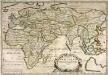
Orbis vetvs
1 Karte : Kupferdruck ; 35 x 51 cm Duval chez l'autheur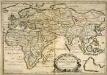
Orbis vetvs
1 Karte : Kupferdruck ; 35 x 50 cm Duval; Somer chez l'autheur
Westliche halb Kugel
1 : 45000000 Amerika Anville, Jean-Baptiste Bourguinon d' Benedicti, Hieronymus im I.G. Trasslerischen Verlage
Westliche halb Kugel
1 : 45000000 Amerika Anville, Jean-Baptiste Bourguinon d' Benedicti, Hieronymus im I.G. Trasslerischen Verlage
Westliche halb Kugel
1 : 45000000 Amerika Anville, Jean-Baptiste Bourguinon d' Benedicti, Hieronymus im I.G. Trasslerischen Verlage
Westliche Halb Kugel
Amerika Anville, Jean-Baptiste Bourguinon d' Benedicti, Hieronymus von F.A. Schrämbl
Westliche halb Kugel
1 : 45000000 Amerika Anville, Jean-Baptiste Bourguinon d' Benedicti, Hieronymus im I.G. Trasslerischen Verlage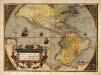
Americae sive novi orbis, nova descriptio
1 Karte : Kupferdruck ; 35 x 49 cm Ortelius s.n.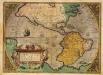
Americae sive novi orbis, nova descriptio
1 Karte : Kupferdruck ; 36 x 50 cm Ortelius s.n.
Eastern Hemisphere.
1 : 100000000 Finley, Anthony
Nova tabula Americæ
1 Karte : Kupferdruck ; 47 x 55 cm Sandrart; Homann Jakob von Sandrart
A new projection of the Western Hemisphere of the Earth on a plane: (showing the proportions of its several parts nearly as on a globe) / by J. Hardy (teacher of mathematics & writing master) at Eton College; J. Hardy, invent. et construc.; T. Bowen, delin. et sculpsit.; The Gentleman's magazine.
from The Gentleman's magazine. Hardy, J.,
Orbis terrarvm veteribus cogniti typus
1 Karte : Kupferdruck ; Durchmesser 32 cm Weigel Christoph Weigel
Orbis veteribus noti tabula nova
1 Karte : Kupferdruck ; Durchmesser 48 cm L'Isle apud auctorem in ripa vulgò dicta le quay de l'Horloge
![[Recto], uit: Michigan, Calumet special map / R.B. Marshall, chief geographer ; W.H. Herron, geographer in charge ; topography by A.M Walker ... [et al.]](https://images-2.georeferencer.com/images/iiif/575414243681/full/,300/0/native.jpg)

