Maps of Iraq

Kaerte van de waerschijnlijkste plaets van den Hof van Eden, de vlakte van Sinear, en den berg, waer op d'Ark gerust heeft, volgens deeze histori
Annotatie: Afkomstig uit dl. I van: Algemeene histori van het begin der wereld af tot den tegenwoordigen tijd toe / ... door Kornelis Westerbaen Wz. - Utrecht : Hermanus Besseling, 1735-1755; Rechtsboven: I Deel tusschen bl. 460 en 461 [Utrecht : H. Besseling excudit]
Persis, Parthia, Armenia, etc.
1 : 14700000 Fenner, Rest.
Persis, Parthia, Armenia.
1 : 14600000 Fenner, Rest.
Paradis Terestre.
1 : 8500000 Houze, Antoine Philippe
Assyrie, Babylonie a Persie

Carte General de la Turquie d'Asie.
1 : 4200000 Vivien de St Martin, L.
Tercia Asiae Tabula [Karte], in: Claudii Ptolemei viri Alexandrini mathematice discipline philosophi doctissimi geographie opus [...], S. 199.
1 Karte aus Atlas Waldseemüller, Martin [und Ptolemaeus, Claudius] Übelin, Georg
L'Euphrate et le Tigre
1 : 2400000 Anville, Jean Baptiste Bourguignon d', 1697-1782 [s.n.]
[XX], uit: Geognostische Karte des Oesterreichischen Kaiserstaates mit einem grossen Theile Deutschland's u. Italien / hauptsachlich nach ... Haidinger's geognostischer Karte dieses Staates bearb. von Josef Scheda
1 : 3000000 titelvariant: General-Karte von Europa in 25 Blättern; Annotatie: Bijlage bij: General-Karte von Europa in 25 Blättern. - 1:2.592.000. - 1845-1847 Scheda, Joseph Wien : K.K. Militär. Geografisch. Institut
Byzantinische Reich, ostliches Blatt.
1 : 3800000 Spruner von Merz, Karl
[Blízký východ-starověk]
starověký Egypt Kiepert, Heinrich Arnd
Afbeelding van alle de landen gelegen tusschen de Middellandsche, Zwarte, Caspische, Persische en Rode Zeeën : benevens derzelver rivieren, bergen, berugtste steden enz. : alles met derzelver aloude namen uitgedrukt, zo als verstrekt tot opheldering van de aards-vaderlyke geschiedenis
1 : 4000000 door W.A. Bachiene J. van Jagen sculp. 1747 ; J. Punt inv. et fecit. Uitgegeven te Gorinchem : by Nicolaas Goetzee
Carte de la situation du paradis terrestre, et des pais habitez par les patriarches
1 : 5000000 Blízký východ Huet, Pierre-Daniel Mortier, Pieter chez Pierre Mortier
West-Persien, oder die westlichen Stufenländer des Iranischen Hochlandes
1 : 3000000 Šíráz (Írán) Kiepert, Heinrich D. Reimer
Western Persia.
1 : 3380000 Sharpe, J.
Friedensdislokation im europäischen Russland
1 : 3125000 Kavkaz-oblast
Euphrates Valley, Syria, Kurdistan &c.
1 : 3220177 Stanford, Edward
[XXV], uit: Geognostische Karte des Oesterreichischen Kaiserstaates mit einem grossen Theile Deutschland's u. Italien / hauptsachlich nach ... Haidinger's geognostischer Karte dieses Staates bearb. von Josef Scheda
1 : 3000000 titelvariant: General-Karte von Europa in 25 Blättern; Annotatie: Bijlage bij: General-Karte von Europa in 25 Blättern. - 1:2.592.000. - 1845-1847 Scheda, Joseph Wien : K.K. Militär. Geografisch. Institut
Karte des Euphrat von Dscherablus bis Felludscha Karte des Euphrat von Dscherablus bis Felludscha
1 : 400000 Eufrat (řeka) Kartogr. Abteilung der Königl. Preuß. Landesaufnahme
[Tertia Asie tabula] [Karte], in: Clavdii Ptholomei Viri Alexandrini Cosmographie, S. 170.
1 Karte aus Atlas Nicolaus Germanus [und Ptolemaeus, Claudius]
Partie, la Perse. Asie 52.
1 : 1641836 Vandermaelen, Philippe, 1795-1869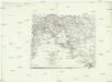
Euphrat und Tigris
1 : 2500000 Eufrat-oblast Anville, Jean-Baptiste Bourguinon d' Schraembl, Franz Anton F.A. Schraembl
Arménie et Kurdistan
Nouvel atlas physique politique et historique de l'Empire ottoman et des états limitrophes en Europe, en Asie et en Afrique, en quarante feuilles Hellert, J.J. Bellizard, Dufour et Cie
149-150. East Mediterranean Lands and Iraq. Baghdad. The World Atlas.
1 : 2500000 USSR (Union of Soviet Socialist Republics).
Syria and the Provinces to the Persian Gulf.
1 : 3380000 Sharpe, J.
Feuille 35 (G V), uit: Carte géologique internationale de l'Europe : la carte, votée au congrès géologique international de Bologne en 1881, est exécutée conformément aux décisions d'une commission internationale, avec le concours des gouvernements, sous le dir. de M.M. Beyrich et Hauchecorne
Annotatie: Blad 48 gamme des couleurs; blad 49: bladwijzer en titelblad Heinrich Ernst Beyrich 1815-1896; Wi. Hauchecorne Berlin : Reimer / (Berlin: Institut lithographique)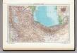
145. Iran, North-west and North. Tehran. The World Atlas.
1 : 2500000 USSR (Union of Soviet Socialist Republics).
Assyria vetvs divisa in Syriam, Mesopotamiam Babyloniam, & Assyriam proprie dictam
Asýrie La Rue, Philippe de Mortier, Pieter apud Pet. Mortier