Maps of Bas-Rhin

Sheet 4, uit: Stanford's large scale map of the seat of war / Stanford's Geographical Estab[lishmen]t
1 : 300000 Stanford's Geographical Establishment, Londen London : Stanford
L'Alsace
1 Karte : Kupferdruck ; 45 x 57 cm Sanson s.n.
Theatrum belli ad Rhenum superior
1 : 400000 Alsasko (Francie) Homanninanis Heredes
Theatrum belli ad Rhenum superior
1 : 400000 Alsasko (Francie) Homanninanis Heredes
Landgraviatus Alsatiae Inferioris Novissima Tabula [...] [Karte], in: Novus atlas absolutissimus, Bd. 2, S. 200.
1 Karte aus Atlas Janssonius Offizin
Ducatus Wurtenbergici, 1
1 Blatt : Johann Baptist Homann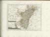

Utriusque Alsatiæ, landgraviatus ducatus Dupontii, et Spirensis episcopatus, nova tabula
1 Karte : Kupferdruck ; 47 x 55 cm Wit ex officina I. Cóvens et C. Mortier
Utriusque Alsatiæ, landgraviatus ducatus Dupontii, et Spirensis episcopatus, nova tabula
1 Karte : Kupferdruck ; 47 x 55 cm Wit F. de Wit
Département du Bas Rhin
1 : 250000 Bas-Rhin (Francie) Chanlaire, Pierre-Grégoire P.G. Chanlaire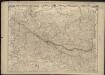
Haute et Basse Alsace, Suntgaw, Brisgaw, Ortenaw et le Marquisat de Bade, avec les divers Routes et Passages des Montagnes et Forests Noires, pour entrer en Souabe
1 : 275000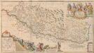
Vera totius Marchionatus Badensis, et Hochbergensis, ceterorumque Ducatuum Landgravionatuum et Comitatuum [...] [Karte], in: Novus atlas absolutissimus, Bd. 2, S. 203.
1 Karte aus Atlas Janssonius Offizin
Landgraviatus Alsatiæ inferioris novissima tabula
1 Karte : Kupferdruck ; 45 x 55 cm Visscher; Schenk nunc apud Petrum Schenk iunior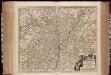
Landgraviatus Alsatiae Inferioris novissima tabula, in qua simul Marchionatus Badensis, Ortenavia caeteraque tam Lotharingica quam alia confinia / accuratissimè describuntur per Nicolaum Visscher
1 : 300000 Annotatie: Cum privilegio Ordinum Hollandiæ et Westfrisiæ; Origineel is Blad 113 in atlas factice; Annotatie geografische gegevens: Schaalstokken: Milliaria Germanica communia, en: Milliaria Gallica communia Nicolaes Jansz. Visscher jr. 1649-1702 [Amsterdam : Nicolaus Visscher]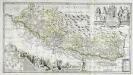
Vera totius marchionatus Badensis, et Hochbergensis
1 Karte auf 2 Blatt : Kupferdruck ; 43 x 80 cm Janssonius van Waesbergen; Pitt; Swart; Morell; Beuch excudebat Janssonio-Waesbergii Moses Pitt et Stephanus Swart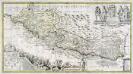
Vera totius marchionatus Badensis, et Hochbergensis
1 Karte auf 2 Blatt : Kupferdruck ; 43 x 80 cm Valck; Schenk; Morell; Beuch apud Gerardum Valk et Petrum Schenk
Accurata Et Novissima Landgraviatus Alsatiae Chorographia
Mollova mapová sbírka Person, Nikolaus Person, Nicolas
Le Theatre de la Guerre Sur le Haut Rhein
1 : 380000 Mollova mapová sbírka Nolin, Jean-Baptiste Rousseau, I. B. T. Leonard, Jean
Haute et Basse Alsace, Suntgaw, Brisgaw, Ortenaw Et Le Marquisat De Bade
1 : 270000 Mollova mapová sbírka Fer, Nicolas de Danet, Guillaume
Carte de la Haute et Basse Alsace Suntgaw, Brisgaw, Ortenaw et partie des marquisats de Baden dressées sur les memoires les plus récens
1 : 210000 Jac. Andr. Fridrich sc. A.V. A Strasbourg : chez J. R. Doulseker
Département du Bas Rhin
1 : 265000 Bas-Rhin (Francie) Houdan, François d' Bureaou de l'Atlas national
Die untere Markgrafschaft Baaden oder die Grafschaft Eberstein mit den Durlachischen Landen : Nro. 192
Reilly, Franz Johann Joseph von
Département du Bas Rhin
1 Karte : Kupferdruck ; 40 x 35 cm Capitaine s.n.
L'Alsace, ou conquestes du roy, en Allemagne, tant deca que dela le Rhein
1 : 325000 Alsasko (Francie) Sanson, Guillaume Pierre Mariette
Doms Serenißimo Celsißimoq;
1 : 250000 Mollova mapová sbírka Homann, Johann Baptist Homann, Johann Baptista - dědici
Landgraviatus Alsatiae Inferioris Novissima Tabula
1 : 280000 Mollova mapová sbírka Visscher, Nicolaes Jansz. Schenk, Peter II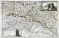
Topographia Alsatiæ, Svngoiæ, et Brisgoiæ
1 Karte : Kupferdruck ; 23 x 36 cm Bodenehr Johann Georg Bodenehr
Landgraviatus Alsatiae tam superioris quam infer[ioris]
1 Karte : Kupferdruck ; 41 x 34 cm s.n.
Suevia universa IX. tabulis delineata, 4
1 Blatt : s.n.
Alsatia landgraviatus
1 Karte : Kupferdruck ; 57 x 48 xm Seutter Matthäus Seutter
Carte de la Haute et Basse Alsace Suntgaw, Brisgaw, Ortenaw et partie des marquisats de Baden
1 Karte auf 3 Blättern : Kupferdruck ; 90 x 34 cm Dulssecker; Fridrich chez I: R: Doulseker
![Sheet 4, uit: Stanford's large scale map of the seat of war / Stanford's Geographical Estab[lishmen]t](https://images-2.georeferencer.com/images/iiif/596463072574/full/,300/0/native.jpg)

