Maps of Luxembourg

Sheet 1, uit: Stanford's large scale map of the seat of war / Stanford's Geographical Estab[lishmen]t
1 : 300000 Stanford's Geographical Establishment, Londen London : Stanford
Les Courans des Riviers de Meuse de Mozel et de la Sar ou se trouvent le Luxembourg et l'Archeveché de Treves
1 : 430000 Mollova mapová sbírka Nolin, Jean-Baptiste Nolin, Jean Baptiste II.
Carte de la France, no. 2
1 Blatt : 61 x 83 cm s.n.
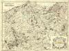
Ducatus Lutzenburgici tabula
1 : 320000 Lucembursko Wit, Frederick de per Fredericum de Wit
Ducatus Luxemburg distinctis limitibus majorum et minorum ditiorum
1 : 330000 Lucemburk (Lucembursko) Seutter, Matthäus a Matthaeo Seutter
Partie du Duché de Luxembourg et de l'Electorat de Treves
1 : 120000 Mollova mapová sbírka Baillieul, Gaspard Baillieul, Gaspard
Höhenschichten-Karte der Eifel / von H. Rauff ; gezeichn. von W. Rose
1 : 200000 Annotatie geografische gegevens: Gebaseerd op: Topografische Uebersichtskarte des Deutschen Reiches Hermann Rauff; W. Rose fl. 1900 Bonn : Cohen


Le duché de Luxembourg
1 : 370000 Lucembursko Fer, Nicolas de Starckman, P. N. de Fer
Le Duché de Luxembourg
1 : 330000 Mollova mapová sbírka Fer, Nicolas de Starckman, P. Fer, Nicolas de
Partie Occidentale Du Temporel De L'Archevesché et Eslectorat, De Treves. [Karte], in: Atlas nouveau, contenant toutes les parties du monde [...], Bd. 1, S. 196.
1 Karte aus Atlas Sanson, Nicolas Jaillot, Alexis Hubert und Mortier, Pieter
Luxenbvrgicvs ducatus
Mollova mapová sbírka Mercator, Gerhard Mercator, Gerard
Treveri Archidiacne. de Coblents dans le Dioecese de l'Archevche de Treves.
Mollova mapová sbírka Sanson, Guillaume Sanson, Guillaume
Archiepiscopatus et Electoratus Trevirensis Novissima delineatio
1 : 310000 Mollova mapová sbírka Wit, Frederik de Wit, Frederick
Archiepiscopatus ac Electoratus Trevirensis ditio
1 : 310000 Mollova mapová sbírka Visscher, Nicolaes Gouwen, Giliam van der Schenk, Peter II
Trevirensis Archi-Episcopatus et Electoratus
1 : 310000 Mollova mapová sbírka Seutter, Matthäus Seutter, Matthäus
Mosellae Fluminis Tabula Specialis
1 : 310000 Mollova mapová sbírka Homann, Johann Baptist Homann, Johann Baptista - dědici
Partie Occidentale Du Temporel De L'Archevesché et Eslectorat, De Treves
1 : 210000 Mollova mapová sbírka Sanson, Guillaume Jaillot, Alexis Hubert
148. Mettendorf, uit: Topographische Uebersichtskarte des Deutschen Reiches / herausgegeben v. d. Kartogr. Abt. d. Königl. Preuß. Landesaufnahme
1 : 200000 titelvariant: Topogr. Übersichtskarte des Deutschen Reiches; Annotatie: Titel boven bladen ook: Topogr. Übersichtskarte des Deutschen Reiches; Annotatie geografische gegevens: Op elk blad twee maatstokken: 10 Kilometer = 5,5 cm; 1 geogr. Meile = 3,6 cm; Legenda onder op elk blad Königlich Preußische Landesaufnahme. Kartographische Abtheilung [S.l : Königlich Preußische Landesaufnahme, Kartographische Abtheilung]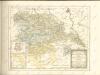

Le Theatre de Bellone :
Mollova mapová sbírka Schenk, Pieter Braakman, Adriaan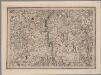
[22], uit: Hydro-Oro und Chorographische General Karte des Koenigreichs der Niederlande und der angrenzenden Länder bis Paris : mit der Angabe der Kunst und Heer-Strassen und der Entfernung der Poststationen / ... zusammengetragen und reducirt von ... Wilhelm Müller
1 : 400000 titelvariant: Generalkarte des Koenigreichs Hannover; Annotatie: 1e supplement bij: Generalkarte des Koenigreichs Hannover (1818) Müller, Wilhelm (fl. 1818) [Hannover : Wilhelm Müller]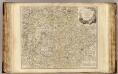
Luxembourg.
1 : 275500 Robert de Vaugondy, Gilles, 1688-1766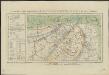
Essai de carte géologique et synoptique du département de l'Ourte, et des environs
1 : 445000 gravé par L. Jéhotte J.L. Wolff, pinx. Spa : [s.n.]
Le Duché de Luxembourg divisé en Quartier Walon et Allemand
1 : 140000 Mollova mapová sbírka Jaillot, Alexis-Hubert Jaillot, Alexis Hubert
Partie Occidentale Du Temporel De L'Archevesché et Eslectorat De Treves
1 : 210000 Mollova mapová sbírka Sanson, Guillaume Jaillot, Alexis Hubert
Theatre De La Guerre Dans Les Pays Qui Sont Situéz Entre le Rhin, la Saare, la Moselle et la Basse Alsace. [Karte], in: Atlas nouveau, contenant toutes les parties du monde [...], Bd. 1, S. 235.
1 Karte aus Atlas Sanson, Nicolas Jaillot, Alexis Hubert und Mortier, Pieter
![Sheet 1, uit: Stanford's large scale map of the seat of war / Stanford's Geographical Estab[lishmen]t](https://images-2.georeferencer.com/images/iiif/271973444243/full/,300/0/native.jpg)

