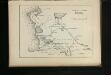
Maps of Mangystau Region

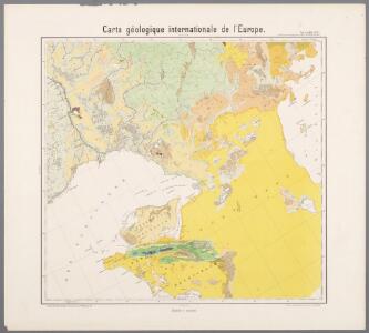
Feuille 28 (G IV), uit: Carte géologique internationale de l'Europe : la carte, votée au congrès géologique international de Bologne en 1881, est exécutée conformément aux décisions d'une commission internationale, avec le concours des gouvernements, sous le dir. de M.M. Beyrich et Hauchecorne
Annotatie: Blad 48 gamme des couleurs; blad 49: bladwijzer en titelblad Heinrich Ernst Beyrich 1815-1896; Wi. Hauchecorne Berlin : Reimer / (Berlin: Institut lithographique)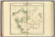
Turcomanie. Asie 40.
1 : 1641836 Vandermaelen, Philippe, 1795-1869
Mer Caspienne, carte marine (northern sheet)
1 : 1600000 Verden, Carl van
Portions of the Russian empire in eastern and western Asia / drawn by Augustus Petermann F.R.G.S. ;
1 : 3000000 2 Karten auf einem Blatt : Mehrfarbendruck ; 33 x 48 cm Petermann, A. A. Fullarton
Russian Empire in Eastern & Western Asia.
1 : 3000000 Fullarton, A. & Co.
Wolga-Delta
1 : 2000000 Wolgadelta
The Caspian Sea.
1 : 2900000 Arrowsmith, John
Vierte Revolution des Caspischen Meeres, oder Karte des Czar Peter des Grossen
1 Karte : Kupferdruck ; 20 x 29 cm Anville Philipp Heinrich Perrenon
Tiefländer
Atlas der Geologie Zittel, K.v. ; Berghaus, Hermann Justus Perthes
Administrativnaja Karta Evropejskoj časti C.C.C.P.

[XV], uit: Geognostische Karte des Oesterreichischen Kaiserstaates mit einem grossen Theile Deutschland's u. Italien / hauptsachlich nach ... Haidinger's geognostischer Karte dieses Staates bearb. von Josef Scheda
1 : 3000000 titelvariant: General-Karte von Europa in 25 Blättern; Annotatie: Bijlage bij: General-Karte von Europa in 25 Blättern. - 1:2.592.000. - 1845-1847 Scheda, Joseph Wien : K.K. Militär. Geografisch. Institut
Nova ac verissima Maris Caspii ante hac maximam fere partem nobis incognita ac regionum adjacentium delineatio : jussu invictissimi principis Petri Alexii fil. magni Russorum imperatoris
1 : 1500000 immenso labore et maximis sumptibus facta, atque ex autographo in lucem edita per Reinerum Ottens geographum Amstelaedam. Iacob Keyser sculp. Gedrukt t'Amsterdam : by de Wed. I. Ottens op de Nieuwen Dyk in de Wereldkaart
Nova et accuratissima maris Caspii hactenus maximam partem nobis non satis cogniti ac regionum adjacentium delineat
1 Karte : Kupferdruck ; 48 x 56 cm Probst; Seutter anjezo in Verlag bey Iohann Michael Probst Chalcogr. in Augspurg
Nova ac verissima Maris Caspii ante hac maximam fere partem nobis incognita ac regionum adjacentium delineatio : jussu invictissimi principis Petri Alexii fil. magni Russorum imperatoris
1 : 1500000 immenso labore et maximis sumptibus facta, atque ex autographo in lucem edita per Reinerum Ottens geographum Amstelaedam. Iacob Keyser sculp. Gedrukt t'Amsterdam : by de Wed. I. Ottens op de Nieuwen Dyk in de Wereldkaart
Nova et accuratissima maris Caspii hactenus maximam partem nobis non satis cogniti ac regionum adjac
1 : 2100000 1 Karte : Kupferdruck ; 48 x 56 cm Seutter, Matthäus [Seutter]
Nova et accuratissima maris Caspii hactenus maximam partem nobis non satis cogniti ac regionum adjac
1 : 2100000 1 Karte : Kupferdruck ; 48 x 56 cm [Seutter]
(Europaischen Russland IV).
1 : 5000000 Berghaus, Heinrich; Flemming, Carl; Handtke, Friedrich H.; Sohr, Karl

Partie, la Turquie. Europe 21.
1 : 1641836 Vandermaelen, Philippe, 1795-1869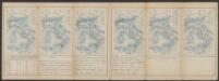
Tabula Asiae II. [Karte], in: Claud. Ptolemaeus. Geographia lat. cum mappis [...], S. 299.
1 Karte aus Atlas Münster, Sebastian [und Ptolemaeus, Claudius]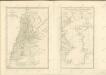

Composite: Mer Caspiene carte marine.
1 : 1600000 Verden, Carl van
Essai d'une nouvelle carte de la mer Caspienne
1 Karte : Kupferdruck ; 51 x 25 cm Anville; Delahaye s.n.
A new and accurate map of the Caspian sea
1 Karte : Kupferdruck ; 31 x 21 cm Bowen s.n.
Carte marine de la mer Caspiene
1 Karte auf 2 Blatt : Kupferdruck ; 86 x 60 cm Verden; L'Isle chez le Sr. Delisle quay de l'horloge
Geographica nova ex oriente gratiosissima, duabus tabulis specialissimis contenta quarum una mare Caspivm altera Kamtzadaliam seu terram Jedso curiosè exhibe[n]t
2 Karten auf 1 Blatt : Kupferdruck ; Bildgrösse 48 x 56 cm Homann editore Io. Bapt. Homann S. C. M. geogr
A new and accurate map of the Caspian sea / by Eman.l Bowen
1 : 4400000 1 Karte : Kupferdruck ; Bowen, Emanuel [Printed for William Innys and Joseph Richardson ... [et al.]]
No.30. Karta Evropeyskaia Rossiia. Sheet 16
1 : 2000000 Shokalskago,Iu. M.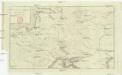
Carte cyclographique de la Sarmatie pour l'année 900 de l'ere chretienne
Asie jihozápadní Martinet