Maps of Amazon Basin

[Bergketten in Nord-Amerika]
Erster Band, enthaltend in vier Abtheilungen die Erscheinungen der anorganischen Natur: 1. Meteorologie und Klimatographie. 2. Hydrologie und Hydrographie. 3. Geologie. 4. Tellurischer Magnetismus Humboldt, Alexander von Verlag von Justus Perthes
Stromgebiet von Nordamerica
Grosser Hand-Atlas über alle Theile der Erde in 170 Karten Meyer, J. Verlag des Bibliographischen Instituts
Nord America
Hand-Atlas über alle Theile der Erde nach dem neuesten Zustande und über das Weltgebäude Stieler, Adolf bei Justus Perthes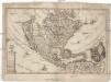
America borealis
1 : 32500000 Severní Amerika Scherer, Heinrich
Ethnographische Karte von Nordamerika
Zweiter Band, enthaltend in vier Abtheilungen die Vertheilung der Organismen: 5. Pflanzen-Geographie, 6. Thier-Geographie, 7. Anthropographie, 8. Ethnographie Humboldt, Alexander von Verlag von Justus Perthes
Mexico, or, New Spain : divided into the audiance of Guadalayara, Mexico, and Guatimala, Florida.
from System of geography with new maps
The Western Ilands / by Rt. Morden.
from Geography rectified, or, A description of the world : in all its kingdoms, provinces, countries, islands, cities, towns, seas, rivers, bayes, capes, ports : their antient and present names, inhabitants, situations, histories, customs, governments, &c. : as also their commodities, coins, weights, and measures, compared with those at London : illustrated with above sixty new maps : the whole work performed according to the more accurate discoveries of modern authors / by Robert Morden.
Nordamerica
Neuester Schul-Atlas Walch, Johann im Verlag bei Joh. Walch
America Septentrionalis. [Karte], in: Novus atlas absolutissimus, Bd. 6, S. 197.
1 Karte aus Atlas Janssonius Offizin
Amérique septentrionale dressée sur les relations les plus modernes des voyageurs et navigateurs ou se remarquent les Etats unis.
from John H. Levine Collection Publiée ... par le S. Robert de Vaugondy, géographe: [Paris?]; Robert de Vaugondy, Gilles,
Composite: A Map of the British Empire in America.
1 : 2000000 Popple, Henry
A new and correct map of North America with the West India Islands : divided according to the last treaty of peace, concluded at Paris, 10th Feby. 1763 ; wherein are particularly distinguished, the several provinces and colonies, which compose the Britis
from Whole
America septentrionalis
1 : 18800000 Severní Amerika Delisle, Guillaume Lotter, Georg F. apud Tobiam Conr. Lotter
America septentrionalis
1 : 18800000 Severní Amerika Delisle, Guillaume Lotter, Georg F. apud Tobiam Conr. Lotter
America septentrionalis
1 : 18800000 Severní Amerika Delisle, Guillaume Lotter, Georg F. apud Tobiam Conr. Lotter
America septentrionalis
1 : 20000000 Severní Amerika Delisle, Guillaume Lotter, Georg F. T. C. Lotter
New Spain ; Guiana.
from A new systeme of the mathematicks: containing I. Arithmetick, as well natural and decimal, as in species, or the principles of algebra. II. Practical geometry, together with the first six books of Euclid's Elements, as also the eleventh and twelfth, symbo
America Septentrionalis.
from Whole Excudit Ioannes Ianssonius: Amstelodami; Jansson, Jan,
L'Amérique septentrionale: dressée sur les observations de Mrs. de l'Academie Royale des Sciences & quelques autres, & sur les memoires les plus recens / par G. de l'Isle, geographe.
from Whole Guillaume de l'Isle,
L'Amerique septentrionale: dressée sur les observations de Mrs. de l'Academie Royale des Sciences & quelques autres, & sur les memoires les plus recens / par G. de L'Isle, geographe.
from Whole Guillaume de l'Isle,
L'Amerique septentrionale
1 : 16000000 dressée sur les observations de Mrs. de l'Academie Royale des Sciences & quelques autres, & sur les memoires les plus recens [...] par G. de l'Isle A Amsterdam : chez J. Cóvens & C. Mortier
L'Amerique septentrionale: dressée sur les observations de Mrs. de l'Academie Royale des Sciences & quelques autres, & sur les memoires les plus recens / par G. De L'Isle, geographe; N. Guerard, im. et fec.
from Whole Guillaume de l'Isle; N. Guerard,
The English empire in America, Newfound-land, Canada, Hudsons Bay, &c. in plano / Herman Moll fecit.
from Atlas manuale, or, A new sett of maps of all the parts of the earth : as well Asia, Africa and America, as Europe : wherein geography is rectify'd, by reforming the old maps according to the modern observations : and the coasts of all countries are laid down, agreeable to Mr. Edmund Halley's own map ... / mostly performed by Herman Moll.
New Map Of The Union.
1 : 6000000 Johnson, D. Griffing
North America / performed under the patronage of Louis Duke of Orleans, First Prince of the Blood by the Sieur d'Anville ; greatly improved by Mr. Bolton ; engrav,d by R. W. Seale ; Gravelot, delin. ; Walker, sculp.
from Whole
L'Amerique septentrionale: dressée sur les observations de Mrs. de l'Academie Royale des Sciences & quelques autres, & sur les memoires les plus recens / par G. de l'Isle, geographe.
from John H. Levine Collection Guillaume de l'Isle,
Charte von Nord-America
1 : 20500000 Severní Amerika
CHARTE von NORD-AMERICA
1 : 20500000 Severní Amerika
Pascaerte van Westindien : de vaste kusten en de Eylanden.
from De zee-atlas, ofte, Water-weereld : waer in vertoont werden alle de zee-kusten van het bekende des aerd-bodems : seer dienstigh voor alle heeren en kooplieden, als oock voor alle schippers en stuurlieden / gesneden, gedruckt en uytgegeven t'Amsteldam.
![[Bergketten in Nord-Amerika]](https://images-2.georeferencer.com/images/iiif/136782020676/full/,300/0/native.jpg)

