Maps of Nigeria

[Afrika, Blatt 3]
Adolf Stieler's Handatlas über alle Theile der Erde und über das Weltgebäude Stieler, Adolf Justus Perthes
[136][139] Tractus Littorales Guineae ..., uit: Atlas sive Descriptio terrarum orbis
Annotatie: Gedigitaliseerde versie. Amsterdam. Heiloo : Picturae (vervaardiger), 2015. tiff-bestand. Gedigitaliseerd: 07-01-2015; Origineel: Universiteitsbibliotheek Vrije Universiteit (XL.05127.-) ; Netherlands; Titelpagina ontbreekt Wit, Frederik de Amsterdam : Frederick de Wit
Tractus littorales Guineæ a Promontorio Verde usque ad sinum Catenbelæ
1 Karte : Kupferdruck ; 49 x 55 cm Renard apud L. Renard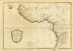
Composite: La Guinee.
1 : 9000000 Bonne, Rigobert, 1727-1794
Africa Southern.
1 : 8000000 Hall, S. (Sidney)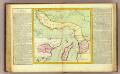
Guinee, Congo.
1 : 15000000 Clouet, J. B. L. (Jean-Baptiste Louis), b. 1730
Übersicht der neuern Erforschungen in Mittel-Africa
Hand-Atlas über alle Theile der Erde nach dem neuesten Zustande und über das Weltgebäude Stieler, Adolf bei Justus Perthes
Senegambien, Sudan, Guinea.
1 : 14700000 Berghaus, Heinrich; Flemming, Carl; Sohr, Karl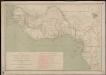
Carte des missions catholiques du Soudan français et de la côte occidentale d'Afrique
1 : 4000000 Vuillot, Paul 18..-19.. [Lyon : Oeuvre de la propagation de la foi]
Afrique Occidentale
Vidal de La Blache, Paul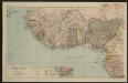
Afrique centrale. Sénégal-Niger
1 : 8000000 Niox, Gustave-Léon 1840-1921 Paris : Ch. Delagrave
Paskaart van Gvinea van C. Verde tot R. de Galion
1 Karte : Kupferdruck ; 43 x 53 cm Doncker bÿ Hendrick Doncker in de Nieuwebrugsteeg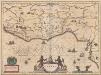
Guinea [Karte], in: Novus Atlas, das ist, Weltbeschreibung, Bd. 2, S. 249.
1 Karte aus Atlas Blaeu, Joan Blaeu, Willem Janszoon
Guineae Nova Descriptio [Karte] I. S. Thomae. [Nebenkarte], in: Gerardi Mercatoris Atlas, sive, Cosmographicae meditationes de fabrica mundi et fabricati figura, S. 508.
1 Karte aus Atlas Mercator, Gerhard Montanus, Petrus
Senegambien

Untitled

Gvinea propria nec non Nigritiæ vel terræ Nigrorvm maxima pars
1 Karte : Kupferdruck ; 44 x 54 cm Anville; Haas; Desmarchais Homännische Erben
Gvinea propria nec non Nigritiæ vel terræ Nigrorvm maxima pars
1 Karte : Kupferdruck ; 44 x 54 cm Anville; Haas; Desmarchais Homännische Erben
Westliches Mittel-Africa
1 : 6000000 Guinea Weiland, Karl Ferdinand Geograph. Instituts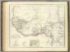
West. Mittel-Africa.
1 : 6000000 Weiland, C. F. (Carl Ferdinand), d. 1847
Gvinea propria nec non Nigritiae vel Terrae Nigrorvm maxima pars, geographis hodiernis dicta ultraq AEthiopia inferior, & hujus quidem pars australis itineri Guineensi D. de Marchais
Afrika západní Anville, Jean-Baptiste Bourguinon d' Hase, Johann Matthias Homannianos Heredes
GVINEA propria nec non NIGRITIAE vel Terrae NIGRORVM maxima pars, geographis hodiernis dicta utraq[ue] AETHIOPIA INFERIOR, & hujus quidem pars australis
1 : 7400000 Afrika západní Anville, Jean-Baptiste Bourguinon d' studio & labore Homannianorum Heredum
Guinea [Karte], in: Le théâtre du monde, ou, Nouvel atlas contenant les chartes et descriptions de tous les païs de la terre, Bd. 2, S. 289.
1 Karte aus Atlas Blaeu, Willem Janszoon und Blaeu, Joan Blaeu, Willem Janszoon
Westliches Mittel-Africa, Senegambien, Sudan, Ober-Guinea und einen Theil der Sahara umfassend oder die Stufenländer des mittlern Africa's und Nordrand von Hochafrica
1 : 6000000 entworfen und gezeichnet von C.F. Weiland gestochen von K.J. Mädel sen. Weimar : Geographisches Institut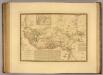
Senegambie, Soudan, Guinee Septentrionale.
1 : 8250000 Picquet, C.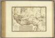
Senegambie, Soudan, Guinee Septentrionale.
1 : 8250000 Brue, Adrien Hubert, 1786-1832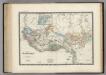
Senegambie, Soudan, Guinee.
1 : 8600000 Levasseur, E.
Afrique occidentale et centrale.
1 : 9500000 Garnier, F. A., 1803-1863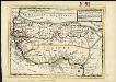
Negroland and Guinea, with the European settlements explaining what belongs to England, Holland, Denmark &c.
1 : 12500000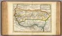
![[Afrika, Blatt 3]](https://images-2.georeferencer.com/images/iiif/081019706510/full/,300/0/native.jpg)

