Maps of Polynesia

[Verbreitung der vorzüglicheren Säugethiere in der neuen Welt]
Zweiter Band, enthaltend in vier Abtheilungen die Vertheilung der Organismen: 5. Pflanzen-Geographie, 6. Thier-Geographie, 7. Anthropographie, 8. Ethnographie Humboldt, Alexander von Verlag von Justus Perthes
[Zoological Geography, Geographical Division and Distribution of Reptilia (Reptiles)]
The physical atlas Johnston, Alexander Keith William Blackwood & Sons
Schlegel's Versuch Einer Schlangen-Karte.
1 : 165000000 Berghaus, Heinrich
Wereldkaart volgens Mercator's projectie
Bruxelles : Institut National de Géographie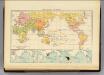
Religions.
1 : 114000000 Andree, Richard; Times (London, England)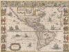
Americae nova Tabula. [Karte], in: Theatrum orbis terrarum, sive, Atlas novus, Bd. 2, S. 307.
1 Karte aus Atlas Blaeu, Joan Blaeu, Willem Janszoon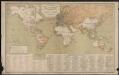
Carte générale des lignes télégraphiques internationales
1 : 40000000 Jaccottey, Paul Paris : Ch. Delagrave
Asia
Hand-Atlas über alle Theile der Erde nach dem neuesten Zustande und über das Weltgebäude Stieler, Adolf bei Justus Perthes
[Zoological Geography, Geographical Division & Distribution of Rodentia (Gnawing Animals)]
The physical atlas Johnston, Alexander Keith William Blackwood & Sons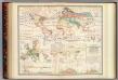
Distribution: plants.
1 : 67000000 Johnston, Alexander Keith, 1804-1871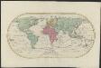
Mappemonde ou Carte générale de l' univers sur une projection nouvelle d'une sphére ovale pour mieux entendre les distances entre l'Europe et Amerique : avec le tour du monde du lieut. Cook et tous les découvertes nouvelles
1 : 45000000 dessinée et gravée par Mathieu Albert Lotter A Augsbourg : [s.n.]
[Zoological Geography, Geographical Division and Distribution of the Birds of Europe]
The physical atlas Johnston, Alexander Keith William Blackwood & Sons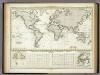
Versuch Einer Karte Zur ?bersicht Der Fluthwellen.
1 : 95000000 Berghaus, Heinrich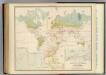
Health, disease.
1 : 67000000 Johnston, Alexander Keith, 1804-1871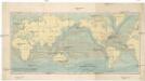
Uebersicht der Strömungen des Meeres
země světa Christmann, Fr. Hartwig Meidinger Sohn
Verbreitung des Katzen-Geschlechts, Genus-Felis, so wie der Hyane.
1 : 115000000 Berghaus, Heinrich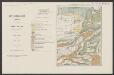
Americae nova Tabula. [Karte], in: Le théâtre du monde, ou, Nouvel atlas contenant les chartes et descriptions de tous les païs de la terre, Bd. 2, S. 298.
1 Karte aus Atlas Blaeu, Willem Janszoon und Blaeu, Joan Blaeu, Willem Janszoon
Vulkane, Koralleninseln.
1 : 110000000 Andree, Richard
Streams, currents and drifts in the Pacific Ocean : mainly from the British Admirality chart No. 2640
1 : 33000000 United States. Hydrographic Office Hydrographic Office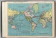
World on Mercator's Projection.
1 : 60000000 Rand McNally and Company
[Historisch-geographischer Atlas zu den allgemeinen Geschichtswerken von C. v. Rotteck, Pölitz u. Becker] : Erdansichten nach den im Mittelalter herrschenden Systemen
von Julius Loewenberg [Freiburg im Breisgau] : [Herder]
[Zoological Geography, Geographical Division & Distribution of Carnivora]
The physical atlas Johnston, Alexander Keith William Blackwood & Sons
Versuch einer Karte zur Übersicht der Fluthwellen
Erster Band, enthaltend in vier Abtheilungen die Erscheinungen der anorganischen Natur: 1. Meteorologie und Klimatographie. 2. Hydrologie und Hydrographie. 3. Geologie. 4. Tellurischer Magnetismus Humboldt, Alexander von Verlag von Justus Perthes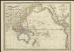
Carte de l'Océanie comprenant l'Australie, la Polynésie et du Grand Archipel d'Asie
1 : 37000000 dressée par Hérisson, géographe gravé par J. B. Tardieu ; Pelicier scrip. Paris : chez Jean, Rue St. Jean-de-Beauvais, No. 10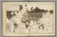
Moral, political World.
1 : 133000000 Woodbridge, William C.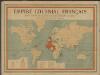
Empire colonial français
1 : 28000000 Barrère, Henry; Ligue coloniale française Paris : Maison Andriveau-Goujon H. Barrère
XIII. Charte für die allgemeine Geschichte von Friedrich IIten Tode bis auf den Frieden von Presburg : d.i. von 1786 bis 1805 n. Christus
Entworfen von F.W. Benicken grav. von A. Falger Weimar : im Verlage des L. Industrie-Comptoirs
Weltkarte zur Uebersicht der vorzügluchsten Varietaeten des Menschen, nach Blumenbach'schen Systeme
1 : 82300000 entworfen und gezeichnet von C.F. Weiland nach Bory de St. Vincent entworfen und gezeichnet von C.F. Weiland Weimar : Im Verlage des Geograph. Instituts
Steamship Routes of The World.
1 : 60000000 Rand McNally and Company
![[Verbreitung der vorzüglicheren Säugethiere in der neuen Welt]](https://images-2.georeferencer.com/images/iiif/535464825724/full/,300/0/native.jpg)

