Maps of Lazníky

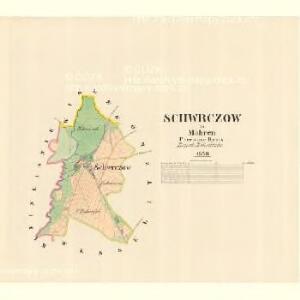
Schwrczow - m2993-1-001 - Kaiserpflichtexemplar der Landkarten des stabilen Katasters
1 : 2880
Wesselitzko - m3364-1-005 - Kaiserpflichtexemplar der Landkarten des stabilen Katasters
1 : 2880
Wesselitzko - m3364-1-006 - Kaiserpflichtexemplar der Landkarten des stabilen Katasters
1 : 2880
Wesselitzko - m3364-1-002 - Kaiserpflichtexemplar der Landkarten des stabilen Katasters
1 : 2880
Wesselitzko - m3364-1-001 - Kaiserpflichtexemplar der Landkarten des stabilen Katasters
1 : 2880
Wesselitzko - m3364-1-007 - Kaiserpflichtexemplar der Landkarten des stabilen Katasters
1 : 2880
Wesselitzko - m3364-1-003 - Kaiserpflichtexemplar der Landkarten des stabilen Katasters
1 : 2880
Wesselitzko - m3364-1-004 - Kaiserpflichtexemplar der Landkarten des stabilen Katasters
1 : 2880
III. vojenské mapování 4159/3
1 : 25000
III. vojenské mapování 4159/3
1 : 25000
Gradkartenblatt
1 : 25000 Morava (Česko) Bernhauer, Clemens
[Kartenblatt]
1 : 25000 Lipník nad Bečvou (Česko : oblast) Reichsamt für Landesaufnahme

Übersichtskarte der Gegend um Olmütz
Olomouc-oblast (Česko) Domek
Hranice
1 : 75000 Hranice-oblast (Přerov, Česko) Vojenský zeměpisný ústav
Hranice
1 : 75000 Hranice (Přerov, Česko : oblast) Vojenský zeměpisný ústav
Hranice
1 : 75000 Hranice (Přerov, Česko : oblast) Vojenský zeměpisný ústav
Weisskirchen in Mähren
1 : 75000 Hranice (Přerov, Česko : oblast) Fitz K. u. k. Militärgeographisches Institut
Weisskirchen in Mähren
1 : 75000 Hranice (Přerov, Česko : oblast) Fitz K. u. k. Militärgeographisches Institut
III. vojenské mapování 4159
1 : 75000
Plan zu den Gefechten bei Biskupitz 14. Juli Tobitschau und Roketnitz 15. Juli 1866
1 : 72000 Biskupice (Prostějov, Česko) Ditfurth, Moritz von des K. u. k. Militärgeographischen Instituts
Plan zu den Gefechten bei Biskupitz 14. Juli Tobitschau und Roketnitz 15. Juli 1866
1 : 72000 Biskupice (Prostějov, Česko)
Olomouc a okolí
1 : 75000 Olomouc (Česko : oblast) Vojenský zeměpisný ústav
Mapa hejtmanství Hranického

Podrobná místopisná mapa Království Českého

Podrobná mapa Markrabství moravského a Vévodství slezkého
1 : 100000 Moravské markrabství Srp, Jan Jos. R. Vilímek
Podrobná místopisná mapa Království Českého

Karte der Umgebung von Olmütz
Olomouc-oblast (Česko) Lepař, Jan Raffelsperger, Franz
Hranice a okolí
1 : 75000 Hranice (Přerov, Česko : oblast) Vojenský zeměpisný ústav