Maps of gmina Goleszów

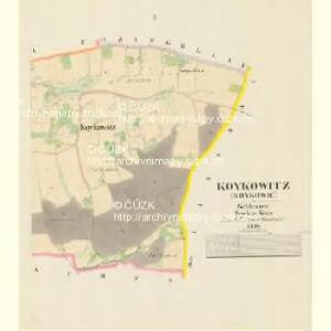
Koykowitz (Koykowic) - m1242-1-001 - Kaiserpflichtexemplar der Landkarten des stabilen Katasters
1 : 2880
Koykowitz (Koykowic) - m1242-1-002 - Kaiserpflichtexemplar der Landkarten des stabilen Katasters
1 : 2880
Nieder Lischna (Lyszna Nižni) - m0507-1-004 - Kaiserpflichtexemplar der Landkarten des stabilen Katasters
1 : 2880
Nieder Lischna (Lyszna Nižni) - m0507-1-001 - Kaiserpflichtexemplar der Landkarten des stabilen Katasters
1 : 2880
Nieder Lischna (Lyszna Nižni) - m0507-1-003 - Kaiserpflichtexemplar der Landkarten des stabilen Katasters
1 : 2880
Nieder Lischna (Lyszna Nižni) - m0507-1-002 - Kaiserpflichtexemplar der Landkarten des stabilen Katasters
1 : 2880
III. vojenské mapování 4161/2
1 : 25000
III. vojenské mapování 4161/2
1 : 25000
[Kartenblatt]
1 : 25000 Cieszyn (Polsko : oblast) Reichsamt für Landesaufnahme
Gradkartenblatt
1 : 25000 Cieszyn-oblast (Polsko) Ducke, Ludwig

III. vojenské mapování 4161
1 : 75000
III. vojenské mapování 4161
1 : 75000
Český Těšín a Frýdek
1 : 75000 Frýdek-Místek (Česko : oblast) Vojenský zeměpisný ústav
Teschen, Mistek und Jablunkau
1 : 75000 Frýdek-Místek (Česko : oblast) Jersche K. u. k. militär-geographisches Institut
Frýdek
1 : 75000 Frýdek-Místek (Česko : oblast) Zeměpisný ústav ministerstva vnitra
Frýdek
1 : 75000 Frýdek-Místek (Česko : oblast) Vojenský zeměpisný ústav
Frýdek
1 : 75000 Frýdek-Místek-oblast (Česko) Vojenský zeměpisný ústav
Český Těšín a Frýdek
1 : 75000 Frýdek-Místek (Česko : oblast) Vojenský zeměpisný ústav
Special-Karte der Mährisch-Schlesischen Beskiden
1 : 75000 Moravskoslezské Beskydy (Česko a Slovensko) Hadaszczok, Johann R. Papauschek
Freistadt Bei Teschen.
from Spezialkarte der osterreichisch-ungarischen Monarchie.
Teschen, Mistek und Jablunkau.
from Spezialkarte der osterreichisch-ungarischen Monarchie.
Special - Karte der Markgrafschaft Maehren und des Herzogthums Schlesien
II. vojenské mapování 6
1 : 144000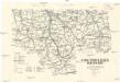
Turistická mapa Bezkyd [sic]
1 : 150000 Pobeskydí (Česko) Riegler, Karel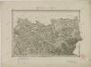
II. vojenské mapování 6
1 : 144000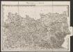
Umgebungen von Teschen
1 : 144000 K.K. Militärisches Geographisches Institut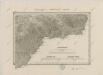
II. vojenské mapování 11
1 : 144000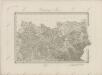
II. vojenské mapování 6
1 : 144000
Der Teschner Kreis
1 : 200000 Český Těšín-oblast (Česko) Schenkl, Conrad Philipp Carl Winiker